How to get to Gateway DC by bus?
Click on the bus route to see step by step directions with maps, line arrival times and updated time schedules.
From French Embassy, Washington
88 minFrom Embassy of France, Washington
87 minFrom Washington Yu Ying Public Charter School, Washington
112 minFrom Crowne Plaza Hotel-Crystal City Washington, D.c., Arlington County
92 minFrom Chinese Embassy Visa Section, Washington
81 minFrom Abraham Lincoln Memorial Washington DC, Washington
80 minFrom Federal Bureau Of Investigation - J. Edgar Hoover Building, Washington
45 minFrom The Jefferson Hotel, Washington
55 minFrom Hampton Inn Washington-Downtown-Convention Center, Washington
59 minFrom Healy Lawn, Georgetown University, Washington
83 min
How to get to Gateway DC by metro?
Click on the metro route to see step by step directions with maps, line arrival times and updated time schedules.
From Washington Yu Ying Public Charter School, Washington
63 minFrom Crowne Plaza Hotel-Crystal City Washington, D.c., Arlington County
45 minFrom Abraham Lincoln Memorial Washington DC, Washington
51 minFrom Federal Bureau Of Investigation - J. Edgar Hoover Building, Washington
35 minFrom The Jefferson Hotel, Washington
46 minFrom Hampton Inn Washington-Downtown-Convention Center, Washington
37 minFrom Healy Lawn, Georgetown University, Washington
63 min
Bus stops near Gateway DC in Washington
Metro station near Gateway DC in Washington
- Anacostia Metro Station, 17 min walk,VIEW
Bus lines to Gateway DC in Washington
What are the closest stations to Gateway DC?
The closest stations to Gateway DC are:
- Ml King Jr Av Se+Saint E Gate 3 is 235 yards away, 3 min walk.
- Ml King Jr Av Se+#2745 is 561 yards away, 7 min walk.
- Anacostia Metro Station is 1394 yards away, 17 min walk.
- Pomeroy Rd Se+Sheridan Rd SE is 1931 yards away, 23 min walk.
Which bus lines stop near Gateway DC?
These bus lines stop near Gateway DC: C11, C13, C15, C17.
Which metro line stops near Gateway DC?
GREEN (Branch Av)
What’s the nearest metro station to Gateway DC in Washington?
The nearest metro station to Gateway DC in Washington is Anacostia Metro Station. It’s a 17 min walk away.
What’s the nearest bus station to Gateway DC in Washington?
The nearest bus station to Gateway DC in Washington is Ml King Jr Av Se+Saint E Gate 3. It’s a 3 min walk away.
What time is the first metro to Gateway DC in Washington?
The GREEN is the first metro that goes to Gateway DC in Washington. It stops nearby at 5:06 AM.
What time is the last metro to Gateway DC in Washington?
The GREEN is the last metro that goes to Gateway DC in Washington. It stops nearby at 12:28 AM.
What time is the first bus to Gateway DC in Washington?
The C11 is the first bus that goes to Gateway DC in Washington. It stops nearby at 3:00 AM.
What time is the last bus to Gateway DC in Washington?
The C13 is the last bus that goes to Gateway DC in Washington. It stops nearby at 3:08 AM.
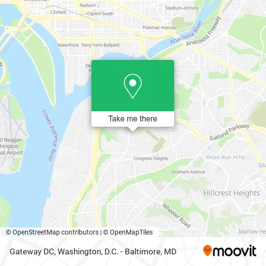
See Gateway DC, Washington, on the map
Public Transit to Gateway DC in Washington
Wondering how to get to Gateway DC in Washington? Moovit helps you find the best way to get to Gateway DC with step-by-step directions from the nearest public transit station.
Moovit provides free maps and live directions to help you navigate through your city. View schedules, routes, timetables, and find out how long does it take to get to Gateway DC in real time.
Looking for the nearest stop or station to Gateway DC? Check out this list of stops closest to your destination: Ml King Jr Av Se+Saint E Gate 3; Ml King Jr Av Se+#2745; Anacostia Metro Station; Pomeroy Rd Se+Sheridan Rd SE.
Bus: C11, C13, C15, C17, C27, C25.Metro: GREEN.
Want to see if there’s another route that gets you there at an earlier time? Moovit helps you find alternative routes or times. Get directions from and directions to Gateway DC easily from the Moovit App or Website.
We make riding to Gateway DC easy, which is why over 1.5 million users, including users in Washington, trust Moovit as the best app for public transit. You don’t need to download an individual bus app or train app, Moovit is your all-in-one transit app that helps you find the best bus time or train time available.
For information on prices of bus and metro, costs and ride fares to Gateway DC, please check the Moovit app.
Use the app to navigate to popular places including to the airport, hospital, stadium, grocery store, mall, coffee shop, school, college, and university.
Gateway DC Address: 2700 Martin Luther King Jr Ave SE street in Washington
- United States Coast Guard Chief Petty Officers Association,
- St. Elizabeths Campus,
- Martin Luther King Jr Ave SE and Magnolia St,
- 2700 Martin Luther King Jr Ave SE,
- Eurest,
- Gateway DC,
- Circle B 24/7,
- We Buy Houses Nationwide USA,
- 2720 Martin Luther King Jr Ave SE,
- Hsema,
- Friendship Tech Prep Academy,
- 2730 Martin Luther King Jr Ave SE,
- Catch of the Day DC,
- Willow Plum St,
- 2750 13th St SE,
- Wonder Mart,
- St. Elizabeths East Entertainment And Sports Arena,
- Coast Guard Exchange,
- Dionne's Good Food,
- Sycamore & Oak
Places Near Gateway DC (Washington)
- National Mall, Washington,
- Basilica of the National Shrine, Washington,
- Marriott Marquis Washington, DC, Washington,
- Sibley Memorial Hospital, Washington,
- Amazon Hq2, Arlington County,
- Rock Creek Tennis Center, Washington,
- Pennsylvania Ave NW (3rd st and pennsylvania), Washington,
- National Zoo, Washington,
- The Anthem, Washington,
- M&T Bank Stadium, Baltimore,
- Washington DC VA Medical Center, Washington,
- PG Mall, Prince George's County,
- Washington National Cathedral, Washington,
- National Museum of African American History and Culture, Washington,
- Capital One Arena, Washington,
- Georgetown, Washington,
- Camden Yards, Baltimore,
- Westfield Montgomery Mall, Montgomery County,
- Museum Of The Bible, Washington,
- Warner Theatre, Washington
How to get to popular places in Washington, D.C. - Baltimore, MD with public transit
Get around Washington by public transit!
Traveling around Washington has never been so easy. See step by step directions as you travel to any attraction, street or major public transit station. View bus and train schedules, arrival times, service alerts and detailed routes on a map, so you know exactly how to get to anywhere in Washington.
When traveling to any destination around Washington use Moovit's Live Directions with Get Off Notifications to know exactly where and how far to walk, how long to wait for your line, and how many stops are left. Moovit will alert you when it's time to get off — no need to constantly re-check whether yours is the next stop.
Wondering how to use public transit in Washington or how to pay for public transit in Washington? Moovit public transit app can help you navigate your way with public transit easily, and at minimum cost. It includes public transit fees, ticket prices, and costs. Looking for a map of Washington public transit lines? Moovit public transit app shows all public transit maps in Washington with all Bus, Train, Metro, Light Rail and Ferry routes and stops on an interactive map.
Washington, D.C. - Baltimore, MD has 5 transit type(s), including: Bus, Train, Metro, Light Rail and Ferry, operated by several transit agencies, including WMATA, Montgomery County Ride On, Fairfax Connector, TheBus, PRTC, DASH - Alexandria, Arlington Transit (ART), RTA of Central Maryland, MDOT MTA, MDOT MTA Light RailLink, MDOT MTA Commuter Bus, MDOT MTA Local Bus, FXBGO!, Virginia Railway Express (VRE) and MARC