Directions to Gaze Optical (Watertown Town) with public transportation
The following transit lines have routes that pass near Gaze Optical
 Bus: 504, 70, 71.
- Train: FITCHBURG, FRAMINGHAM/WORCESTER.
- Subway: GREEN LINE B.
How to get to Gaze Optical by bus?
Click on the bus route to see step by step directions with maps, line arrival times and updated time schedules.
From Harvard Square, Cambridge
39 minFrom Target, Boston
68 minFrom Pine Street Inn, Boston
45 minFrom US Coast Guard Base Boston, Boston
78 minFrom MBTA-Aquarium, Boston
55 minFrom Beth Israel Deaconess Medical Center, Brookline
51 minFrom Fidelity Investments, Boston
50 minFrom Government Center/Faneuil Hall, Boston
66 minFrom Old North Church, Boston
64 minFrom Harborside Inn, Boston
55 min
How to get to Gaze Optical by train?
Click on the train route to see step by step directions with maps, line arrival times and updated time schedules.
How to get to Gaze Optical by subway?
Click on the subway route to see step by step directions with maps, line arrival times and updated time schedules.
Bus stops near Gaze Optical in Watertown Town
Subway station near Gaze Optical in Watertown Town
- Boston College, 19 min walk,VIEW
Train stations near Gaze Optical in Watertown Town
What are the closest stations to Gaze Optical?
The closest stations to Gaze Optical are:
- Mt Auburn St @ Walnut St is 519 yards away, 7 min walk.
- Arsenal St Opp Louise St is 855 yards away, 11 min walk.
- Boston College is 1622 yards away, 19 min walk.
- Newtonville is 3710 yards away, 44 min walk.
- Waverley is 3857 yards away, 46 min walk.
Which bus lines stop near Gaze Optical?
These bus lines stop near Gaze Optical: 504, 70.
Which train lines stop near Gaze Optical?
These train lines stop near Gaze Optical: FITCHBURG, FRAMINGHAM/WORCESTER.
Which subway line stops near Gaze Optical?
GREEN LINE B (Boston College)
What’s the nearest subway station to Gaze Optical in Watertown Town?
The nearest subway station to Gaze Optical in Watertown Town is Boston College. It’s a 19 min walk away.
What’s the nearest bus station to Gaze Optical in Watertown Town?
The nearest bus station to Gaze Optical in Watertown Town is Mt Auburn St @ Walnut St. It’s a 7 min walk away.
What time is the first subway to Gaze Optical in Watertown Town?
The GREEN LINE B is the first subway that goes to Gaze Optical in Watertown Town. It stops nearby at 5:01 AM.
What time is the last subway to Gaze Optical in Watertown Town?
The GREEN LINE B is the last subway that goes to Gaze Optical in Watertown Town. It stops nearby at 2:39 AM.
What time is the first train to Gaze Optical in Watertown Town?
The FRAMINGHAM/WORCESTER is the first train that goes to Gaze Optical in Watertown Town. It stops nearby at 5:25 AM.
What time is the last train to Gaze Optical in Watertown Town?
The FRAMINGHAM/WORCESTER is the last train that goes to Gaze Optical in Watertown Town. It stops nearby at 12:17 AM.
What time is the first bus to Gaze Optical in Watertown Town?
The 70 is the first bus that goes to Gaze Optical in Watertown Town. It stops nearby at 4:37 AM.
What time is the last bus to Gaze Optical in Watertown Town?
The 70 is the last bus that goes to Gaze Optical in Watertown Town. It stops nearby at 1:24 AM.
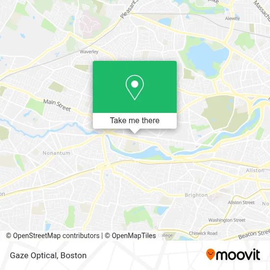
See Gaze Optical, Watertown Town, on the map
Public Transit to Gaze Optical in Watertown Town
Wondering how to get to Gaze Optical in Watertown Town? Moovit helps you find the best way to get to Gaze Optical with step-by-step directions from the nearest public transit station.
Moovit provides free maps and live directions to help you navigate through your city. View schedules, routes, timetables, and find out how long does it take to get to Gaze Optical in real time.
Looking for the nearest stop or station to Gaze Optical? Check out this list of stops closest to your destination: Mt Auburn St @ Walnut St; Arsenal St Opp Louise St; Boston College; Newtonville; Waverley.
Bus: 504, 70, 71.Train: FITCHBURG, FRAMINGHAM/WORCESTER.Subway: GREEN LINE B.
Want to see if there’s another route that gets you there at an earlier time? Moovit helps you find alternative routes or times. Get directions from and directions to Gaze Optical easily from the Moovit App or Website.
We make riding to Gaze Optical easy, which is why over 1.7 million users, including users in Watertown Town, trust Moovit as the best app for public transit. You don’t need to download an individual bus app or train app, Moovit is your all-in-one transit app that helps you find the best bus time or train time available.
For information on prices of bus, subway and train, costs and ride fares to Gaze Optical, please check the Moovit app.
Use the app to navigate to popular places including to the airport, hospital, stadium, grocery store, mall, coffee shop, school, college, and university.
Gaze Optical Address: 204 Arsenal St street in Watertown Town
- Gables Arsenal Street,
- Craigs Kempo Karate Academy,
- Watertown, MA,
- Move & Groove Watertown,
- Ecast Productions,
- Sanda Fighting Arts,
- Dal Contractors,
- Twin Tige 100 Parker S,
- Extra Innings Watertown,
- Get Lively: Health & Fitness,
- Mobile Auto Clinic Towing Service,
- Imai Keller Moore,
- Perkins School For the Blind,
- Alvarados Painting,
- Thorpe Construction,
- Perkins School,
- Centre for Mediation & Dispute Resolution,
- USPS Collection Box - Blue Box,
- Bostonian Towing,
- Sisters of Saint Joseph
Places Near Gaze Optical (Watertown Town)
- Massachusetts General Hospital, Boston,
- Boston Convention & Exhibition Center, Boston,
- Cheers, Boston,
- North End, Boston,
- Mgm Music Hall, Boston,
- Seaport District, Boston,
- Museum Of Science, Boston,
- Isabella Stewart Gardner Museum, Boston,
- Td Garden, Boston,
- Boston Children's Hospital, Boston,
- Castle Island, Boston,
- Prudential Center, Boston,
- Boston Common, Boston,
- Leader Bank Pavilion (Leader Bank Pavillion), Boston,
- Wang Theater, Boston,
- Faneuil Hall, Boston,
- Boston Medical Center, Boston,
- Quincy Market, Boston,
- House Of Blues, Boston,
- Wilbur Theatre, Boston
How to get to popular places in Boston with public transit
Get around Watertown Town by public transit!
Traveling around Watertown Town has never been so easy. See step by step directions as you travel to any attraction, street or major public transit station. View bus and train schedules, arrival times, service alerts and detailed routes on a map, so you know exactly how to get to anywhere in Watertown Town.
When traveling to any destination around Watertown Town use Moovit's Live Directions with Get Off Notifications to know exactly where and how far to walk, how long to wait for your line, and how many stops are left. Moovit will alert you when it's time to get off — no need to constantly re-check whether yours is the next stop.
Wondering how to use public transit in Watertown Town or how to pay for public transit in Watertown Town? Moovit public transit app can help you navigate your way with public transit easily, and at minimum cost. It includes public transit fees, ticket prices, and costs. Looking for a map of Watertown Town public transit lines? Moovit public transit app shows all public transit maps in Watertown Town with all Bus, Train, Subway and Ferry routes and stops on an interactive map.
Boston has 4 transit type(s), including: Bus, Train, Subway and Ferry, operated by several transit agencies, including MBTA, Southeastern Regional Transit Authority, MetroWest Regional Transit Authority, Rhode Island Public Transit Authority, WRTA, Lowell Regional Transit Authority, Merrimack Valley Transit, Montachusett Regional Transit Authority, Cape Cod Regional Transit Authority, Brockton Area Transit Authority, Martha's Vineyard Transit Authority, the WAVE - Nantucket Regional Transit Authority, GATRA, Cape Ann Transportation Authority and Massport