Directions to Gea (Campo) with public transportation
The following transit lines have routes that pass near Gea
How to get to Gea by bus?
Click on the bus route to see step by step directions with maps, line arrival times and updated time schedules.
From Universidade Positivo (UP), Cic
89 minFrom Araucária Acqua Park, Araucária
180 minFrom Rua Lodovico Kaminski, Augusta
106 minFrom Teatro Positivo, Cic
87 minFrom universidade positivo campus ecovile, Cic
87 minFrom Campo Magro, Campo Magro
66 minFrom Avenida Juscelino Kubitschek de Oliveira 2600, Cic
94 minFrom Volvo do Brasil, Cic
83 minFrom Colônia Cristina, Araucária
250 minFrom Orleans, Orleans
60 min
Bus stops near Gea in Campo
Bus lines to Gea in Campo
- 120 HOSPITAL ROCIO / OURO VERDE, São Gerônimo → Terminal Urbano Campo Largo (via Ambulatório),VIEW
- 110 RETIRO, Terminal Urbano Campo Largo → Retiro (via Felpudo),VIEW
- 105 FERRARI / JARDIM SOCIAL, Terminal Urbano Campo Largo ↺ Jardim Social / Ferrari (Circular),VIEW
- 107 BATEIAS, Bateias (Km 36) → Terminal Urbano Campo Largo,VIEW
- 111 GERMER, Germer → Terminal Urbano Campo Largo (via Jardim Social),VIEW
What are the closest stations to Gea?
The closest stations to Gea are:
- Rua Marechal Floriano Peixoto, 303 is 12 meters away, 1 min walk.
- Rua Caetano Munhoz Da Rocha, 299 is 372 meters away, 5 min walk.
- Rua Constantino Marochi, 165 is 614 meters away, 9 min walk.
- Rua Ema Taner De Andrade, 35 is 837 meters away, 11 min walk.
- Rua Elias Rivabem is 1107 meters away, 15 min walk.
Which bus lines stop near Gea?
These bus lines stop near Gea: 120 HOSPITAL ROCIO / OURO VERDE, J02 CAMPO LARGO / CAMPINA DO SIQUEIRA, J62 CAMPO LARGO / GUADALUPE.
What’s the nearest bus station to Gea in Campo?
The nearest bus station to Gea in Campo is Rua Marechal Floriano Peixoto, 303. It’s a 1 min walk away.
What time is the first bus to Gea in Campo?
The 107 BATEIAS is the first bus that goes to Gea in Campo. It stops nearby at 5:28 AM.
What time is the last bus to Gea in Campo?
The 105 FERRARI / JARDIM SOCIAL is the last bus that goes to Gea in Campo. It stops nearby at 12:01 AM.
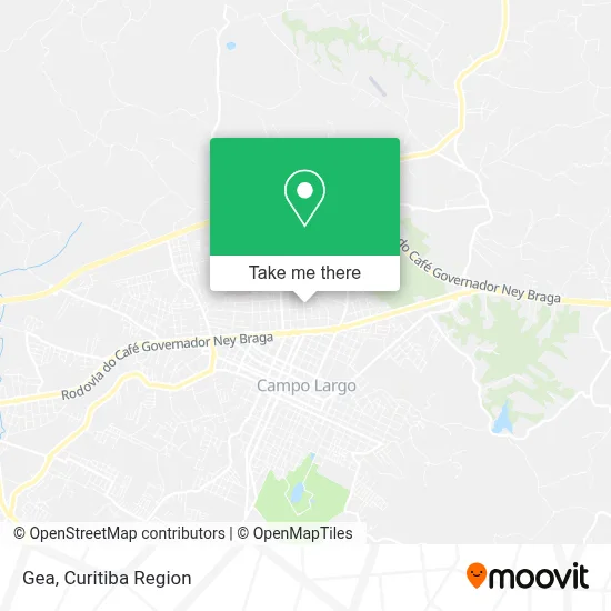
See Gea, Campo, on the map
Public Transit to Gea in Campo
Wondering how to get to Gea in Campo? Moovit helps you find the best way to get to Gea with step-by-step directions from the nearest public transit station.
Moovit provides free maps and live directions to help you navigate through your city. View schedules, routes, timetables, and find out how long does it take to get to Gea in real time.
Looking for the nearest stop or station to Gea? Check out this list of stops closest to your destination: Rua Marechal Floriano Peixoto; Rua Caetano Munhoz Da Rocha; Rua Constantino Marochi; Rua Ema Taner De Andrade; Rua Elias Rivabem.
Bus: 120 HOSPITAL ROCIO / OURO VERDE, J02 CAMPO LARGO / CAMPINA DO SIQUEIRA, J62 CAMPO LARGO / GUADALUPE, 110 RETIRO, 105 FERRARI / JARDIM SOCIAL, 107 BATEIAS, 111 GERMER.
Want to see if there’s another route that gets you there at an earlier time? Moovit helps you find alternative routes or times. Get directions from and directions to Gea easily from the Moovit App or Website.
We make riding to Gea easy, which is why over 1.5 million users, including users in Campo, trust Moovit as the best app for public transit. You don’t need to download an individual bus app or train app, Moovit is your all-in-one transit app that helps you find the best bus time or train time available.
For information on prices of bus, costs and ride fares to Gea, please check the Moovit app.
Use the app to navigate to popular places including to the airport, hospital, stadium, grocery store, mall, coffee shop, school, college, and university.
Gea Address: Rua Marechal Floriano Peixoto, 415 Ouro Verde Campo Largo-PR 83606-290 street in Campo
- J M de Jesus Paisagismo,
- A.P.M.F.,
- C. M. Darlei Adad,
- Biotaramar,
- Aline Drinks,
- Silmara Durau,
- Garagem 386,
- Cl Fedalto Serviços Administrativos,
- Palanque Barber,
- Rivabem & Dallagrana,
- Escola Darlei Adad,
- Heloísa Helena Benato Klassen - Sociedade Individual de Advocacia,
- B.F.Florestal,
- Unique Studio,
- Rua Barão Do Rio Branco,
- Ideal Moveis Sob Medida,
- Duas Marias Comércio e Confeccao,
- Condominio Residencial Turquesa,
- Ato Stands & Eventos Me,
- Academia Naja de Karatê
Places Near Gea (Campo)
- Hospital Erasto Gaertner, Jardim Das Américas,
- Hospital Madalena Sofia, Bairro Alto,
- Pontifícia Universidade Católica do Paraná (PUCPR), Prado Velho,
- Shopping Estação, Rebouças,
- Jardim Botânico de Curitiba PR, Centro,
- Jockey Plaza Shopping Center, Tarumã,
- Hospital de Clínicas (HC - UFPR), Centro,
- Arena Da Baixada - Curitiba,
- Hospital Universitário Evangélico de Curitiba, Bigorrilho,
- Rua Martim Afonso 558, Mercês,
- Hospital Da Cruz Vermelha, Batel,
- Hospital Nossa Senhora Das Graças, Mercês,
- Parque Barigui, Mercês,
- Hospital do Rocio, Campo,
- Hhhhh, Fazendinha,
- Rua General Mário Tourinho, Campina Do Siqueira,
- Hospital Angelina Caron, Campina Grande Do Sul,
- Campo Largo, Campo,
- Park Shopping Barigüi, Mossunguê,
- Shopping Palladium, Portão
How to get to popular places in Curitiba Region with public transit
Get around Campo by public transit!
Traveling around Campo has never been so easy. See step by step directions as you travel to any attraction, street or major public transit station. View bus and train schedules, arrival times, service alerts and detailed routes on a map, so you know exactly how to get to anywhere in Campo.
When traveling to any destination around Campo use Moovit's Live Directions with Get Off Notifications to know exactly where and how far to walk, how long to wait for your line, and how many stops are left. Moovit will alert you when it's time to get off — no need to constantly re-check whether yours is the next stop.
Wondering how to use public transit in Campo or how to pay for public transit in Campo? Moovit public transit app can help you navigate your way with public transit easily, and at minimum cost. It includes public transit fees, ticket prices, and costs. Looking for a map of Campo public transit lines? Moovit public transit app shows all public transit maps in Campo with all Bus and Cable Car routes and stops on an interactive map.
Curitiba Region has 2 transit type(s), including: Bus and Cable Car, operated by several transit agencies, including Sistema Integrado de Mobilidade (URBS), Sistema Integrado de Mobilidade (AMEP), URBS (Cartões bancários e Dinheiro), URBS (Cartões bancários / Cartão URBS), AMEP (Cartões bancários / Cartão MetroCard), AMEP (Cartões bancários / Cartão MetroCard / Dinheiro), Viação Colombo (Dinheiro), TRIAR (Cartão TRIAR / Dinheiro), Empresa Curitiba Cerro Azul (Dinheiro), Expresso Nossa Senhora da Penha (Dinheiro), Empresa Campo Alto Tijucas (Dinheiro), Auto Viação São José (Cartão VEM / Dinheiro), BRT S/A (Cartão VEM / Dinheiro), TransPiedade (Cartão Cidadão / Dinheiro) and Oceânica Sul (Cartão Transporte / Dinheiro)