How to get to Genewiz by bus?
Click on the bus route to see step by step directions with maps, line arrival times and updated time schedules.
From SoWa Open Market, Boston
60 minFrom Club Quarters, Boston
63 minFrom ICA, Boston
98 minFrom Piers Park, Boston
100 minFrom East Boston, Boston
95 minFrom Franklin Park, Boston
90 minFrom Boston Latin Academy, Boston
80 minFrom Hynes Convention Center, Boston
49 minFrom Royale Boston, Boston
56 minFrom The Institute Of Contemporary Art, Boston
100 min
How to get to Genewiz by train?
Click on the train route to see step by step directions with maps, line arrival times and updated time schedules.
How to get to Genewiz by subway?
Click on the subway route to see step by step directions with maps, line arrival times and updated time schedules.
From SoWa Open Market, Boston
61 minFrom Club Quarters, Boston
51 minFrom ICA, Boston
65 minFrom Piers Park, Boston
73 minFrom East Boston, Boston
73 minFrom Franklin Park, Boston
78 minFrom Boston Latin Academy, Boston
85 minFrom Hynes Convention Center, Boston
65 minFrom Royale Boston, Boston
54 minFrom The Institute Of Contemporary Art, Boston
66 min
Bus stop near Genewiz in Cambridge
- Concord Ave @ Blanchard Rd, 6 min walk,VIEW
Train station near Genewiz in Cambridge
- Waverley, 39 min walk,VIEW
Subway station near Genewiz in Cambridge
- Davis Sq., 48 min walk,VIEW
Bus lines to Genewiz in Cambridge
What are the closest stations to Genewiz?
The closest stations to Genewiz are:
- Concord Ave @ Blanchard Rd is 420 yards away, 6 min walk.
- Waverley is 3331 yards away, 39 min walk.
- Davis Sq. is 4074 yards away, 48 min walk.
Which bus lines stop near Genewiz?
These bus lines stop near Genewiz: 74, 78.
Which train line stops near Genewiz?
FITCHBURG (#409 | Wachusett)
Which subway line stops near Genewiz?
RED LINE (Alewife)
What’s the nearest bus station to Genewiz in Cambridge?
The nearest bus station to Genewiz in Cambridge is Concord Ave @ Blanchard Rd. It’s a 6 min walk away.
What time is the first subway to Genewiz in Cambridge?
The RED LINE is the first subway that goes to Genewiz in Cambridge. It stops nearby at 5:15 AM.
What time is the last subway to Genewiz in Cambridge?
The RED LINE is the last subway that goes to Genewiz in Cambridge. It stops nearby at 2:06 AM.
What time is the first train to Genewiz in Cambridge?
The FITCHBURG is the first train that goes to Genewiz in Cambridge. It stops nearby at 5:39 AM.
What time is the last train to Genewiz in Cambridge?
The FITCHBURG is the last train that goes to Genewiz in Cambridge. It stops nearby at 12:17 AM.
What time is the first bus to Genewiz in Cambridge?
The 74 is the first bus that goes to Genewiz in Cambridge. It stops nearby at 5:12 AM.
What time is the last bus to Genewiz in Cambridge?
The 74 is the last bus that goes to Genewiz in Cambridge. It stops nearby at 1:22 AM.
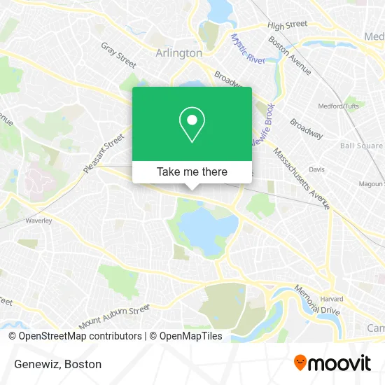
See Genewiz, Cambridge, on the map
Public Transit to Genewiz in Cambridge
Wondering how to get to Genewiz in Cambridge? Moovit helps you find the best way to get to Genewiz with step-by-step directions from the nearest public transit station.
Moovit provides free maps and live directions to help you navigate through your city. View schedules, routes, timetables, and find out how long does it take to get to Genewiz in real time.
Looking for the nearest stop or station to Genewiz? Check out this list of stops closest to your destination: Concord Ave @ Blanchard Rd; Waverley; Davis Sq..
Bus: 74, 78.Train: FITCHBURG.Subway: RED LINE.
Want to see if there’s another route that gets you there at an earlier time? Moovit helps you find alternative routes or times. Get directions from and directions to Genewiz easily from the Moovit App or Website.
We make riding to Genewiz easy, which is why over 1.7 million users, including users in Cambridge, trust Moovit as the best app for public transit. You don’t need to download an individual bus app or train app, Moovit is your all-in-one transit app that helps you find the best bus time or train time available.
For information on prices of bus, subway and train, costs and ride fares to Genewiz, please check the Moovit app.
Use the app to navigate to popular places including to the airport, hospital, stadium, grocery store, mall, coffee shop, school, college, and university.
Genewiz Address: 733 Concord Ave street in Cambridge
- Geo Mart,
- Nano Terra,
- Italian MC Wear,
- Sobuta, Andy, Pt,
- Joycelyn Datu MD,
- Ronald Warren, MD,
- Ent Surgery Associates,
- Rma Policies,
- Fayerweather Street School,
- ProEMS,
- Zhao Acupuncture,
- Higher Synthesis Foundation,
- Paula Wright Electrolysis,
- Herbert Martha MD,
- Fo Guang Buddhist Temple Boston 佛光山波士頓三佛中心,
- Xsurgical Robotics,
- Genorsco,
- Dr Elizabeth E McKeen, MD,
- De Bonte Leeuw,
- DaVita Dialysis Center
Places Near Genewiz (Cambridge)
- House Of Blues, Boston,
- Castle Island, Boston,
- Mgm Music Hall, Boston,
- Leader Bank Pavilion (Leader Bank Pavillion), Boston,
- Massachusetts General Hospital, Boston,
- Boston Common, Boston,
- Prudential Center, Boston,
- Quincy Market, Boston,
- Isabella Stewart Gardner Museum, Boston,
- Seaport District, Boston,
- Museum Of Science, Boston,
- Cheers, Boston,
- Boston Medical Center, Boston,
- Faneuil Hall, Boston,
- North End, Boston,
- Wilbur Theatre, Boston,
- Td Garden, Boston,
- Boston Convention & Exhibition Center, Boston,
- Boston Children's Hospital, Boston,
- Wang Theater, Boston
How to get to popular places in Boston with public transit
Get around Cambridge by public transit!
Traveling around Cambridge has never been so easy. See step by step directions as you travel to any attraction, street or major public transit station. View bus and train schedules, arrival times, service alerts and detailed routes on a map, so you know exactly how to get to anywhere in Cambridge.
When traveling to any destination around Cambridge use Moovit's Live Directions with Get Off Notifications to know exactly where and how far to walk, how long to wait for your line, and how many stops are left. Moovit will alert you when it's time to get off — no need to constantly re-check whether yours is the next stop.
Wondering how to use public transit in Cambridge or how to pay for public transit in Cambridge? Moovit public transit app can help you navigate your way with public transit easily, and at minimum cost. It includes public transit fees, ticket prices, and costs. Looking for a map of Cambridge public transit lines? Moovit public transit app shows all public transit maps in Cambridge with all Bus, Train, Subway and Ferry routes and stops on an interactive map.
Boston has 4 transit type(s), including: Bus, Train, Subway and Ferry, operated by several transit agencies, including MBTA, Southeastern Regional Transit Authority, MetroWest Regional Transit Authority, Rhode Island Public Transit Authority, WRTA, Lowell Regional Transit Authority, Merrimack Valley Transit, Montachusett Regional Transit Authority, Cape Cod Regional Transit Authority, Brockton Area Transit Authority, Martha's Vineyard Transit Authority, the WAVE - Nantucket Regional Transit Authority, GATRA, Cape Ann Transportation Authority and Massport