Directions to Geo Nail Studio (Boston) with public transportation
The following transit lines have routes that pass near Geo Nail Studio
 Bus: B6.
How to get to Geo Nail Studio by bus?
Click on the bus route to see step by step directions with maps, line arrival times and updated time schedules.
From South High Community School, Worcester
203 minFrom Dcu Center, Worcester
109 minFrom Worcester, MA, Worcester
107 minFrom Walmart Supercenter, Worcester
165 minFrom Foxwoods, Worcester
136 minFrom Palladium, Worcester
112 minFrom Polar Park, Worcester
108 minFrom Registry Of Motor Vehicles (Rmv) Branch Office, Worcester
111 min
Bus stop near Geo Nail Studio in Boston
- Berkshire / Page, 3 min walk,VIEW
Bus lines to Geo Nail Studio in Boston
- B6, Ludlow Big Y Via Bay/Berkshire,VIEW
What are the closest stations to Geo Nail Studio?
The closest stations to Geo Nail Studio are:
- Berkshire / Page is 144 yards away, 3 min walk.
Which bus line stops near Geo Nail Studio?
B6 (Ludlow Big Y Via Bay/Berkshire/Pasco)
What’s the nearest bus station to Geo Nail Studio in Boston?
The nearest bus station to Geo Nail Studio in Boston is Berkshire / Page. It’s a 3 min walk away.
What time is the first bus to Geo Nail Studio in Boston?
The B6 is the first bus that goes to Geo Nail Studio in Boston. It stops nearby at 5:27 AM.
What time is the last bus to Geo Nail Studio in Boston?
The B6 is the last bus that goes to Geo Nail Studio in Boston. It stops nearby at 10:18 PM.
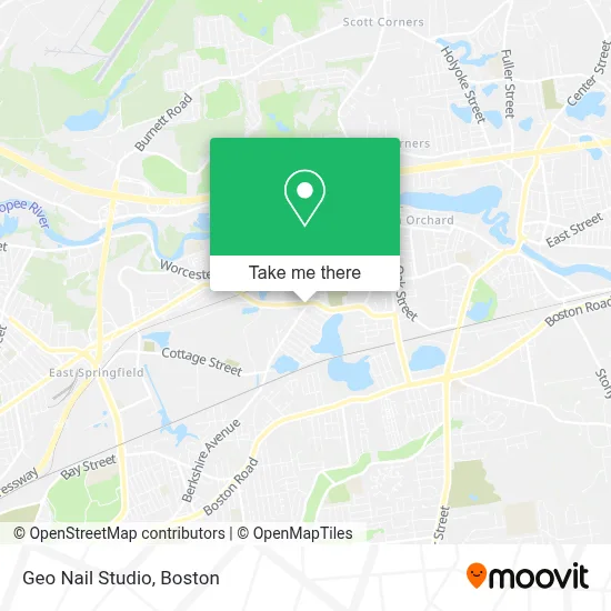
See Geo Nail Studio, Boston, on the map
Public Transit to Geo Nail Studio in Boston
Wondering how to get to Geo Nail Studio in Boston? Moovit helps you find the best way to get to Geo Nail Studio with step-by-step directions from the nearest public transit station.
Moovit provides free maps and live directions to help you navigate through your city. View schedules, routes, timetables, and find out how long does it take to get to Geo Nail Studio in real time.
Looking for the nearest stop or station to Geo Nail Studio? Check out this list of stops closest to your destination: Berkshire / Page.
Bus: B6.
Want to see if there’s another route that gets you there at an earlier time? Moovit helps you find alternative routes or times. Get directions from and directions to Geo Nail Studio easily from the Moovit App or Website.
We make riding to Geo Nail Studio easy, which is why over 1.7 million users, including users in Boston, trust Moovit as the best app for public transit. You don’t need to download an individual bus app or train app, Moovit is your all-in-one transit app that helps you find the best bus time or train time available.
For information on prices of bus, costs and ride fares to Geo Nail Studio, please check the Moovit app.
Use the app to navigate to popular places including to the airport, hospital, stadium, grocery store, mall, coffee shop, school, college, and university.
Geo Nail Studio Address: 1142 Berkshire Ave street in Boston
- La Taqueria de Mexico,
- Breezeways Wellness,
- Orchard Plaza,
- Apwu Afl Cio,
- Polish American Veterans,
- Pride,
- Springfield Pallet,
- Pioneer Valley Signs,
- USPS Collection Box - Po Lobby,
- Ernie's Pool Warehouse,
- Nes Rentals,
- DJ Productions,
- Monster Junk Yard,
- Faith Marie,
- Us Postal Service Springfield Network Distribution Center,
- Saint Aloysius Cemetery,
- Lake Lorraine,
- ATM,
- Monsanto Company Upper Dam,
- Plastic Park Pond
Places Near Geo Nail Studio (Boston)
- Faneuil Hall, Boston,
- Boston Medical Center, Boston,
- Boston Children's Hospital, Boston,
- Museum Of Science, Boston,
- Wang Theater, Boston,
- Cheers, Boston,
- North End, Boston,
- House Of Blues, Boston,
- Seaport District, Boston,
- Boston Convention & Exhibition Center, Boston,
- Castle Island, Boston,
- Quincy Market, Boston,
- Boston Common, Boston,
- Prudential Center, Boston,
- Leader Bank Pavilion (Leader Bank Pavillion), Boston,
- Massachusetts General Hospital, Boston,
- Wilbur Theatre, Boston,
- Td Garden, Boston,
- Mgm Music Hall, Boston,
- Isabella Stewart Gardner Museum, Boston
How to get to popular places in Boston with public transit
Get around Boston by public transit!
Traveling around Boston has never been so easy. See step by step directions as you travel to any attraction, street or major public transit station. View bus and train schedules, arrival times, service alerts and detailed routes on a map, so you know exactly how to get to anywhere in Boston.
When traveling to any destination around Boston use Moovit's Live Directions with Get Off Notifications to know exactly where and how far to walk, how long to wait for your line, and how many stops are left. Moovit will alert you when it's time to get off — no need to constantly re-check whether yours is the next stop.
Wondering how to use public transit in Boston or how to pay for public transit in Boston? Moovit public transit app can help you navigate your way with public transit easily, and at minimum cost. It includes public transit fees, ticket prices, and costs. Looking for a map of Boston public transit lines? Moovit public transit app shows all public transit maps in Boston with all Bus, Train, Subway and Ferry routes and stops on an interactive map.
Boston has 4 transit type(s), including: Bus, Train, Subway and Ferry, operated by several transit agencies, including MBTA, Southeastern Regional Transit Authority, MetroWest Regional Transit Authority, Rhode Island Public Transit Authority, WRTA, Lowell Regional Transit Authority, Merrimack Valley Transit, Montachusett Regional Transit Authority, Cape Cod Regional Transit Authority, Brockton Area Transit Authority, Martha's Vineyard Transit Authority, the WAVE - Nantucket Regional Transit Authority, GATRA, Cape Ann Transportation Authority and Massport