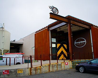
Directions to Georgetown Brewing Co (Seattle) with public transportation
The following transit lines have routes that pass near Georgetown Brewing Co
How to get to Georgetown Brewing Co by bus?
Click on the bus route to see step by step directions with maps, line arrival times and updated time schedules.
Bus stops near Georgetown Brewing Co in Seattle
- Airpt Way S & S Doris St, 1 min walk,
Bus lines to Georgetown Brewing Co in Seattle
- 124, Tukwila Link Station Georgetown,
What are the closest stations to Georgetown Brewing Co?
The closest stations to Georgetown Brewing Co are:
- Airpt Way S & S Doris St is 58 yards away, 1 min walk.
Which bus line stops near Georgetown Brewing Co?
124
What’s the nearest bus stop to Georgetown Brewing Co in Seattle?
The nearest bus stop to Georgetown Brewing Co in Seattle is Airpt Way S & S Doris St. It’s a 1 min walk away.
See Georgetown Brewing Co, Seattle, on the map
Public Transit to Georgetown Brewing Co in Seattle
Wondering how to get to Georgetown Brewing Co in Seattle, United States? Moovit helps you find the best way to get to Georgetown Brewing Co with step-by-step directions from the nearest public transit station.
Moovit provides free maps and live directions to help you navigate through your city. View schedules, routes, timetables, and find out how long does it take to get to Georgetown Brewing Co in real time.
Looking for the nearest stop or station to Georgetown Brewing Co? Check out this list of stops closest to your destination: Airpt Way S & S Doris St.
Bus: 124.
Want to see if there’s another route that gets you there at an earlier time? Moovit helps you find alternative routes or times. Get directions from and directions to Georgetown Brewing Co easily from the Moovit App or Website.
We make riding to Georgetown Brewing Co easy, which is why over 1.5 million users, including users in Seattle, trust Moovit as the best app for public transit. You don’t need to download an individual bus app or train app, Moovit is your all-in-one transit app that helps you find the best bus time or train time available.
For information on prices of bus, costs and ride fares to Georgetown Brewing Co, please check the Moovit app.
Use the app to navigate to popular places including to the airport, hospital, stadium, grocery store, mall, coffee shop, school, college, and university.
Location: Seattle, Seattle - Tacoma, WA
Attractions near Georgetown Brewing Co
Metal Solutions LLC,Sweet Spirit Candles Internati,Sidereal Press,Ken Caruso,Phenol55,Issue Design Build,Landbridge Lighting,Sweet Spirit Candles,Status Inc Custom Ceramics,Sandscript,Georgetown Studios @ The Engine Room,The Conservatory,Georgetown Art Attack,Georgetown Arts and Cultural Center,Atelier Coffee Company, Ltd.,Seattle Tavern & Pool Room,Museum of Curious Things,Sire Vintage,Misfits Georgetown, Wa,Tyco Valves & ControlsHow to get to popular attractions in Seattle with public transit
Sumner Station, Sumner,The Old Spaghetti Factory, Tacoma,The Home Depot,Jollibee, Tukwila,Shoreline Community College, Shoreline,Southcenter Mall, Tukwila,Edmonds Community College, Lynnwood,North Bend, WA, North Bend,Quil Ceda Creek Casino & Nightclub,Harborview Medical Center, Seattle,Westlake Center, Seattle,Upper Queen Anne, Seattle,Loews Hotel 1000, Seattle, Seattle,City of University Place, University Place,Costco Wholesale, Federal Way,Downtown Tacoma, Tacoma,Stadium Thriftway, Tacoma,City of Olympia, Olympia,Washington State Fair & Events Center, Puyallup,Bellevue College, BellevueGet around Seattle - Tacoma, WA by public transit!
Traveling around Seattle - Tacoma, WA has never been so easy. See step by step directions as you travel to any attraction, street or major public transit station. View bus and train schedules, arrival times, service alerts and detailed routes on a map, so you know exactly how to get to anywhere in Seattle - Tacoma, WA.
When traveling to any destination around Seattle - Tacoma, WA use Moovit's Live Directions with Get Off Notifications to know exactly where and how far to walk, how long to wait for your line, and how many stops are left. Moovit will alert you when it's time to get off — no need to constantly re-check whether yours is the next stop.
Wondering how to use public transit in Seattle - Tacoma, WA or how to pay for public transit in Seattle - Tacoma, WA? Moovit public transit app can help you navigate your way with public transit easily, and at minimum cost. It includes public transit fees, ticket prices, and costs. Looking for a map of Seattle - Tacoma, WA public transit lines? Moovit public transit app shows all public transit maps in Seattle - Tacoma, WA with all Bus, Train, Light Rail and Ferry routes and stops on an interactive map.
Seattle - Tacoma, WA has 4 transit type(s), including: Bus, Train, Light Rail and Ferry, operated by several transit agencies, including Sound Transit, Seattle Streetcar, Metro Transit, Whatcom Transportation Authority, Mason Transit Authority, Snoqualmie Valley Transportation (SVT), Snoqualmie Valley Transportation, Amtrak, Island Transit, Kitsap Transit, Intercity Transit, Everett Transit, Community Transit, Skagit Transit, Pierce Transit