Directions to Gibbs (Boston) with public transportation
The following transit lines have routes that pass near Gibbs
 Bus: 17, 18, 19, 22, 23.
- Train: FAIRMOUNT, FRANKLIN/FOXBORO, FAIRMOUNT LINE SHUTTLE, PROVIDENCE/STOUGHTON.
- Subway: RED LINE, MATTAPAN LINE.
How to get to Gibbs by bus?
Click on the bus route to see step by step directions with maps, line arrival times and updated time schedules.
From Downeast Cider House, Boston
101 minFrom Brighton, Boston
79 minFrom The Westin Boston Waterfront, Boston
71 minFrom Harvard Upper Busway, Cambridge
82 minFrom Mr Dooley's Boston Tavern, Boston
65 minFrom Alumni Stadium, Newton
97 minFrom Studio Allston, Boston
91 minFrom Faneuil Hall, Boston
72 minFrom Hotel Commonwealth, Boston
59 minFrom The Cheesecake Factory, Boston
57 min
How to get to Gibbs by train?
Click on the train route to see step by step directions with maps, line arrival times and updated time schedules.
How to get to Gibbs by subway?
Click on the subway route to see step by step directions with maps, line arrival times and updated time schedules.
From Brighton, Boston
81 minFrom The Westin Boston Waterfront, Boston
39 minFrom Harvard Upper Busway, Cambridge
37 minFrom Mr Dooley's Boston Tavern, Boston
34 minFrom Alumni Stadium, Newton
84 minFrom Faneuil Hall, Boston
30 minFrom Hotel Commonwealth, Boston
44 minFrom The Cheesecake Factory, Boston
46 min
Bus stops near Gibbs in Boston
Train stations near Gibbs in Boston
- Talbot Avenue, 21 min walk,VIEW
Bus lines to Gibbs in Boston
- 15, Ruggles - Fields Corner,VIEW
- 18, Andrew - Ashmont,VIEW
- RED LINE SHUTTLE, Ashmont - Park Street via Post Office,VIEW
- RED LINE SHUTTLE, Ashmont - JFK/UMass (Shuttle),VIEW
- RED LINE SHUTTLE, Ashmont - JFK/UMass,VIEW
- RED LINE SHUTTLE, Ashmont - Broadway (Shuttle),VIEW
- RED/MATTAPAN LINE SHUTTLE, Mattapan - JFK/UMass,VIEW
- 201, Avenue Louis Pasteur Via Fields Corner,VIEW
- 19, Gallivan Blvd,VIEW
- 202, Keystone Apts Via Adams St,VIEW
What are the closest stations to Gibbs?
The closest stations to Gibbs are:
- Dorchester Ave @ Centre St is 49 yards away, 1 min walk.
- Adams St Opp Lonsdale St is 336 yards away, 4 min walk.
- Fields Corner is 390 yards away, 5 min walk.
- Adams St @ King St is 634 yards away, 8 min walk.
- Talbot Avenue is 1716 yards away, 21 min walk.
- Cedar Grove is 1954 yards away, 24 min walk.
Which bus lines stop near Gibbs?
These bus lines stop near Gibbs: 17, 18, 19, 22, 23.
Which train line stops near Gibbs?
FAIRMOUNT (#1619 | Fairmount)
Which subway line stops near Gibbs?
RED LINE (Ashmont/Braintree)
What’s the nearest subway station to Gibbs in Boston?
The nearest subway station to Gibbs in Boston is Fields Corner. It’s a 5 min walk away.
What’s the nearest train station to Gibbs in Boston?
The nearest train station to Gibbs in Boston is Talbot Avenue. It’s a 21 min walk away.
What’s the nearest bus station to Gibbs in Boston?
The nearest bus station to Gibbs in Boston is Dorchester Ave @ Centre St. It’s a 1 min walk away.
What time is the first subway to Gibbs in Boston?
The MATTAPAN LINE is the first subway that goes to Gibbs in Boston. It stops nearby at 5:10 AM.
What time is the last subway to Gibbs in Boston?
The MATTAPAN LINE is the last subway that goes to Gibbs in Boston. It stops nearby at 2:31 AM.
What time is the first train to Gibbs in Boston?
The FAIRMOUNT is the first train that goes to Gibbs in Boston. It stops nearby at 4:41 AM.
What time is the last train to Gibbs in Boston?
The FAIRMOUNT is the last train that goes to Gibbs in Boston. It stops nearby at 12:03 AM.
What time is the first bus to Gibbs in Boston?
The 15 is the first bus that goes to Gibbs in Boston. It stops nearby at 3:27 AM.
What time is the last bus to Gibbs in Boston?
The 201 is the last bus that goes to Gibbs in Boston. It stops nearby at 12:47 AM.
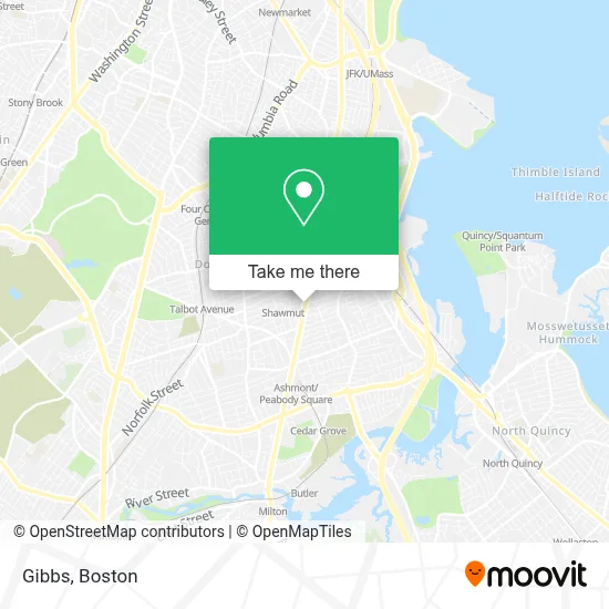
See Gibbs, Boston, on the map
Public Transit to Gibbs in Boston
Wondering how to get to Gibbs in Boston? Moovit helps you find the best way to get to Gibbs with step-by-step directions from the nearest public transit station.
Moovit provides free maps and live directions to help you navigate through your city. View schedules, routes, timetables, and find out how long does it take to get to Gibbs in real time.
Looking for the nearest stop or station to Gibbs? Check out this list of stops closest to your destination: Dorchester Ave @ Centre St; Adams St Opp Lonsdale St; Fields Corner; Adams St @ King St; Talbot Avenue; Cedar Grove.
Bus: 17, 18, 19, 22, 23, 15, RED LINE SHUTTLE, RED LINE SHUTTLE, RED LINE SHUTTLE, 201.Train: FAIRMOUNT, FRANKLIN/FOXBORO, FAIRMOUNT LINE SHUTTLE, PROVIDENCE/STOUGHTON.Subway: RED LINE, MATTAPAN LINE.
Want to see if there’s another route that gets you there at an earlier time? Moovit helps you find alternative routes or times. Get directions from and directions to Gibbs easily from the Moovit App or Website.
We make riding to Gibbs easy, which is why over 1.7 million users, including users in Boston, trust Moovit as the best app for public transit. You don’t need to download an individual bus app or train app, Moovit is your all-in-one transit app that helps you find the best bus time or train time available.
For information on prices of subway, bus and train, costs and ride fares to Gibbs, please check the Moovit app.
Use the app to navigate to popular places including to the airport, hospital, stadium, grocery store, mall, coffee shop, school, college, and university.
Gibbs Address: 1707 Dorchester Ave street in Boston
- Daumos Boutique,
- St. Mark's Catholic Church,
- Henderson K12 Inclusion School Friends,
- The Maneikis Companies,
- Dareales,
- O'Brien's Market & Deli,
- TL Cargo,
- Italian Item,
- Logan Construction Services,
- American Dry Cleaners,
- Via Cannuccia,
- Thuy's Hair Salon (Gigi Hair Concepts),
- Slushy Lady Boston's Italian Ice Mobile Bar Service,
- King St,
- St Joseph Rehab,
- Hallows Eve Fun Run,
- Sisters in Motion Travel,
- MR. Kool Ice Cream Truck,
- Shawmut Station,
- Shawmut Station - MBTA - Red Line
Places Near Gibbs (Boston)
- Leader Bank Pavilion (Leader Bank Pavillion), Boston,
- Boston Common, Boston,
- House Of Blues, Boston,
- Wilbur Theatre, Boston,
- Massachusetts General Hospital, Boston,
- Quincy Market, Boston,
- Boston Children's Hospital, Boston,
- Mgm Music Hall, Boston,
- Faneuil Hall, Boston,
- Prudential Center, Boston,
- Wang Theater, Boston,
- North End, Boston,
- Museum Of Science, Boston,
- Boston Medical Center, Boston,
- Boston Convention & Exhibition Center, Boston,
- Castle Island, Boston,
- Td Garden, Boston,
- Cheers, Boston,
- Seaport District, Boston,
- Isabella Stewart Gardner Museum, Boston
How to get to popular places in Boston with public transit
Get around Boston by public transit!
Traveling around Boston has never been so easy. See step by step directions as you travel to any attraction, street or major public transit station. View bus and train schedules, arrival times, service alerts and detailed routes on a map, so you know exactly how to get to anywhere in Boston.
When traveling to any destination around Boston use Moovit's Live Directions with Get Off Notifications to know exactly where and how far to walk, how long to wait for your line, and how many stops are left. Moovit will alert you when it's time to get off — no need to constantly re-check whether yours is the next stop.
Wondering how to use public transit in Boston or how to pay for public transit in Boston? Moovit public transit app can help you navigate your way with public transit easily, and at minimum cost. It includes public transit fees, ticket prices, and costs. Looking for a map of Boston public transit lines? Moovit public transit app shows all public transit maps in Boston with all Bus, Train, Subway and Ferry routes and stops on an interactive map.
Boston has 4 transit type(s), including: Bus, Train, Subway and Ferry, operated by several transit agencies, including MBTA, Southeastern Regional Transit Authority, MetroWest Regional Transit Authority, Rhode Island Public Transit Authority, WRTA, Lowell Regional Transit Authority, Merrimack Valley Transit, Montachusett Regional Transit Authority, Cape Cod Regional Transit Authority, Brockton Area Transit Authority, Martha's Vineyard Transit Authority, the WAVE - Nantucket Regional Transit Authority, GATRA, Cape Ann Transportation Authority and Massport