How to get to Gibson And Gray by bus?
Click on the bus route to see step by step directions with maps, line arrival times and updated time schedules.
From Old South Church, Boston
64 minFrom Cheers, Boston
74 minFrom MCPHS University-Boston, Boston
77 minFrom Brookline High School (Brookline Town High School), Brookline
88 minFrom Lolita Cocina & Tequila Bar, Boston
64 minFrom Citizenm Boston Back Bay Hotel, Boston
53 minFrom Boda Borg, Malden
55 minFrom Thermo Fisher Scientific, Waltham
118 minFrom Encore Boston Harbor, Everett
59 minFrom Acorn Street, Boston
79 min
How to get to Gibson And Gray by train?
Click on the train route to see step by step directions with maps, line arrival times and updated time schedules.
How to get to Gibson And Gray by subway?
Click on the subway route to see step by step directions with maps, line arrival times and updated time schedules.
From Old South Church, Boston
80 minFrom Cheers, Boston
77 minFrom MCPHS University-Boston, Boston
96 minFrom Brookline High School (Brookline Town High School), Brookline
101 minFrom Lolita Cocina & Tequila Bar, Boston
79 minFrom Citizenm Boston Back Bay Hotel, Boston
86 minFrom Boda Borg, Malden
95 minFrom Acorn Street, Boston
74 min
Bus stops near Gibson And Gray in Arlington
Subway station near Gibson And Gray in Arlington
- Alewife, 34 min walk,VIEW
Train stations near Gibson And Gray in Arlington
What are the closest stations to Gibson And Gray?
The closest stations to Gibson And Gray are:
- Massachusetts Ave @ Willow Ct is 309 yards away, 4 min walk.
- Massachusetts Ave @ Academy St is 453 yards away, 6 min walk.
- Alewife is 2878 yards away, 34 min walk.
- Belmont is 3589 yards away, 42 min walk.
- West Medford is 5114 yards away, 60 min walk.
Which bus lines stop near Gibson And Gray?
These bus lines stop near Gibson And Gray: 67, 77.
Which train lines stop near Gibson And Gray?
These train lines stop near Gibson And Gray: FITCHBURG, LOWELL.
Which subway line stops near Gibson And Gray?
RED LINE (Alewife)
What’s the nearest bus station to Gibson And Gray in Arlington?
The nearest bus station to Gibson And Gray in Arlington is Massachusetts Ave @ Willow Ct. It’s a 4 min walk away.
What time is the first subway to Gibson And Gray in Arlington?
The RED LINE is the first subway that goes to Gibson And Gray in Arlington. It stops nearby at 5:15 AM.
What time is the last subway to Gibson And Gray in Arlington?
The RED LINE is the last subway that goes to Gibson And Gray in Arlington. It stops nearby at 2:06 AM.
What time is the first train to Gibson And Gray in Arlington?
The LOWELL is the first train that goes to Gibson And Gray in Arlington. It stops nearby at 5:31 AM.
What time is the last train to Gibson And Gray in Arlington?
The LOWELL is the last train that goes to Gibson And Gray in Arlington. It stops nearby at 12:20 AM.
What time is the first bus to Gibson And Gray in Arlington?
The 77 is the first bus that goes to Gibson And Gray in Arlington. It stops nearby at 4:52 AM.
What time is the last bus to Gibson And Gray in Arlington?
The 77 is the last bus that goes to Gibson And Gray in Arlington. It stops nearby at 1:24 AM.
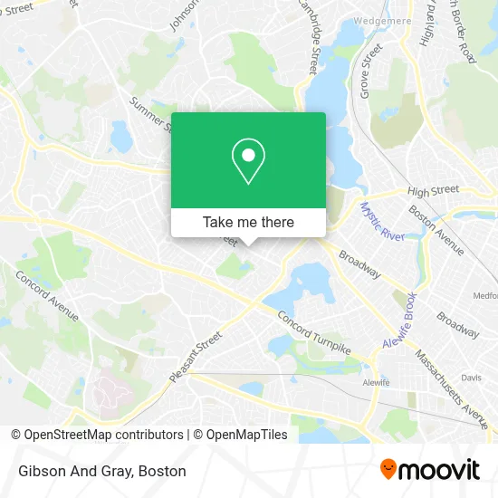
See Gibson And Gray, Arlington, on the map
Public Transit to Gibson And Gray in Arlington
Wondering how to get to Gibson And Gray in Arlington? Moovit helps you find the best way to get to Gibson And Gray with step-by-step directions from the nearest public transit station.
Moovit provides free maps and live directions to help you navigate through your city. View schedules, routes, timetables, and find out how long does it take to get to Gibson And Gray in real time.
Looking for the nearest stop or station to Gibson And Gray? Check out this list of stops closest to your destination: Massachusetts Ave @ Willow Ct; Massachusetts Ave @ Academy St; Alewife; Belmont; West Medford.
Bus: 67, 77.Train: FITCHBURG, LOWELL.Subway: RED LINE.
Want to see if there’s another route that gets you there at an earlier time? Moovit helps you find alternative routes or times. Get directions from and directions to Gibson And Gray easily from the Moovit App or Website.
We make riding to Gibson And Gray easy, which is why over 1.7 million users, including users in Arlington, trust Moovit as the best app for public transit. You don’t need to download an individual bus app or train app, Moovit is your all-in-one transit app that helps you find the best bus time or train time available.
For information on prices of bus, subway and train, costs and ride fares to Gibson And Gray, please check the Moovit app.
Use the app to navigate to popular places including to the airport, hospital, stadium, grocery store, mall, coffee shop, school, college, and university.
Gibson And Gray Address: 103 Gray St street in Arlington
- Greater Boston,
- Mls Property Information Network, Inc.,
- Cipolloni B Dr,
- Tibet Arts,
- Berkshire Hathaway Homeservices,
- Eckon,
- Macingenius,
- Breezys Butters,
- GEICO,
- Drikung Meditation Center,
- FedEx,
- Regina Gifts,
- Joe's Barber Shop,
- Otaku Gifts Shop,
- A T B Travel Network,
- Wild Ember,
- Body Tune,
- Coinstar - Bitcoin ATM,
- American Locksmith,
- Freebird Designs
Places Near Gibson And Gray (Arlington)
- House Of Blues, Boston,
- Prudential Center, Boston,
- Wang Theater, Boston,
- Boston Convention & Exhibition Center, Boston,
- Wilbur Theatre, Boston,
- Boston Children's Hospital, Boston,
- North End, Boston,
- Boston Medical Center, Boston,
- Boston Common, Boston,
- Museum Of Science, Boston,
- Td Garden, Boston,
- Mgm Music Hall, Boston,
- Massachusetts General Hospital, Boston,
- Faneuil Hall, Boston,
- Seaport District, Boston,
- Quincy Market, Boston,
- Isabella Stewart Gardner Museum, Boston,
- Cheers, Boston,
- Leader Bank Pavilion (Leader Bank Pavillion), Boston,
- Castle Island, Boston
How to get to popular places in Boston with public transit
Get around Arlington by public transit!
Traveling around Arlington has never been so easy. See step by step directions as you travel to any attraction, street or major public transit station. View bus and train schedules, arrival times, service alerts and detailed routes on a map, so you know exactly how to get to anywhere in Arlington.
When traveling to any destination around Arlington use Moovit's Live Directions with Get Off Notifications to know exactly where and how far to walk, how long to wait for your line, and how many stops are left. Moovit will alert you when it's time to get off — no need to constantly re-check whether yours is the next stop.
Wondering how to use public transit in Arlington or how to pay for public transit in Arlington? Moovit public transit app can help you navigate your way with public transit easily, and at minimum cost. It includes public transit fees, ticket prices, and costs. Looking for a map of Arlington public transit lines? Moovit public transit app shows all public transit maps in Arlington with all Bus, Train, Subway and Ferry routes and stops on an interactive map.
Boston has 4 transit type(s), including: Bus, Train, Subway and Ferry, operated by several transit agencies, including MBTA, Southeastern Regional Transit Authority, MetroWest Regional Transit Authority, Rhode Island Public Transit Authority, WRTA, Lowell Regional Transit Authority, Merrimack Valley Transit, Montachusett Regional Transit Authority, Cape Cod Regional Transit Authority, Brockton Area Transit Authority, Martha's Vineyard Transit Authority, the WAVE - Nantucket Regional Transit Authority, GATRA, Cape Ann Transportation Authority and Massport