How to get to Gilmore Landscape Architecture by bus?
Click on the bus route to see step by step directions with maps, line arrival times and updated time schedules.
From 110 Francis Street Garage, Boston
73 minFrom Beth Israel Deaconess Medical Center, Boston
67 minFrom Micro Center (Micro Elecronics), Cambridge
66 minFrom Cambridge, MA, Cambridge
38 minFrom Stone Zoo, Stoneham
116 minFrom Guitar Center, Boston
63 minFrom Boston Arts Academy, Boston
62 minFrom Galleria Mall, Cambridge
71 minFrom Beth Israel Hospital, Boston
68 minFrom Embassy Suites by Hilton Boston Waltham, Waltham
124 min
How to get to Gilmore Landscape Architecture by train?
Click on the train route to see step by step directions with maps, line arrival times and updated time schedules.
How to get to Gilmore Landscape Architecture by subway?
Click on the subway route to see step by step directions with maps, line arrival times and updated time schedules.
Bus stops near Gilmore Landscape Architecture in Belmont
Subway station near Gilmore Landscape Architecture in Belmont
- Alewife, 34 min walk,VIEW
Train stations near Gilmore Landscape Architecture in Belmont
Bus lines to Gilmore Landscape Architecture in Belmont
What are the closest stations to Gilmore Landscape Architecture?
The closest stations to Gilmore Landscape Architecture are:
- Park Ave Opp Wachusett Ave is 229 yards away, 3 min walk.
- West Service Rd @ George St is 280 yards away, 4 min walk.
- Alewife is 2881 yards away, 34 min walk.
- Waverley is 3502 yards away, 41 min walk.
- West Medford is 5434 yards away, 64 min walk.
Which bus lines stop near Gilmore Landscape Architecture?
These bus lines stop near Gilmore Landscape Architecture: 554, 62, 78, 80.
Which train line stops near Gilmore Landscape Architecture?
FITCHBURG (#414 | North Station)
Which subway line stops near Gilmore Landscape Architecture?
RED LINE (Alewife)
What’s the nearest bus station to Gilmore Landscape Architecture in Belmont?
The nearest bus station to Gilmore Landscape Architecture in Belmont is Park Ave Opp Wachusett Ave. It’s a 3 min walk away.
What time is the first subway to Gilmore Landscape Architecture in Belmont?
The RED LINE is the first subway that goes to Gilmore Landscape Architecture in Belmont. It stops nearby at 5:15 AM.
What time is the last subway to Gilmore Landscape Architecture in Belmont?
The RED LINE is the last subway that goes to Gilmore Landscape Architecture in Belmont. It stops nearby at 2:06 AM.
What time is the first train to Gilmore Landscape Architecture in Belmont?
The LOWELL is the first train that goes to Gilmore Landscape Architecture in Belmont. It stops nearby at 5:31 AM.
What time is the last train to Gilmore Landscape Architecture in Belmont?
The LOWELL is the last train that goes to Gilmore Landscape Architecture in Belmont. It stops nearby at 12:20 AM.
What time is the first bus to Gilmore Landscape Architecture in Belmont?
The 62 is the first bus that goes to Gilmore Landscape Architecture in Belmont. It stops nearby at 5:15 AM.
What time is the last bus to Gilmore Landscape Architecture in Belmont?
The 78 is the last bus that goes to Gilmore Landscape Architecture in Belmont. It stops nearby at 12:46 AM.
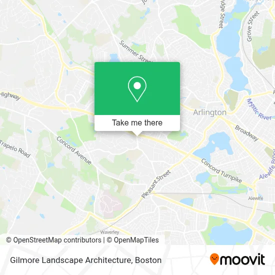
See Gilmore Landscape Architecture, Belmont, on the map
Public Transit to Gilmore Landscape Architecture in Belmont
Wondering how to get to Gilmore Landscape Architecture in Belmont? Moovit helps you find the best way to get to Gilmore Landscape Architecture with step-by-step directions from the nearest public transit station.
Moovit provides free maps and live directions to help you navigate through your city. View schedules, routes, timetables, and find out how long does it take to get to Gilmore Landscape Architecture in real time.
Looking for the nearest stop or station to Gilmore Landscape Architecture? Check out this list of stops closest to your destination: Park Ave Opp Wachusett Ave; West Service Rd @ George St; Alewife; Waverley; West Medford.
Bus: 554, 62, 78, 80, 76.Train: FITCHBURG, LOWELL.Subway: RED LINE.
Want to see if there’s another route that gets you there at an earlier time? Moovit helps you find alternative routes or times. Get directions from and directions to Gilmore Landscape Architecture easily from the Moovit App or Website.
We make riding to Gilmore Landscape Architecture easy, which is why over 1.7 million users, including users in Belmont, trust Moovit as the best app for public transit. You don’t need to download an individual bus app or train app, Moovit is your all-in-one transit app that helps you find the best bus time or train time available.
For information on prices of bus, subway and train, costs and ride fares to Gilmore Landscape Architecture, please check the Moovit app.
Use the app to navigate to popular places including to the airport, hospital, stadium, grocery store, mall, coffee shop, school, college, and university.
Gilmore Landscape Architecture Address: 94 Park Ave street in Belmont
- Petit Vin LLC,
- Melvoin Academic Center,
- Eddie's Tree Service,
- Pulitano,
- Science Center,
- Mls Property Information Network, Inc.,
- Belmont Hill School,
- Landscape Design, Install and Maintenance, Eastern Ma,
- Lutheran Social Services,
- St Gregory's Rectory,
- Sichem Temple Youth Ministries,
- MBTA Bus Route 84,
- LDS Boston Center,
- Distribution Services,
- Holistic Chiropractic Care,
- Address Masterpiece Cards,
- Chikako Designs,
- Hank Wonder Tunes,
- Ascend Wellness Consulting,
- Power Pro Exteriors
Places Near Gilmore Landscape Architecture (Belmont)
- Castle Island, Boston,
- House Of Blues, Boston,
- Leader Bank Pavilion (Leader Bank Pavillion), Boston,
- Mgm Music Hall, Boston,
- Seaport District, Boston,
- Boston Common, Boston,
- Museum Of Science, Boston,
- Prudential Center, Boston,
- North End, Boston,
- Quincy Market, Boston,
- Isabella Stewart Gardner Museum, Boston,
- Faneuil Hall, Boston,
- Boston Medical Center, Boston,
- Wilbur Theatre, Boston,
- Boston Convention & Exhibition Center, Boston,
- Massachusetts General Hospital, Boston,
- Cheers, Boston,
- Wang Theater, Boston,
- Boston Children's Hospital, Boston,
- Td Garden, Boston
How to get to popular places in Boston with public transit
Get around Belmont by public transit!
Traveling around Belmont has never been so easy. See step by step directions as you travel to any attraction, street or major public transit station. View bus and train schedules, arrival times, service alerts and detailed routes on a map, so you know exactly how to get to anywhere in Belmont.
When traveling to any destination around Belmont use Moovit's Live Directions with Get Off Notifications to know exactly where and how far to walk, how long to wait for your line, and how many stops are left. Moovit will alert you when it's time to get off — no need to constantly re-check whether yours is the next stop.
Wondering how to use public transit in Belmont or how to pay for public transit in Belmont? Moovit public transit app can help you navigate your way with public transit easily, and at minimum cost. It includes public transit fees, ticket prices, and costs. Looking for a map of Belmont public transit lines? Moovit public transit app shows all public transit maps in Belmont with all Bus, Train, Subway and Ferry routes and stops on an interactive map.
Boston has 4 transit type(s), including: Bus, Train, Subway and Ferry, operated by several transit agencies, including MBTA, Southeastern Regional Transit Authority, MetroWest Regional Transit Authority, Rhode Island Public Transit Authority, WRTA, Lowell Regional Transit Authority, Merrimack Valley Transit, Montachusett Regional Transit Authority, Cape Cod Regional Transit Authority, Brockton Area Transit Authority, Martha's Vineyard Transit Authority, the WAVE - Nantucket Regional Transit Authority, GATRA, Cape Ann Transportation Authority and Massport