How to get to Glacken Field Baseball Fields by bus?
Click on the bus route to see step by step directions with maps, line arrival times and updated time schedules.
From Boston University Henry M. Goldman School of Dental Medicine, Boston
51 minFrom Rental Car Center - Logan Airport, Boston
92 minFrom Mspca, Boston
68 minFrom South Boston, Boston
67 minFrom Hotel Aka Back Bay (Hotel Back Bay), Boston
51 minFrom Legal Harborside, Boston
79 minFrom Embassy Suites by Hilton Boston Waltham, Waltham
82 minFrom Mount Ida College, Newton
60 minFrom The Strand Theater, Boston
77 minFrom East Boston, Boston
93 min
How to get to Glacken Field Baseball Fields by subway?
Click on the subway route to see step by step directions with maps, line arrival times and updated time schedules.
From Boston University Henry M. Goldman School of Dental Medicine, Boston
82 minFrom Rental Car Center - Logan Airport, Boston
76 minFrom Mspca, Boston
99 minFrom South Boston, Boston
69 minFrom Hotel Aka Back Bay (Hotel Back Bay), Boston
70 minFrom Legal Harborside, Boston
83 minFrom The Strand Theater, Boston
88 minFrom East Boston, Boston
75 min
Bus stops near Glacken Field Baseball Fields in Cambridge
Subway station near Glacken Field Baseball Fields in Cambridge
- Harvard Square, 32 min walk,VIEW
Train station near Glacken Field Baseball Fields in Cambridge
- Belmont, 33 min walk,VIEW
What are the closest stations to Glacken Field Baseball Fields?
The closest stations to Glacken Field Baseball Fields are:
- Fresh Pond Golf Course is 73 yards away, 1 min walk.
- Belmont St @ Cushing St is 201 yards away, 3 min walk.
- Harvard Square is 2675 yards away, 32 min walk.
- Belmont is 2780 yards away, 33 min walk.
Which bus lines stop near Glacken Field Baseball Fields?
These bus lines stop near Glacken Field Baseball Fields: 71, 73, 75.
Which subway line stops near Glacken Field Baseball Fields?
RED LINE (Alewife)
What’s the nearest bus station to Glacken Field Baseball Fields in Cambridge?
The nearest bus station to Glacken Field Baseball Fields in Cambridge is Fresh Pond Golf Course. It’s a 1 min walk away.
What time is the first subway to Glacken Field Baseball Fields in Cambridge?
The RED LINE is the first subway that goes to Glacken Field Baseball Fields in Cambridge. It stops nearby at 5:15 AM.
What time is the last subway to Glacken Field Baseball Fields in Cambridge?
The RED LINE is the last subway that goes to Glacken Field Baseball Fields in Cambridge. It stops nearby at 2:06 AM.
What time is the first train to Glacken Field Baseball Fields in Cambridge?
The FITCHBURG is the first train that goes to Glacken Field Baseball Fields in Cambridge. It stops nearby at 5:41 AM.
What time is the last train to Glacken Field Baseball Fields in Cambridge?
The FITCHBURG is the last train that goes to Glacken Field Baseball Fields in Cambridge. It stops nearby at 12:17 AM.
What time is the first bus to Glacken Field Baseball Fields in Cambridge?
The 73 is the first bus that goes to Glacken Field Baseball Fields in Cambridge. It stops nearby at 4:53 AM.
What time is the last bus to Glacken Field Baseball Fields in Cambridge?
The 73 is the last bus that goes to Glacken Field Baseball Fields in Cambridge. It stops nearby at 1:13 AM.
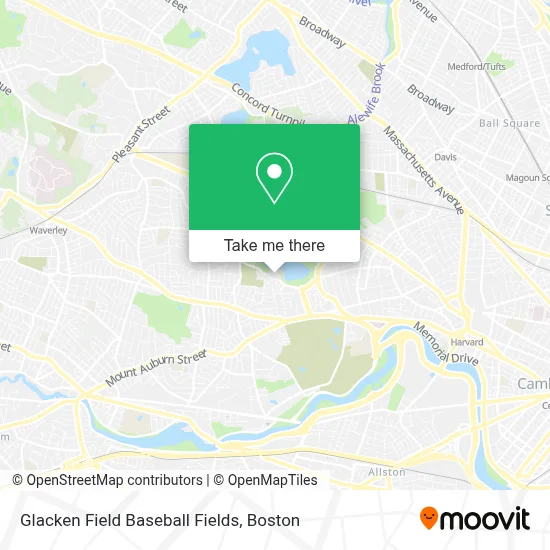
See Glacken Field Baseball Fields, Cambridge, on the map
Public Transit to Glacken Field Baseball Fields in Cambridge
Wondering how to get to Glacken Field Baseball Fields in Cambridge? Moovit helps you find the best way to get to Glacken Field Baseball Fields with step-by-step directions from the nearest public transit station.
Moovit provides free maps and live directions to help you navigate through your city. View schedules, routes, timetables, and find out how long does it take to get to Glacken Field Baseball Fields in real time.
Looking for the nearest stop or station to Glacken Field Baseball Fields? Check out this list of stops closest to your destination: Fresh Pond Golf Course; Belmont St @ Cushing St; Harvard Square; Belmont.
Bus: 71, 73, 75.Train: FITCHBURG.Subway: RED LINE.
Want to see if there’s another route that gets you there at an earlier time? Moovit helps you find alternative routes or times. Get directions from and directions to Glacken Field Baseball Fields easily from the Moovit App or Website.
We make riding to Glacken Field Baseball Fields easy, which is why over 1.7 million users, including users in Cambridge, trust Moovit as the best app for public transit. You don’t need to download an individual bus app or train app, Moovit is your all-in-one transit app that helps you find the best bus time or train time available.
For information on prices of bus and subway, costs and ride fares to Glacken Field Baseball Fields, please check the Moovit app.
Use the app to navigate to popular places including to the airport, hospital, stadium, grocery store, mall, coffee shop, school, college, and university.
Glacken Field Baseball Fields Address: Glacken Field, 635 Huron Ave street in Cambridge
- Haggery Library & Technology Center,
- Benoit Real Estate Group,
- Religious Sacred Heart,
- Kendall Green Luce Team,
- Pull Not Push Marketing,
- Kitaeff Showroom,
- Cave in,
- Corcoran Park Center,
- Pavao Consulting Dr,
- Coinstar - Bitcoin ATM,
- STARBUCKS,
- Auto Repair Tires & Repair,
- The New England of Optometry,
- Mount Auburn,
- Robert J Nickerson,
- Belmont Lock and Key Inc,
- Sofra Bakery & Cafe,
- Belmont, MA,
- Kaizen Karate & Martial Arts,
- Belmont Variety
Places Near Glacken Field Baseball Fields (Cambridge)
- Wang Theater, Boston,
- Faneuil Hall, Boston,
- Massachusetts General Hospital, Boston,
- Isabella Stewart Gardner Museum, Boston,
- Boston Common, Boston,
- Wilbur Theatre, Boston,
- Mgm Music Hall, Boston,
- Castle Island, Boston,
- Cheers, Boston,
- Boston Convention & Exhibition Center, Boston,
- Td Garden, Boston,
- Boston Children's Hospital, Boston,
- Leader Bank Pavilion (Leader Bank Pavillion), Boston,
- Boston Medical Center, Boston,
- Museum Of Science, Boston,
- Seaport District, Boston,
- Quincy Market, Boston,
- Prudential Center, Boston,
- North End, Boston,
- House Of Blues, Boston
How to get to popular places in Boston with public transit
Get around Cambridge by public transit!
Traveling around Cambridge has never been so easy. See step by step directions as you travel to any attraction, street or major public transit station. View bus and train schedules, arrival times, service alerts and detailed routes on a map, so you know exactly how to get to anywhere in Cambridge.
When traveling to any destination around Cambridge use Moovit's Live Directions with Get Off Notifications to know exactly where and how far to walk, how long to wait for your line, and how many stops are left. Moovit will alert you when it's time to get off — no need to constantly re-check whether yours is the next stop.
Wondering how to use public transit in Cambridge or how to pay for public transit in Cambridge? Moovit public transit app can help you navigate your way with public transit easily, and at minimum cost. It includes public transit fees, ticket prices, and costs. Looking for a map of Cambridge public transit lines? Moovit public transit app shows all public transit maps in Cambridge with all Bus, Train, Subway and Ferry routes and stops on an interactive map.
Boston has 4 transit type(s), including: Bus, Train, Subway and Ferry, operated by several transit agencies, including MBTA, Southeastern Regional Transit Authority, MetroWest Regional Transit Authority, Rhode Island Public Transit Authority, WRTA, Lowell Regional Transit Authority, Merrimack Valley Transit, Montachusett Regional Transit Authority, Cape Cod Regional Transit Authority, Brockton Area Transit Authority, Martha's Vineyard Transit Authority, the WAVE - Nantucket Regional Transit Authority, GATRA, Cape Ann Transportation Authority and Massport