Directions to Glambot Experience (Everett) with public transportation
The following transit lines have routes that pass near Glambot Experience
 Bus: 105, 109, 99, 106, 97.
- Train: NEWBURYPORT/ROCKPORT.
- Subway: ORANGE LINE.
How to get to Glambot Experience by bus?
Click on the bus route to see step by step directions with maps, line arrival times and updated time schedules.
From St. Elizabeth's Medical Center, Boston
65 minFrom Sam Adams Boston Brewery Tour, Boston
105 minFrom Jamaica Plain, Boston
91 minFrom SoWa Winter Market, Boston
77 minFrom Samuel Adams Brewery, Boston
105 minFrom Watertown, MA, Watertown Town
58 minFrom Brattle St / Harvard Sq, Cambridge
31 minFrom Four Seasons Hotel One Dalton, Boston
52 minFrom AC Hotel by Marriott Boston Cleveland Circle, Boston
69 minFrom Agganis Arena, Boston
46 min
How to get to Glambot Experience by train?
Click on the train route to see step by step directions with maps, line arrival times and updated time schedules.
How to get to Glambot Experience by subway?
Click on the subway route to see step by step directions with maps, line arrival times and updated time schedules.
From St. Elizabeth's Medical Center, Boston
89 minFrom Sam Adams Boston Brewery Tour, Boston
56 minFrom Jamaica Plain, Boston
59 minFrom SoWa Winter Market, Boston
55 minFrom Samuel Adams Brewery, Boston
56 minFrom Brattle St / Harvard Sq, Cambridge
57 minFrom Four Seasons Hotel One Dalton, Boston
53 minFrom AC Hotel by Marriott Boston Cleveland Circle, Boston
73 minFrom Agganis Arena, Boston
71 min
Bus stops near Glambot Experience in Everett
Train station near Glambot Experience in Everett
- Chelsea, 20 min walk,VIEW
Subway station near Glambot Experience in Everett
- Wellington, 40 min walk,VIEW
Bus lines to Glambot Experience in Everett
What are the closest stations to Glambot Experience?
The closest stations to Glambot Experience are:
- Main St @ Oakes St is 125 yards away, 2 min walk.
- Broadway @ Dexter St is 419 yards away, 5 min walk.
- Broadway @ Gladstone St is 458 yards away, 6 min walk.
- Chelsea is 1444 yards away, 20 min walk.
- Wellington is 3408 yards away, 40 min walk.
Which bus lines stop near Glambot Experience?
These bus lines stop near Glambot Experience: 105, 109.
Which train line stops near Glambot Experience?
NEWBURYPORT/ROCKPORT (#27 | Rockport)
Which subway line stops near Glambot Experience?
ORANGE LINE (Oak Grove)
What’s the nearest train station to Glambot Experience in Everett?
The nearest train station to Glambot Experience in Everett is Chelsea. It’s a 20 min walk away.
What’s the nearest bus station to Glambot Experience in Everett?
The nearest bus station to Glambot Experience in Everett is Main St @ Oakes St. It’s a 2 min walk away.
What time is the first subway to Glambot Experience in Everett?
The ORANGE LINE is the first subway that goes to Glambot Experience in Everett. It stops nearby at 5:19 AM.
What time is the last subway to Glambot Experience in Everett?
The ORANGE LINE is the last subway that goes to Glambot Experience in Everett. It stops nearby at 1:53 AM.
What time is the first train to Glambot Experience in Everett?
The NEWBURYPORT/ROCKPORT is the first train that goes to Glambot Experience in Everett. It stops nearby at 5:40 AM.
What time is the last train to Glambot Experience in Everett?
The NEWBURYPORT/ROCKPORT is the last train that goes to Glambot Experience in Everett. It stops nearby at 12:06 AM.
What time is the first bus to Glambot Experience in Everett?
The 109 is the first bus that goes to Glambot Experience in Everett. It stops nearby at 4:41 AM.
What time is the last bus to Glambot Experience in Everett?
The 110 is the last bus that goes to Glambot Experience in Everett. It stops nearby at 2:06 AM.
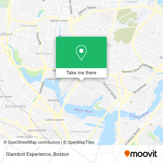
See Glambot Experience, Everett, on the map
Public Transit to Glambot Experience in Everett
Wondering how to get to Glambot Experience in Everett? Moovit helps you find the best way to get to Glambot Experience with step-by-step directions from the nearest public transit station.
Moovit provides free maps and live directions to help you navigate through your city. View schedules, routes, timetables, and find out how long does it take to get to Glambot Experience in real time.
Looking for the nearest stop or station to Glambot Experience? Check out this list of stops closest to your destination: Main St @ Oakes St; Broadway @ Dexter St; Broadway @ Gladstone St; Chelsea; Wellington.
Bus: 105, 109, 99, 106, 97, 110, 112.Train: NEWBURYPORT/ROCKPORT.Subway: ORANGE LINE.
Want to see if there’s another route that gets you there at an earlier time? Moovit helps you find alternative routes or times. Get directions from and directions to Glambot Experience easily from the Moovit App or Website.
We make riding to Glambot Experience easy, which is why over 1.7 million users, including users in Everett, trust Moovit as the best app for public transit. You don’t need to download an individual bus app or train app, Moovit is your all-in-one transit app that helps you find the best bus time or train time available.
For information on prices of bus, subway and train, costs and ride fares to Glambot Experience, please check the Moovit app.
Use the app to navigate to popular places including to the airport, hospital, stadium, grocery store, mall, coffee shop, school, college, and university.
Glambot Experience Address: 167 Bow St street in Everett
- The Batch Yard,
- Rte 99 Rotary At Rte 16,
- Mbta Commuter Rail, Newburyport Line,
- Gurdwara Sikh Sangat Boston,
- MBTA Main Repair Facility,
- Richie's Slush (Richie's Retail Menu),
- Ulta Beauty,
- Buteco do Tigrin,
- Turn-Key Petroleum,
- Papa's Ponytime Palace,
- A G Quealy Towing,
- Five Below,
- Acrobots Led,
- Boston Motor Sports LL,
- Premium Painting,
- Mémoire,
- TGI Fridays,
- Leandro Lemos,
- Super Petroleum,
- Mass Bay Movers
Places Near Glambot Experience (Everett)
- Wilbur Theatre, Boston,
- Isabella Stewart Gardner Museum, Boston,
- House Of Blues, Boston,
- Seaport District, Boston,
- North End, Boston,
- Faneuil Hall, Boston,
- Wang Theater, Boston,
- Leader Bank Pavilion (Leader Bank Pavillion), Boston,
- Boston Convention & Exhibition Center, Boston,
- Boston Common, Boston,
- Boston Children's Hospital, Boston,
- Mgm Music Hall, Boston,
- Boston Medical Center, Boston,
- Td Garden, Boston,
- Quincy Market, Boston,
- Castle Island, Boston,
- Museum Of Science, Boston,
- Cheers, Boston,
- Massachusetts General Hospital, Boston,
- Prudential Center, Boston
How to get to popular places in Boston with public transit
Get around Everett by public transit!
Traveling around Everett has never been so easy. See step by step directions as you travel to any attraction, street or major public transit station. View bus and train schedules, arrival times, service alerts and detailed routes on a map, so you know exactly how to get to anywhere in Everett.
When traveling to any destination around Everett use Moovit's Live Directions with Get Off Notifications to know exactly where and how far to walk, how long to wait for your line, and how many stops are left. Moovit will alert you when it's time to get off — no need to constantly re-check whether yours is the next stop.
Wondering how to use public transit in Everett or how to pay for public transit in Everett? Moovit public transit app can help you navigate your way with public transit easily, and at minimum cost. It includes public transit fees, ticket prices, and costs. Looking for a map of Everett public transit lines? Moovit public transit app shows all public transit maps in Everett with all Bus, Train, Subway and Ferry routes and stops on an interactive map.
Boston has 4 transit type(s), including: Bus, Train, Subway and Ferry, operated by several transit agencies, including MBTA, Southeastern Regional Transit Authority, MetroWest Regional Transit Authority, Rhode Island Public Transit Authority, WRTA, Lowell Regional Transit Authority, Merrimack Valley Transit, Montachusett Regional Transit Authority, Cape Cod Regional Transit Authority, Brockton Area Transit Authority, Martha's Vineyard Transit Authority, the WAVE - Nantucket Regional Transit Authority, GATRA, Cape Ann Transportation Authority and Massport