Glenmarie station - Sunday schedule
| Line | Direction | Time |
|---|---|---|
| 2 | Southbound - To Port Klang | 06.06 |
| 2 | Southbound - To Port Klang | 06.16 |
| 2 | Southbound - To Port Klang | 06.26 |
| 2 | Southbound - To Port Klang | 06.36 |
| 2 | Northbound - To Tanjung Malim | 06.40 |
| 2 | Southbound - To Port Klang | 06.46 |
| 2 | Northbound - To Tanjung Malim | 06.50 |
| 2 | Southbound - To Port Klang | 06.56 |
| 2 | Northbound - To Tanjung Malim | 07.00 |
| 2 | Southbound - To Port Klang | 07.06 |
| 2 | Northbound - To Tanjung Malim | 07.10 |
| 2 | Southbound - To Port Klang | 07.16 |
| 2 | Northbound - To Tanjung Malim | 07.20 |
| 2 | Southbound - To Port Klang | 07.26 |
| 2 | Northbound - To Tanjung Malim | 07.30 |
| 2 | Southbound - To Port Klang | 07.36 |
| 2 | Northbound - To Tanjung Malim | 07.40 |
| 2 | Southbound - To Port Klang | 07.46 |
| 2 | Northbound - To Tanjung Malim | 07.50 |
| 2 | Southbound - To Port Klang | 07.56 |
| 2 | Northbound - To Tanjung Malim | 08.00 |
| 2 | Southbound - To Port Klang | 08.06 |
| 2 | Northbound - To Tanjung Malim | 08.10 |
| 2 | Southbound - To Port Klang | 08.16 |
| 2 | Northbound - To Tanjung Malim | 08.20 |
Directions to Glenmarie station (Petaling) with public transit
The following transit lines have routes that pass near Glenmarie
How to get to Glenmarie station by bus?
Click on the bus route to see step by step directions with maps, line arrival times and updated time schedules.
How to get to Glenmarie station by train?
Click on the train route to see step by step directions with maps, line arrival times and updated time schedules.
How to get to Glenmarie station by MRT & LRT?
Click on the MRT & LRT route to see step by step directions with maps, line arrival times and updated time schedules.
Bus stops near Glenmarie stop in Petaling
- Temasya Niaga (Sa964), 3 min walk,
- POS Malaysia Kelana Jaya (Pj634), 3 min walk,
- Plaza Kelana Jaya (Pj685), 11 min walk,
Mrt & lrt stations near Glenmarie station in Petaling
- Kelana Jaya, 13 min walk,
Train stations near Glenmarie station in Petaling
- Subang Jaya, 47 min walk,
Bus lines to Glenmarie station in Petaling
- T774, LRT Glenmarie ↺ Stadium Shah Alam,
- 506, MRT Putrajaya Sentral,
- 783, LRT Kelana Jaya ↺ Subang Parade,
- T781, LRT Kelana Jaya ↺ Kelana Centre Point,
What are the closest stations to Glenmarie?
The closest stations to Glenmarie are:
- Temasya Niaga (Sa964) is 168 meters away, 3 min walk.
- POS Malaysia Kelana Jaya (Pj634) is 202 meters away, 3 min walk.
- Plaza Kelana Jaya (Pj685) is 804 meters away, 11 min walk.
- Kelana Jaya is 938 meters away, 13 min walk.
- Subang Jaya is 3689 meters away, 47 min walk.
Which bus lines stop near Glenmarie?
These bus lines stop near Glenmarie: 772, T774, T781.
Which train line stops near Glenmarie?
2 (Southbound - To Port Klang)
Which MRT & LRT line stops near Glenmarie?
5 (Gombak)
What’s the nearest MRT & LRT station to Glenmarie in Petaling?
The nearest MRT & LRT station to Glenmarie in Petaling is Kelana Jaya. It’s a 13 min walk away.
What’s the nearest bus stop to Glenmarie in Petaling?
The nearest bus stops to Glenmarie in Petaling are Temasya Niaga (Sa964) and POS Malaysia Kelana Jaya (Pj634). The closest one is a 3 min walk away.
What time is the first MRT & LRT to Glenmarie in Petaling?
The 5 is the first MRT & LRT that goes to Glenmarie in Petaling. It stops nearby at 6:00 AM.
What time is the last MRT & LRT to Glenmarie in Petaling?
The 5 is the last MRT & LRT that goes to Glenmarie in Petaling. It stops nearby at 12:35 AM.
What time is the first train to Glenmarie in Petaling?
The 2 is the first train that goes to Glenmarie in Petaling. It stops nearby at 6:57 AM.
What time is the last train to Glenmarie in Petaling?
The 2 is the last train that goes to Glenmarie in Petaling. It stops nearby at 9:46 PM.
What time is the first bus to Glenmarie in Petaling?
The T774 is the first bus that goes to Glenmarie in Petaling. It stops nearby at 6:00 AM.
What time is the last bus to Glenmarie in Petaling?
The T774 is the last bus that goes to Glenmarie in Petaling. It stops nearby at 12:02 AM.
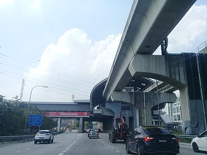
Glenmarie station
 Taken by Guang P.
See Glenmarie station, Petaling, on the map
Public transit to Glenmarie station in Petaling
Looking for directions to Glenmarie in Petaling, Malaysia?
Download the Moovit App to find the current schedule and step-by-step directions for Bus, MRT & LRT or Train routes that pass through Glenmarie.
Looking for the nearest stops closest to Glenmarie ? Check out this list of closest stops to your destination: Temasya Niaga (Sa964); POS Malaysia Kelana Jaya (Pj634); Plaza Kelana Jaya (Pj685); Kelana Jaya; Subang Jaya.
Bus: 772, T774, T781, 506, 783.Train: 2.MRT & LRT: 5.
We make riding on public transit to Glenmarie easy, which is why over 1.5 million users, including users in Petaling trust Moovit as the best app for public transit.
Use the app to navigate to popular places including to the airport, hospital, stadium, grocery store, mall, coffee shop, school, college, and university.
The station has the following entrances: Car Park and Kelana Business Centre
The first line to this station is 2, at 06.06, and the last line is 2 at 00.30.
This station serves Keretapi Tanah Melayu’s lines
Popular routes from Glenmarie station, Petaling
Bus stops near Glenmarie stop
Mrt & lrt station near Glenmarie station
Train station near Glenmarie station
Popular public transit stations in Petaling
Get around Petaling by public transit!
Traveling around Petaling has never been so easy. See step by step directions as you travel to any attraction, street or major public transit station. View bus and train schedules, arrival times, service alerts and detailed routes on a map, so you know exactly how to get to anywhere in Petaling.
When traveling to any destination around Petaling use Moovit's Live Directions with Get Off Notifications to know exactly where and how far to walk, how long to wait for your line, and how many stops are left. Moovit will alert you when it's time to get off — no need to constantly re-check whether yours is the next stop.
Wondering how to use public transit in Petaling or how to pay for public transit in Petaling? Moovit public transit app can help you navigate your way with public transit easily, and at minimum cost. It includes public transit fees, ticket prices, and costs. Looking for a map of Petaling public transit lines? Moovit public transit app shows all public transit maps in Petaling with all Bus, Train, MRT & LRT, Monorail, Ferry and Cable Car routes and stops on an interactive map.
Kuala Lumpur has 6 transit type(s), including: Bus, Train, MRT & LRT, Monorail, Ferry and Cable Car, operated by several transit agencies, including Express Rail Link - ERL, rapidKL, GOKL City Bus, Smart Selangor, PJ City Bus, Nadiputra (Operated by RapidKL), Causeway Link (Handal Indah Sdn Bhd), Free Shuttle Service, Airport Coach Sdn Bhd, Universiti Malaya, Wawasan Sutera, BAS.MY Seremban (operated by KR Travel & Tours), Keretapi Tanah Melayu - KTM, rapidKL MRT and SkyBus