Directions to Glenn Knowles & Associates (Boston) with public transportation
The following transit lines have routes that pass near Glenn Knowles & Associates
 Bus: 15, 16, 17, 41, FAIRMOUNT LINE SHUTTLE.
- Train: FAIRMOUNT, FALL RIVER/NEW BEDFORD, GREENBUSH, KINGSTON, FRANKLIN/FOXBORO.
- Subway: RED LINE.
How to get to Glenn Knowles & Associates by bus?
Click on the bus route to see step by step directions with maps, line arrival times and updated time schedules.
From Apple Cinemas, Cambridge
88 minFrom Sommerville Theatre, Somerville
83 minFrom The Mall At Chestnut Hill, Newton
67 minFrom Canopy by Hilton Boston Downtown, Boston
46 minFrom crown Colony Shuttle, Quincy
87 minFrom Bunker Hill, Boston
78 minFrom Suffolk Downs, Boston
92 minFrom Qea, Quincy
58 minFrom Danehy Park, Cambridge
84 minFrom Mount Auburn Hospital, Cambridge
70 min
How to get to Glenn Knowles & Associates by train?
Click on the train route to see step by step directions with maps, line arrival times and updated time schedules.
How to get to Glenn Knowles & Associates by subway?
Click on the subway route to see step by step directions with maps, line arrival times and updated time schedules.
From Apple Cinemas, Cambridge
60 minFrom Sommerville Theatre, Somerville
48 minFrom The Mall At Chestnut Hill, Newton
89 minFrom Canopy by Hilton Boston Downtown, Boston
39 minFrom crown Colony Shuttle, Quincy
55 minFrom Bunker Hill, Boston
54 minFrom Suffolk Downs, Boston
64 minFrom Qea, Quincy
36 minFrom Danehy Park, Cambridge
61 minFrom Mount Auburn Hospital, Cambridge
59 min
Bus stops near Glenn Knowles & Associates in Boston
Subway station near Glenn Knowles & Associates in Boston
- Savin Hill, 9 min walk,VIEW
Train stations near Glenn Knowles & Associates in Boston
Bus lines to Glenn Knowles & Associates in Boston
What are the closest stations to Glenn Knowles & Associates?
The closest stations to Glenn Knowles & Associates are:
- Columbia Rd @ Massachusetts Ave is 147 yards away, 2 min walk.
- Dudley St @ Virginia St is 316 yards away, 4 min walk.
- Dudley St @ Uphams Corner Station is 435 yards away, 6 min walk.
- Savin Hill is 716 yards away, 9 min walk.
- Jfk/Umass is 808 yards away, 10 min walk.
- Uphams Corner is 1276 yards away, 15 min walk.
Which bus lines stop near Glenn Knowles & Associates?
These bus lines stop near Glenn Knowles & Associates: 15, 16, 17.
Which train line stops near Glenn Knowles & Associates?
FAIRMOUNT (#1619 | Fairmount)
Which subway line stops near Glenn Knowles & Associates?
RED LINE (Ashmont/Braintree)
What’s the nearest subway station to Glenn Knowles & Associates in Boston?
The nearest subway station to Glenn Knowles & Associates in Boston is Savin Hill. It’s a 9 min walk away.
What’s the nearest train station to Glenn Knowles & Associates in Boston?
The nearest train station to Glenn Knowles & Associates in Boston is Jfk/Umass. It’s a 10 min walk away.
What’s the nearest bus station to Glenn Knowles & Associates in Boston?
The nearest bus station to Glenn Knowles & Associates in Boston is Columbia Rd @ Massachusetts Ave. It’s a 2 min walk away.
What time is the first subway to Glenn Knowles & Associates in Boston?
The RED LINE is the first subway that goes to Glenn Knowles & Associates in Boston. It stops nearby at 5:21 AM.
What time is the last subway to Glenn Knowles & Associates in Boston?
The RED LINE is the last subway that goes to Glenn Knowles & Associates in Boston. It stops nearby at 1:57 AM.
What time is the first train to Glenn Knowles & Associates in Boston?
The FAIRMOUNT is the first train that goes to Glenn Knowles & Associates in Boston. It stops nearby at 4:47 AM.
What time is the last train to Glenn Knowles & Associates in Boston?
The FAIRMOUNT is the last train that goes to Glenn Knowles & Associates in Boston. It stops nearby at 11:57 PM.
What time is the first bus to Glenn Knowles & Associates in Boston?
The 15 is the first bus that goes to Glenn Knowles & Associates in Boston. It stops nearby at 3:34 AM.
What time is the last bus to Glenn Knowles & Associates in Boston?
The 16 is the last bus that goes to Glenn Knowles & Associates in Boston. It stops nearby at 1:50 AM.
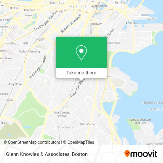
See Glenn Knowles & Associates, Boston, on the map
Public Transit to Glenn Knowles & Associates in Boston
Wondering how to get to Glenn Knowles & Associates in Boston? Moovit helps you find the best way to get to Glenn Knowles & Associates with step-by-step directions from the nearest public transit station.
Moovit provides free maps and live directions to help you navigate through your city. View schedules, routes, timetables, and find out how long does it take to get to Glenn Knowles & Associates in real time.
Looking for the nearest stop or station to Glenn Knowles & Associates? Check out this list of stops closest to your destination: Columbia Rd @ Massachusetts Ave; Dudley St @ Virginia St; Dudley St @ Uphams Corner Station; Savin Hill; Jfk/Umass; Uphams Corner.
Bus: 15, 16, 17, 41, FAIRMOUNT LINE SHUTTLE.Train: FAIRMOUNT, FALL RIVER/NEW BEDFORD, GREENBUSH, KINGSTON, FRANKLIN/FOXBORO, PROVIDENCE/STOUGHTON.Subway: RED LINE.
Want to see if there’s another route that gets you there at an earlier time? Moovit helps you find alternative routes or times. Get directions from and directions to Glenn Knowles & Associates easily from the Moovit App or Website.
We make riding to Glenn Knowles & Associates easy, which is why over 1.7 million users, including users in Boston, trust Moovit as the best app for public transit. You don’t need to download an individual bus app or train app, Moovit is your all-in-one transit app that helps you find the best bus time or train time available.
For information on prices of bus, subway and train, costs and ride fares to Glenn Knowles & Associates, please check the Moovit app.
Use the app to navigate to popular places including to the airport, hospital, stadium, grocery store, mall, coffee shop, school, college, and university.
Glenn Knowles & Associates Address: 584 Columbia Rd street in Boston
- Boston City 19 Locks Rekey,
- Brookline Red Cabs,
- Cricket,
- Design Studio for Social Intervention,
- PCS Express,
- Lara Communications,
- PC Computers,
- Dial 2 Style,
- Hygiene Carpet Cleaning,
- Chase,
- Local Auto Repair Shop,
- Andy's Cafe,
- Coinstar,
- Easton Auto Service,
- Boutique Yasser,
- Affordable Accounting and Tax Service,
- ATM,
- UPS Access Point Location,
- Singh's Roti Shop,
- Rainbow
Places Near Glenn Knowles & Associates (Boston)
- Seaport District, Boston,
- Quincy Market, Boston,
- Isabella Stewart Gardner Museum, Boston,
- Cheers, Boston,
- Boston Medical Center, Boston,
- Castle Island, Boston,
- Wilbur Theatre, Boston,
- Faneuil Hall, Boston,
- Boston Children's Hospital, Boston,
- Mgm Music Hall, Boston,
- Museum Of Science, Boston,
- Leader Bank Pavilion (Leader Bank Pavillion), Boston,
- Prudential Center, Boston,
- Massachusetts General Hospital, Boston,
- Boston Convention & Exhibition Center, Boston,
- Wang Theater, Boston,
- North End, Boston,
- House Of Blues, Boston,
- Td Garden, Boston,
- Boston Common, Boston
How to get to popular places in Boston with public transit
Get around Boston by public transit!
Traveling around Boston has never been so easy. See step by step directions as you travel to any attraction, street or major public transit station. View bus and train schedules, arrival times, service alerts and detailed routes on a map, so you know exactly how to get to anywhere in Boston.
When traveling to any destination around Boston use Moovit's Live Directions with Get Off Notifications to know exactly where and how far to walk, how long to wait for your line, and how many stops are left. Moovit will alert you when it's time to get off — no need to constantly re-check whether yours is the next stop.
Wondering how to use public transit in Boston or how to pay for public transit in Boston? Moovit public transit app can help you navigate your way with public transit easily, and at minimum cost. It includes public transit fees, ticket prices, and costs. Looking for a map of Boston public transit lines? Moovit public transit app shows all public transit maps in Boston with all Bus, Train, Subway and Ferry routes and stops on an interactive map.
Boston has 4 transit type(s), including: Bus, Train, Subway and Ferry, operated by several transit agencies, including MBTA, Southeastern Regional Transit Authority, MetroWest Regional Transit Authority, Rhode Island Public Transit Authority, WRTA, Lowell Regional Transit Authority, Merrimack Valley Transit, Montachusett Regional Transit Authority, Cape Cod Regional Transit Authority, Brockton Area Transit Authority, Martha's Vineyard Transit Authority, the WAVE - Nantucket Regional Transit Authority, GATRA, Cape Ann Transportation Authority and Massport