Directions to Go City® - Boston with public transportation
The following transit lines have routes that pass near Go City® - Boston
 Bus: 111, 354, 43, 504, SL4.
- Train: FRAMINGHAM/WORCESTER, LOWELL, NEEDHAM.
- Subway: GREEN LINE B, GREEN LINE D, GREEN LINE E, ORANGE LINE, RED LINE.
How to get to Go City® - Boston by bus?
Click on the bus route to see step by step directions with maps, line arrival times and updated time schedules.
How to get to Go City® - Boston by train?
Click on the train route to see step by step directions with maps, line arrival times and updated time schedules.
How to get to Go City® - Boston by subway?
Click on the subway route to see step by step directions with maps, line arrival times and updated time schedules.
Bus stops near Go City® - Boston
- Charles St @ Beacon St, 2 min walk,VIEW
- Temple Pl @ Washington St, 3 min walk,VIEW
- Tremont St Opp Temple Pl, 3 min walk,VIEW
- Tremont St @ Beacon St, 4 min walk,VIEW
- Washington St @ Essex St, 4 min walk,VIEW
- Otis St @ Summer St, 4 min walk,VIEW
- Park Street - Tremont St @ Winter St, 4 min walk,VIEW
- Downtown Crossing - Franklin St @ Washington St, 5 min walk,VIEW
- Park Street - Tremont St Opp Hamilton Pl, 6 min walk,VIEW
Subway stations near Go City® - Boston
Bus lines to Go City® - Boston
- 43, Park St & Tremont St,VIEW
- SL5, Downtown,VIEW
- 15, Haymarket Via Fields Corner & Nubian,VIEW
- 39, Haymarket Via Forest Hills,VIEW
- 57, Haymarket Via Kenmore,VIEW
- GREEN LINE E SHUTTLE, Heath Street - Park Street,VIEW
- GREEN LINE SHUTTLE, Boston University East - Park Street,VIEW
- RED LINE SHUTTLE, Harvard - South Station,VIEW
- RED LINE SHUTTLE, Ashmont - Park Street via Post Office,VIEW
- RED LINE SHUTTLE, JFK/UMass - Park Street via Post Office,VIEW
- 11, Chauncy & Summer,VIEW
- SL4, South Station,VIEW
- 7, Otis & Summer - City Point,VIEW
- 501, Downtown via Copley (Express) - Brighton via Copley (Express),VIEW
- 504, Downtown via Copley (Express) - Watertown via Copley and Newton Corner (Express),VIEW
- 505, Downtown (Express) - Waltham (Express),VIEW
- RED LINE SHUTTLE, Harvard - JFK/UMass via Congress Street,VIEW
- RED LINE SHUTTLE, Harvard - Broadway,VIEW
- RED LINE SHUTTLE, Kendall/MIT - JFK/UMass,VIEW
- RED LINE SHUTTLE, Harvard - JFK/UMass via State Street,VIEW
What are the closest stations to Go City® - Boston?
The closest stations to Go City® - Boston are:
- Charles St @ Beacon St is 133 yards away, 2 min walk.
- Government Center is 157 yards away, 3 min walk.
- Temple Pl @ Washington St is 189 yards away, 3 min walk.
- Tremont St @ Beacon St is 240 yards away, 4 min walk.
- Tremont St Opp Temple Pl is 248 yards away, 3 min walk.
- Washington St @ Essex St is 269 yards away, 4 min walk.
- Otis St @ Summer St is 314 yards away, 4 min walk.
- Park Street - Tremont St @ Winter St is 326 yards away, 4 min walk.
- Downtown Crossing - Franklin St @ Washington St is 336 yards away, 5 min walk.
- Downtown Crossing is 422 yards away, 6 min walk.
- Park Street - Tremont St Opp Hamilton Pl is 430 yards away, 6 min walk.
Which bus lines stop near Go City® - Boston?
These bus lines stop near Go City® - Boston: 111, 354, 43, 504, SL4, SL5.
Which train lines stop near Go City® - Boston?
These train lines stop near Go City® - Boston: FRAMINGHAM/WORCESTER, LOWELL, NEEDHAM.
Which subway lines stop near Go City® - Boston?
These subway lines stop near Go City® - Boston: GREEN LINE B, GREEN LINE D, GREEN LINE E, ORANGE LINE, RED LINE.
What’s the nearest subway station to Go City® - Boston?
The nearest subway station to Go City® - Boston is Government Center. It’s a 3 min walk away.
What’s the nearest bus station to Go City® - Boston?
The nearest bus station to Go City® - Boston is Charles St @ Beacon St. It’s a 2 min walk away.
What time is the first subway to Go City® - Boston?
The GREEN LINE E is the first subway that goes to Go City® - Boston. It stops nearby at 5:05 AM.
What time is the last subway to Go City® - Boston?
The GREEN LINE E is the last subway that goes to Go City® - Boston. It stops nearby at 2:20 AM.
What time is the first bus to Go City® - Boston?
The 57 is the first bus that goes to Go City® - Boston. It stops nearby at 5:00 AM.
What time is the last bus to Go City® - Boston?
The 11 is the last bus that goes to Go City® - Boston. It stops nearby at 1:15 AM.
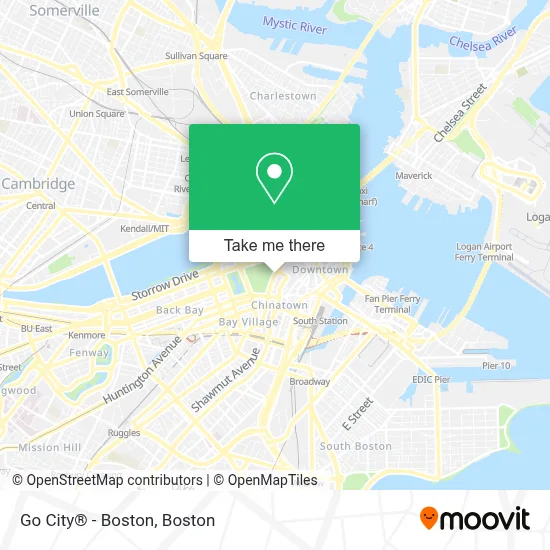
See Go City® - Boston on the map
Public Transportation to Go City® - Boston
Wondering how to get to Go City® - Boston? Moovit helps you find the best way to get to Go City® - Boston with step-by-step directions from the nearest public transit station.
Moovit provides free maps and live directions to help you navigate through your city. View schedules, routes, timetables, and find out how long does it take to get to Go City® - Boston in real time.
Looking for the nearest stop or station to Go City® - Boston? Check out this list of stops closest to your destination: Charles St @ Beacon St; Government Center; Temple Pl @ Washington St; Tremont St @ Beacon St; Tremont St Opp Temple Pl; Washington St @ Essex St; Otis St @ Summer St; Park Street - Tremont St @ Winter St; Downtown Crossing - Franklin St @ Washington St; Downtown Crossing; Park Street - Tremont St Opp Hamilton Pl.
Bus: 111, 354, 43, 504, SL4, SL5, GREEN LINE E SHUTTLE, GREEN LINE SHUTTLE, RED LINE SHUTTLE, RED LINE SHUTTLE, RED LINE SHUTTLE, 15, 39, 57.Train: FRAMINGHAM/WORCESTER, LOWELL, NEEDHAM.Subway: GREEN LINE B, GREEN LINE D, GREEN LINE E, ORANGE LINE, RED LINE, BLUE LINE, GREEN LINE C.
Want to see if there’s another route that gets you there at an earlier time? Moovit helps you find alternative routes or times. Get directions from and directions to Go City® - Boston easily from the Moovit App or Website.
We make riding to Go City® - Boston easy, which is why over 1.7 million users, including users in Boston, trust Moovit as the best app for public transit. You don’t need to download an individual bus app or train app, Moovit is your all-in-one transit app that helps you find the best bus time or train time available.
For information on prices of bus, subway and train, costs and ride fares to Go City® - Boston, please check the Moovit app.
Use the app to navigate to popular places including to the airport, hospital, stadium, grocery store, mall, coffee shop, school, college, and university.
Go City® - Boston Address: 139 Tremont St street in Boston
- Boston Common Visitor Center,
- Visitor Information Center at Boston Common,
- 141 Tremont Street,
- Freedom Trail (Pirates & Patriots Freedom Trl Tour),
- 139 Tremont St,
- Cohen & Associates (Marc A Cohen CPA),
- Lambert's Marketplace,
- Tremont St,
- Fajitas & 'Ritas,
- Freedom Trail Starting Point,
- Temple Place Suites,
- Boston Common,
- CW&S 1799 Pos ,
- Democracy Brewing,
- Cafe 26 (Temple Place Cafe),
- Many the Jeweler,
- Boston Opera House,
- Temple Place Silver Line Bus Stop,
- Suffolk University Residence Hall,
- Brattle Book Shop
Places Near Go City® - Boston
- Leader Bank Pavilion (Leader Bank Pavillion), Boston,
- Seaport District, Boston,
- North End, Boston,
- Mgm Music Hall, Boston,
- Isabella Stewart Gardner Museum, Boston,
- Boston Medical Center, Boston,
- Prudential Center, Boston,
- Museum Of Science, Boston,
- Castle Island, Boston,
- Boston Children's Hospital, Boston,
- Wilbur Theatre, Boston,
- Massachusetts General Hospital, Boston,
- Boston Convention & Exhibition Center, Boston,
- House Of Blues, Boston,
- Quincy Market, Boston,
- Cheers, Boston,
- Td Garden, Boston,
- Wang Theater, Boston,
- Boston Common, Boston,
- Faneuil Hall, Boston
How to get to popular places in Boston with public transit
Get around Boston by public transit!
Traveling around Boston has never been so easy. See step by step directions as you travel to any attraction, street or major public transit station. View bus and train schedules, arrival times, service alerts and detailed routes on a map, so you know exactly how to get to anywhere in Boston.
When traveling to any destination around Boston use Moovit's Live Directions with Get Off Notifications to know exactly where and how far to walk, how long to wait for your line, and how many stops are left. Moovit will alert you when it's time to get off — no need to constantly re-check whether yours is the next stop.
Wondering how to use public transit in Boston or how to pay for public transit in Boston? Moovit public transit app can help you navigate your way with public transit easily, and at minimum cost. It includes public transit fees, ticket prices, and costs. Looking for a map of Boston public transit lines? Moovit public transit app shows all public transit maps in Boston with all Bus, Train, Subway and Ferry routes and stops on an interactive map.
Boston has 4 transit type(s), including: Bus, Train, Subway and Ferry, operated by several transit agencies, including MBTA, Southeastern Regional Transit Authority, MetroWest Regional Transit Authority, Rhode Island Public Transit Authority, WRTA, Lowell Regional Transit Authority, Merrimack Valley Transit, Montachusett Regional Transit Authority, Cape Cod Regional Transit Authority, Brockton Area Transit Authority, Martha's Vineyard Transit Authority, the WAVE - Nantucket Regional Transit Authority, GATRA, Cape Ann Transportation Authority and Massport