Directions to Go Woof Woof (Newton) with public transportation
The following transit lines have routes that pass near Go Woof Woof
 Bus: 52, 60, GREEN LINE D SHUTTLE, GREEN LINE D SHUTTLE, GREEN LINE D SHUTTLE.
- Train: FRAMINGHAM/WORCESTER.
- Subway: GREEN LINE D, GREEN LINE B.
How to get to Go Woof Woof by bus?
Click on the bus route to see step by step directions with maps, line arrival times and updated time schedules.
From Moxy Hotel, Boston
49 minFrom Hampton Inn-Cambridge, Cambridge
83 minFrom Holiday Inn Express Boston, Boston
100 minFrom Uphams Corner, Boston
95 minFrom Hotel Commonwealth, Boston
52 minFrom MGH 50 Staniford Street 3rd flr, Boston
69 minFrom Hewlett Room 32-G882 (MIT Stata Center), Cambridge
74 minFrom Back Bay, Boston
61 minFrom Holiday Inn Express Boston Hotel Boston, Boston
100 minFrom Beacon Hill, Boston
61 min
How to get to Go Woof Woof by train?
Click on the train route to see step by step directions with maps, line arrival times and updated time schedules.
How to get to Go Woof Woof by subway?
Click on the subway route to see step by step directions with maps, line arrival times and updated time schedules.
From Moxy Hotel, Boston
54 minFrom Hampton Inn-Cambridge, Cambridge
70 minFrom Holiday Inn Express Boston, Boston
74 minFrom Uphams Corner, Boston
80 minFrom Hotel Commonwealth, Boston
41 minFrom MGH 50 Staniford Street 3rd flr, Boston
65 minFrom Hewlett Room 32-G882 (MIT Stata Center), Cambridge
66 minFrom Back Bay, Boston
56 minFrom Holiday Inn Express Boston Hotel Boston, Boston
74 minFrom Beacon Hill, Boston
57 min
Subway stations near Go Woof Woof in Newton
Bus stop near Go Woof Woof in Newton
- Newton Centre - Langley Rd Opp Braeland Ave, 7 min walk,VIEW
Bus lines to Go Woof Woof in Newton
- GREEN LINE D SHUTTLE, Newton Highlands - Kenmore,VIEW
- GREEN LINE D SHUTTLE, Riverside - Kenmore via Saint Mary's Street,VIEW
- GREEN LINE D SHUTTLE, Riverside - Brookline Hills,VIEW
- GREEN LINE D SHUTTLE, Newton Highlands - Brookline Hills,VIEW
- GREEN LINE D SHUTTLE, Newton Highlands - Fenway,VIEW
- GREEN LINE D SHUTTLE, Riverside - Fenway,VIEW
- GREEN LINE D SHUTTLE, Riverside - Kenmore (Shuttle),VIEW
- GREEN LINE D SHUTTLE, Riverside - Brookline Village,VIEW
- GREEN LINE D SHUTTLE, Riverside - Reservoir,VIEW
- GREEN LINE D SHUTTLE, Newton Highlands - Kenmore via Saint Mary's Street,VIEW
- GREEN LINE D SHUTTLE, Newton Highlands - Reservoir,VIEW
- GREEN LINE D SHUTTLE, Riverside - Kenmore,VIEW
What are the closest stations to Go Woof Woof?
The closest stations to Go Woof Woof are:
- Newton Centre is 492 yards away, 7 min walk.
- Newton Centre - Langley Rd Opp Braeland Ave is 505 yards away, 7 min walk.
- Boston College is 1097 yards away, 14 min walk.
Which bus lines stop near Go Woof Woof?
These bus lines stop near Go Woof Woof: 52, 60.
Which train line stops near Go Woof Woof?
FRAMINGHAM/WORCESTER (#521 | Worcester)
Which subway line stops near Go Woof Woof?
GREEN LINE D (Riverside)
What’s the nearest subway station to Go Woof Woof in Newton?
The nearest subway station to Go Woof Woof in Newton is Newton Centre. It’s a 7 min walk away.
What’s the nearest bus station to Go Woof Woof in Newton?
The nearest bus station to Go Woof Woof in Newton is Newton Centre - Langley Rd Opp Braeland Ave. It’s a 7 min walk away.
What time is the first subway to Go Woof Woof in Newton?
The GREEN LINE D is the first subway that goes to Go Woof Woof in Newton. It stops nearby at 4:54 AM.
What time is the last subway to Go Woof Woof in Newton?
The GREEN LINE B is the last subway that goes to Go Woof Woof in Newton. It stops nearby at 2:39 AM.
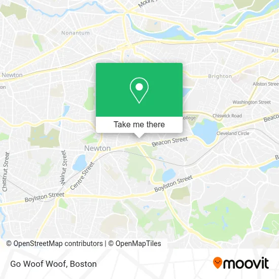
See Go Woof Woof, Newton, on the map
Public Transit to Go Woof Woof in Newton
Wondering how to get to Go Woof Woof in Newton? Moovit helps you find the best way to get to Go Woof Woof with step-by-step directions from the nearest public transit station.
Moovit provides free maps and live directions to help you navigate through your city. View schedules, routes, timetables, and find out how long does it take to get to Go Woof Woof in real time.
Looking for the nearest stop or station to Go Woof Woof? Check out this list of stops closest to your destination: Newton Centre; Newton Centre - Langley Rd Opp Braeland Ave; Boston College.
Bus: 52, 60, GREEN LINE D SHUTTLE, GREEN LINE D SHUTTLE, GREEN LINE D SHUTTLE, GREEN LINE D SHUTTLE, GREEN LINE D SHUTTLE.Train: FRAMINGHAM/WORCESTER.Subway: GREEN LINE D, GREEN LINE B.
Want to see if there’s another route that gets you there at an earlier time? Moovit helps you find alternative routes or times. Get directions from and directions to Go Woof Woof easily from the Moovit App or Website.
We make riding to Go Woof Woof easy, which is why over 1.7 million users, including users in Newton, trust Moovit as the best app for public transit. You don’t need to download an individual bus app or train app, Moovit is your all-in-one transit app that helps you find the best bus time or train time available.
For information on prices of subway, bus and train, costs and ride fares to Go Woof Woof, please check the Moovit app.
Use the app to navigate to popular places including to the airport, hospital, stadium, grocery store, mall, coffee shop, school, college, and university.
Go Woof Woof Address: 124 Intervale Rd street in Newton
- 140 Commonwealth Avenue,
- Dr. Timothy Davis,
- ATM Holdings,
- John Ward,
- Suzanne Merlis, Psychologist,
- Walls by Mitchell Expert Wallcovering Installations,
- Palmer, Jonathan MD,
- BC Office of Residential Life,
- Trustees of BC Tom Peters,
- Flynn Recreation Complex,
- The Robsham Theater Arts Center,
- Fish Field House,
- The Plex,
- Collegiate Press - BOS,
- Whitney Laboratory,
- Dr Barry H Schneider Professor of Psychology,
- Micros Northeast - Che,
- Student Service Office,
- Boston College Bookstore,
- Ignacio Hall
Places Near Go Woof Woof (Newton)
- Boston Medical Center, Boston,
- Prudential Center, Boston,
- House Of Blues, Boston,
- Quincy Market, Boston,
- Boston Common, Boston,
- Museum Of Science, Boston,
- Isabella Stewart Gardner Museum, Boston,
- Seaport District, Boston,
- Leader Bank Pavilion (Leader Bank Pavillion), Boston,
- Castle Island, Boston,
- North End, Boston,
- Boston Children's Hospital, Boston,
- Boston Convention & Exhibition Center, Boston,
- Massachusetts General Hospital, Boston,
- Wilbur Theatre, Boston,
- Faneuil Hall, Boston,
- Cheers, Boston,
- Mgm Music Hall, Boston,
- Wang Theater, Boston,
- Td Garden, Boston
How to get to popular places in Boston with public transit
Get around Newton by public transit!
Traveling around Newton has never been so easy. See step by step directions as you travel to any attraction, street or major public transit station. View bus and train schedules, arrival times, service alerts and detailed routes on a map, so you know exactly how to get to anywhere in Newton.
When traveling to any destination around Newton use Moovit's Live Directions with Get Off Notifications to know exactly where and how far to walk, how long to wait for your line, and how many stops are left. Moovit will alert you when it's time to get off — no need to constantly re-check whether yours is the next stop.
Wondering how to use public transit in Newton or how to pay for public transit in Newton? Moovit public transit app can help you navigate your way with public transit easily, and at minimum cost. It includes public transit fees, ticket prices, and costs. Looking for a map of Newton public transit lines? Moovit public transit app shows all public transit maps in Newton with all Bus, Train, Subway and Ferry routes and stops on an interactive map.
Boston has 4 transit type(s), including: Bus, Train, Subway and Ferry, operated by several transit agencies, including MBTA, Southeastern Regional Transit Authority, MetroWest Regional Transit Authority, Rhode Island Public Transit Authority, WRTA, Lowell Regional Transit Authority, Merrimack Valley Transit, Montachusett Regional Transit Authority, Cape Cod Regional Transit Authority, Brockton Area Transit Authority, Martha's Vineyard Transit Authority, the WAVE - Nantucket Regional Transit Authority, GATRA, Cape Ann Transportation Authority and Massport