Directions to Gogreen Cab Co. (Boston) with public transportation
The following transit lines have routes that pass near Gogreen Cab Co.
 Bus: 31, G47, G73E, GREYHOUND US0255S, R41.
- Train: VERMONTER, VALLEY FLYER.
How to get to Gogreen Cab Co. by bus?
Click on the bus route to see step by step directions with maps, line arrival times and updated time schedules.
From Foxwoods, Worcester
191 minFrom Polar Park, Worcester
172 minFrom Worcester, MA, Worcester
171 minFrom Registry Of Motor Vehicles (Rmv) Branch Office, Worcester
175 minFrom Palladium, Worcester
176 minFrom Gardner, MA, Gardner
224 minFrom South High Community School, Worcester
258 minFrom Dcu Center, Worcester
173 min
How to get to Gogreen Cab Co. by train?
Click on the train route to see step by step directions with maps, line arrival times and updated time schedules.
Train station near Gogreen Cab Co. in Boston
- Northampton, 7 min walk,VIEW
What are the closest stations to Gogreen Cab Co.?
The closest stations to Gogreen Cab Co. are:
- Northampton is 510 yards away, 7 min walk.
Which bus lines stop near Gogreen Cab Co.?
These bus lines stop near Gogreen Cab Co.: 31, G47, G73E, GREYHOUND US0255S, R41.
Which train line stops near Gogreen Cab Co.?
VERMONTER (St Albans)
What’s the nearest train station to Gogreen Cab Co. in Boston?
The nearest train station to Gogreen Cab Co. in Boston is Northampton. It’s a 7 min walk away.
What time is the first train to Gogreen Cab Co. in Boston?
The VALLEY FLYER is the first train that goes to Gogreen Cab Co. in Boston. It stops nearby at 6:30 AM.
What time is the last train to Gogreen Cab Co. in Boston?
The VALLEY FLYER is the last train that goes to Gogreen Cab Co. in Boston. It stops nearby at 10:07 PM.
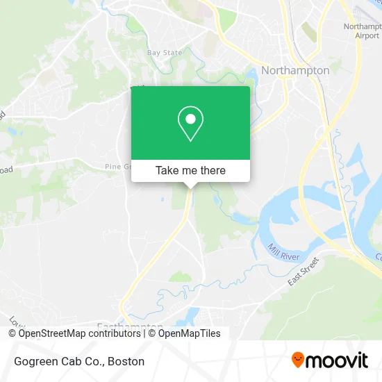
See Gogreen Cab Co., Boston, on the map
Public Transit to Gogreen Cab Co. in Boston
Wondering how to get to Gogreen Cab Co. in Boston? Moovit helps you find the best way to get to Gogreen Cab Co. with step-by-step directions from the nearest public transit station.
Moovit provides free maps and live directions to help you navigate through your city. View schedules, routes, timetables, and find out how long does it take to get to Gogreen Cab Co. in real time.
Looking for the nearest stop or station to Gogreen Cab Co.? Check out this list of stops closest to your destination: Northampton.
Bus: 31, G47, G73E, GREYHOUND US0255S, R41.Train: VERMONTER, VALLEY FLYER.
Want to see if there’s another route that gets you there at an earlier time? Moovit helps you find alternative routes or times. Get directions from and directions to Gogreen Cab Co. easily from the Moovit App or Website.
We make riding to Gogreen Cab Co. easy, which is why over 1.7 million users, including users in Boston, trust Moovit as the best app for public transit. You don’t need to download an individual bus app or train app, Moovit is your all-in-one transit app that helps you find the best bus time or train time available.
For information on prices of bus and train, costs and ride fares to Gogreen Cab Co., please check the Moovit app.
Use the app to navigate to popular places including to the airport, hospital, stadium, grocery store, mall, coffee shop, school, college, and university.
Gogreen Cab Co. Address: 376 Easthampton Rd street in Boston
- Valley Recycling,
- Richard's Fuel & Heating,
- Northampton State Hospital,
- Reichelt and Company,
- Aura Speak,
- Sisu Wellness Center,
- Lifesafer Ignition Interlock,
- Intoxalock Ignition Interlock,
- C and R Auto Repair,
- Meadows Conservation Area,
- Louis and Clark-Eastha,
- Elizabeth Cory,
- David M Slack MD,
- Guarav Chawla MD,
- VMG Ma,
- Valley Medical Group,
- Bankesb,
- Aquarius Plumbing,
- Hulberts Pond,
- Rocky Hill Pond Dam
Places Near Gogreen Cab Co. (Boston)
- Boston Common, Boston,
- Boston Medical Center, Boston,
- North End, Boston,
- Td Garden, Boston,
- Boston Children's Hospital, Boston,
- Cheers, Boston,
- Seaport District, Boston,
- Museum Of Science, Boston,
- Isabella Stewart Gardner Museum, Boston,
- Faneuil Hall, Boston,
- Wang Theater, Boston,
- Prudential Center, Boston,
- Massachusetts General Hospital, Boston,
- Castle Island, Boston,
- Wilbur Theatre, Boston,
- Boston Convention & Exhibition Center, Boston,
- Mgm Music Hall, Boston,
- House Of Blues, Boston,
- Quincy Market, Boston,
- Leader Bank Pavilion (Leader Bank Pavillion), Boston
How to get to popular places in Boston with public transit
Get around Boston by public transit!
Traveling around Boston has never been so easy. See step by step directions as you travel to any attraction, street or major public transit station. View bus and train schedules, arrival times, service alerts and detailed routes on a map, so you know exactly how to get to anywhere in Boston.
When traveling to any destination around Boston use Moovit's Live Directions with Get Off Notifications to know exactly where and how far to walk, how long to wait for your line, and how many stops are left. Moovit will alert you when it's time to get off — no need to constantly re-check whether yours is the next stop.
Wondering how to use public transit in Boston or how to pay for public transit in Boston? Moovit public transit app can help you navigate your way with public transit easily, and at minimum cost. It includes public transit fees, ticket prices, and costs. Looking for a map of Boston public transit lines? Moovit public transit app shows all public transit maps in Boston with all Bus, Train, Subway and Ferry routes and stops on an interactive map.
Boston has 4 transit type(s), including: Bus, Train, Subway and Ferry, operated by several transit agencies, including MBTA, Southeastern Regional Transit Authority, MetroWest Regional Transit Authority, Rhode Island Public Transit Authority, WRTA, Lowell Regional Transit Authority, Merrimack Valley Transit, Montachusett Regional Transit Authority, Cape Cod Regional Transit Authority, Brockton Area Transit Authority, Martha's Vineyard Transit Authority, the WAVE - Nantucket Regional Transit Authority, GATRA, Cape Ann Transportation Authority and Massport