How to get to Gold Beech Construction by bus?
Click on the bus route to see step by step directions with maps, line arrival times and updated time schedules.
From Waltham, MA, Waltham
123 minFrom Belmont, MA, Belmont
62 minFrom Tufts University, Medford
51 minFrom The Westin Waltham Boston, Waltham
152 minFrom Chevalier Theater, Medford
63 minFrom Watertown, MA, Watertown Town
79 minFrom Medford Square, Medford
61 minFrom MBTA Alewife Station, Cambridge
22 minFrom Terrace Room, Paige Hall, Medford
52 min
Bus stops near Gold Beech Construction in Lexington
Bus lines to Gold Beech Construction in Lexington
What are the closest stations to Gold Beech Construction?
The closest stations to Gold Beech Construction are:
- Massachusetts Ave @ Winthrop Rd is 296 yards away, 4 min walk.
- Lexington Center (Arrive/Depart) is 848 yards away, 11 min walk.
Which bus lines stop near Gold Beech Construction?
These bus lines stop near Gold Beech Construction: 62, 76.
What’s the nearest bus station to Gold Beech Construction in Lexington?
The nearest bus station to Gold Beech Construction in Lexington is Massachusetts Ave @ Winthrop Rd. It’s a 4 min walk away.
What time is the first bus to Gold Beech Construction in Lexington?
The 62 is the first bus that goes to Gold Beech Construction in Lexington. It stops nearby at 5:23 AM.
What time is the last bus to Gold Beech Construction in Lexington?
The 62 is the last bus that goes to Gold Beech Construction in Lexington. It stops nearby at 10:38 PM.
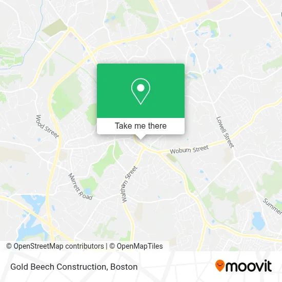
See Gold Beech Construction, Lexington, on the map
Public Transit to Gold Beech Construction in Lexington
Wondering how to get to Gold Beech Construction in Lexington? Moovit helps you find the best way to get to Gold Beech Construction with step-by-step directions from the nearest public transit station.
Moovit provides free maps and live directions to help you navigate through your city. View schedules, routes, timetables, and find out how long does it take to get to Gold Beech Construction in real time.
Looking for the nearest stop or station to Gold Beech Construction? Check out this list of stops closest to your destination: Massachusetts Ave @ Winthrop Rd; Lexington Center (Arrive/Depart).
Bus: 62, 76, R2.
Want to see if there’s another route that gets you there at an earlier time? Moovit helps you find alternative routes or times. Get directions from and directions to Gold Beech Construction easily from the Moovit App or Website.
We make riding to Gold Beech Construction easy, which is why over 1.7 million users, including users in Lexington, trust Moovit as the best app for public transit. You don’t need to download an individual bus app or train app, Moovit is your all-in-one transit app that helps you find the best bus time or train time available.
For information on prices of bus, subway and train, costs and ride fares to Gold Beech Construction, please check the Moovit app.
Use the app to navigate to popular places including to the airport, hospital, stadium, grocery store, mall, coffee shop, school, college, and university.
Gold Beech Construction Address: 9 Meriam St street in Lexington
- Ives Ben Architect,
- O'Keeffe Jennifer,
- Ve Industries,
- Nirapath Acupuncture Clinic,
- Lexingtonsoaps,
- Armando Locksmith Shop,
- The Lexington Visitors Center,
- Abbott's Frozen Custard,
- IV Hydration and Aesthetics,
- Bechtel Frank Erickson Architects,
- Therapist Services,
- Quality Door Repair,
- Lexington Garage Door,
- Nascar Wings,
- McKenney Counseling,
- Strategic Academic Success,
- Petra Lexington (Petra Clothing for Women),
- Residential Carpet Cleaning,
- Look Ceramic Tile Flooring,
- Samita Mandelia, Realtor
Places Near Gold Beech Construction (Lexington)
- Museum Of Science, Boston,
- Boston Children's Hospital, Boston,
- Mgm Music Hall, Boston,
- Leader Bank Pavilion (Leader Bank Pavillion), Boston,
- North End, Boston,
- Boston Convention & Exhibition Center, Boston,
- Wilbur Theatre, Boston,
- Castle Island, Boston,
- Prudential Center, Boston,
- Wang Theater, Boston,
- House Of Blues, Boston,
- Cheers, Boston,
- Massachusetts General Hospital, Boston,
- Td Garden, Boston,
- Faneuil Hall, Boston,
- Seaport District, Boston,
- Boston Common, Boston,
- Isabella Stewart Gardner Museum, Boston,
- Boston Medical Center, Boston,
- Quincy Market, Boston
How to get to popular places in Boston with public transit
Get around Lexington by public transit!
Traveling around Lexington has never been so easy. See step by step directions as you travel to any attraction, street or major public transit station. View bus and train schedules, arrival times, service alerts and detailed routes on a map, so you know exactly how to get to anywhere in Lexington.
When traveling to any destination around Lexington use Moovit's Live Directions with Get Off Notifications to know exactly where and how far to walk, how long to wait for your line, and how many stops are left. Moovit will alert you when it's time to get off — no need to constantly re-check whether yours is the next stop.
Wondering how to use public transit in Lexington or how to pay for public transit in Lexington? Moovit public transit app can help you navigate your way with public transit easily, and at minimum cost. It includes public transit fees, ticket prices, and costs. Looking for a map of Lexington public transit lines? Moovit public transit app shows all public transit maps in Lexington with all Bus, Train, Subway and Ferry routes and stops on an interactive map.
Boston has 4 transit type(s), including: Bus, Train, Subway and Ferry, operated by several transit agencies, including MBTA, Southeastern Regional Transit Authority, MetroWest Regional Transit Authority, Rhode Island Public Transit Authority, WRTA, Lowell Regional Transit Authority, Merrimack Valley Transit, Montachusett Regional Transit Authority, Cape Cod Regional Transit Authority, Brockton Area Transit Authority, Martha's Vineyard Transit Authority, the WAVE - Nantucket Regional Transit Authority, GATRA, Cape Ann Transportation Authority and Massport