Directions to Golden Jewelry (Boston) with public transportation
The following transit lines have routes that pass near Golden Jewelry
 Bus: 354, 450, 504, SL4, SL5.
- Train: FRAMINGHAM/WORCESTER, GREENBUSH, HAVERHILL, NEEDHAM.
- Subway: BLUE LINE, GREEN LINE D, ORANGE LINE, RED LINE, GREEN LINE B.
How to get to Golden Jewelry by bus?
Click on the bus route to see step by step directions with maps, line arrival times and updated time schedules.
From Charles W. Eliot Bridge, Boston
74 minFrom Jamaica Plain, Boston
48 minFrom The Mall At Chestnut Hill, Newton
75 minFrom Hilton Garden Inn Boston Logan Airport, Boston
32 minFrom UMass Boston Campus Center, Boston
57 minFrom Qea, Quincy
100 minFrom Ac Hotel Cambridge, Cambridge
100 minFrom Melrose, MA, Melrose
66 minFrom FOUR POINTS BY SHERATON Boston Newton, Newton
36 minFrom Arlington, MA, Arlington
78 min
How to get to Golden Jewelry by train?
Click on the train route to see step by step directions with maps, line arrival times and updated time schedules.
How to get to Golden Jewelry by subway?
Click on the subway route to see step by step directions with maps, line arrival times and updated time schedules.
Bus stops near Golden Jewelry in Boston
- State - Devonshire St @ State St, 3 min walk,VIEW
- State St @ Washington Mall - State St Sta, 3 min walk,VIEW
- Tremont St @ Beacon St, 3 min walk,VIEW
- Devonshire St @ Milk St, 4 min walk,VIEW
- Park Street - Tremont St @ Winter St, 5 min walk,VIEW
- Downtown Crossing - Franklin St @ Washington St, 5 min walk,VIEW
- Pearl St @ Congress St, 5 min walk,VIEW
- Tremont St Opp Temple Pl, 5 min walk,VIEW
- Park Street - Tremont St Opp Hamilton Pl, 5 min walk,VIEW
- Temple Pl @ Washington St, 6 min walk,VIEW
- Otis St @ Summer St, 6 min walk,VIEW
- Chauncy St @ Summer St, 7 min walk,VIEW
Subway stations near Golden Jewelry in Boston
Bus lines to Golden Jewelry in Boston
- RED LINE SHUTTLE, Jfk/Umass (Shuttle),VIEW
- 116, Maverick - Wonderland,VIEW
- 354, Boston (Express) via Woburn - Burlington (Express) via Woburn,VIEW
- BLUE LINE SHUTTLE, Airport - Government Center (Express),VIEW
- BLUE LINE SHUTTLE, Airport - Government Center via Maverick,VIEW
- BLUE LINE SHUTTLE, Orient Heights - Government Center (Local),VIEW
- BLUE LINE SHUTTLE, Orient Heights - Government Center (Express),VIEW
- BLUE LINE SHUTTLE, Airport - Government Center (Local),VIEW
- BLUE LINE SHUTTLE, Wonderland - Government Center,VIEW
- 15, Haymarket Via Fields Corner & Nubian,VIEW
- 39, Haymarket Via Forest Hills,VIEW
- 57, Haymarket Via Kenmore,VIEW
- 92, Sullivan,VIEW
- 93, Sullivan Via Navy Yard,VIEW
- RED LINE SHUTTLE, Kendall/MIT - Park Street,VIEW
- RED LINE SHUTTLE, Kendall/MIT - Broadway via Pearl Street,VIEW
- RED LINE SHUTTLE, Kendall/MIT - Broadway via Downtown Crossing,VIEW
- RED LINE SHUTTLE, Ashmont - Park Street via Post Office,VIEW
- RED LINE SHUTTLE, JFK/UMass - Park Street via Post Office,VIEW
- RED LINE SHUTTLE, JFK/UMass - Park Street,VIEW
What are the closest stations to Golden Jewelry?
The closest stations to Golden Jewelry are:
- State - Devonshire St @ State St is 176 yards away, 3 min walk.
- State St @ Washington Mall - State St Sta is 184 yards away, 3 min walk.
- Tremont St @ Beacon St is 225 yards away, 3 min walk.
- Devonshire St @ Milk St is 277 yards away, 4 min walk.
- Park Street - Tremont St @ Winter St is 337 yards away, 5 min walk.
- State Street is 347 yards away, 5 min walk.
- Downtown Crossing - Franklin St @ Washington St is 352 yards away, 5 min walk.
- Pearl St @ Congress St is 379 yards away, 5 min walk.
- Tremont St Opp Temple Pl is 382 yards away, 5 min walk.
- Park Street - Tremont St Opp Hamilton Pl is 409 yards away, 5 min walk.
- Temple Pl @ Washington St is 447 yards away, 6 min walk.
- Otis St @ Summer St is 481 yards away, 6 min walk.
- Chauncy St @ Summer St is 560 yards away, 7 min walk.
- Downtown Crossing is 580 yards away, 7 min walk.
- Park Street is 671 yards away, 8 min walk.
Which bus lines stop near Golden Jewelry?
These bus lines stop near Golden Jewelry: 354, 450, 504, SL4, SL5.
Which train lines stop near Golden Jewelry?
These train lines stop near Golden Jewelry: FRAMINGHAM/WORCESTER, GREENBUSH, HAVERHILL, NEEDHAM.
Which subway lines stop near Golden Jewelry?
These subway lines stop near Golden Jewelry: BLUE LINE, GREEN LINE D, ORANGE LINE, RED LINE.
What’s the nearest subway station to Golden Jewelry in Boston?
The nearest subway station to Golden Jewelry in Boston is State Street. It’s a 5 min walk away.
What’s the nearest bus station to Golden Jewelry in Boston?
The nearest bus stations to Golden Jewelry in Boston are State - Devonshire St @ State St, State St @ Washington Mall - State St Sta and Tremont St @ Beacon St. The closest one is a 3 min walk away.
What time is the first subway to Golden Jewelry in Boston?
The GREEN LINE E is the first subway that goes to Golden Jewelry in Boston. It stops nearby at 5:05 AM.
What time is the last subway to Golden Jewelry in Boston?
The GREEN LINE E is the last subway that goes to Golden Jewelry in Boston. It stops nearby at 2:20 AM.
What time is the first bus to Golden Jewelry in Boston?
The 57 is the first bus that goes to Golden Jewelry in Boston. It stops nearby at 5:00 AM.
What time is the last bus to Golden Jewelry in Boston?
The 116 is the last bus that goes to Golden Jewelry in Boston. It stops nearby at 1:58 AM.
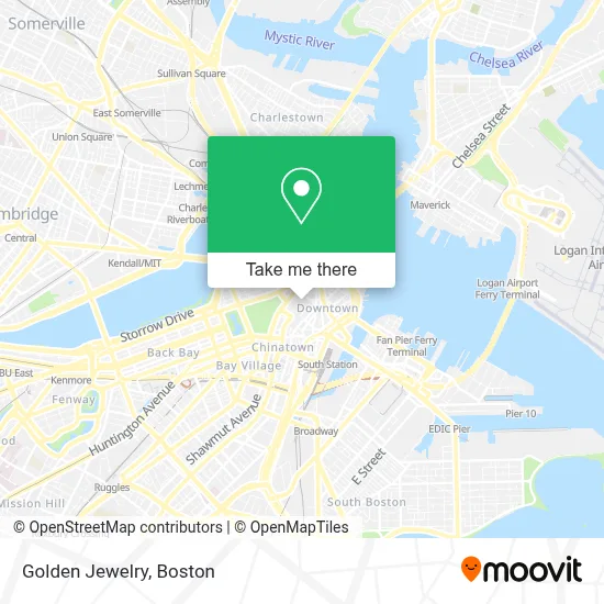
See Golden Jewelry, Boston, on the map
Public Transit to Golden Jewelry in Boston
Wondering how to get to Golden Jewelry in Boston? Moovit helps you find the best way to get to Golden Jewelry with step-by-step directions from the nearest public transit station.
Moovit provides free maps and live directions to help you navigate through your city. View schedules, routes, timetables, and find out how long does it take to get to Golden Jewelry in real time.
Looking for the nearest stop or station to Golden Jewelry? Check out this list of stops closest to your destination: State - Devonshire St @ State St; State St @ Washington Mall - State St Sta; Tremont St @ Beacon St; Devonshire St @ Milk St; Park Street - Tremont St @ Winter St; State Street; Downtown Crossing - Franklin St @ Washington St; Pearl St @ Congress St; Tremont St Opp Temple Pl; Park Street - Tremont St Opp Hamilton Pl; Temple Pl @ Washington St; Otis St @ Summer St; Chauncy St @ Summer St; Downtown Crossing; Park Street.
Bus: 354, 450, 504, SL4, SL5, RED LINE SHUTTLE, 116, BLUE LINE SHUTTLE, BLUE LINE SHUTTLE, BLUE LINE SHUTTLE, 15, 39, 57.Train: FRAMINGHAM/WORCESTER, GREENBUSH, HAVERHILL, NEEDHAM.Subway: BLUE LINE, GREEN LINE D, ORANGE LINE, RED LINE, GREEN LINE B, GREEN LINE C, GREEN LINE E.
Want to see if there’s another route that gets you there at an earlier time? Moovit helps you find alternative routes or times. Get directions from and directions to Golden Jewelry easily from the Moovit App or Website.
We make riding to Golden Jewelry easy, which is why over 1.7 million users, including users in Boston, trust Moovit as the best app for public transit. You don’t need to download an individual bus app or train app, Moovit is your all-in-one transit app that helps you find the best bus time or train time available.
For information on prices of bus, subway and train, costs and ride fares to Golden Jewelry, please check the Moovit app.
Use the app to navigate to popular places including to the airport, hospital, stadium, grocery store, mall, coffee shop, school, college, and university.
Golden Jewelry Address: 365 Washington St street in Boston
- Marshalls,
- The Diamond & Jewelry Building,
- T.J. Maxx,
- Elite Time (Boston Time Pieces),
- DePrisco Jewelers,
- Precision Watch Works (Boston Watch & Clock Repair),
- Di Star,
- DSW Designer Shoe Warehouse,
- Amway Products Distributor,
- Sam LaGrassa's,
- Mrbeast Burger (MR. Beast Burger),
- Kids Foot Locker,
- JHD,
- Jewelers Exchange Building,
- Millennium Tower Boston,
- Old Navy,
- Claire's,
- Chick-fil-A,
- Lambert's @ Old South Meeting House,
- 45 Province Boston Condos
Places Near Golden Jewelry (Boston)
- House Of Blues, Boston,
- Isabella Stewart Gardner Museum, Boston,
- North End, Boston,
- Prudential Center, Boston,
- Td Garden, Boston,
- Mgm Music Hall, Boston,
- Wilbur Theatre, Boston,
- Boston Common, Boston,
- Boston Medical Center, Boston,
- Boston Children's Hospital, Boston,
- Wang Theater, Boston,
- Massachusetts General Hospital, Boston,
- Castle Island, Boston,
- Faneuil Hall, Boston,
- Boston Convention & Exhibition Center, Boston,
- Seaport District, Boston,
- Cheers, Boston,
- Museum Of Science, Boston,
- Quincy Market, Boston,
- Leader Bank Pavilion (Leader Bank Pavillion), Boston
How to get to popular places in Boston with public transit
Get around Boston by public transit!
Traveling around Boston has never been so easy. See step by step directions as you travel to any attraction, street or major public transit station. View bus and train schedules, arrival times, service alerts and detailed routes on a map, so you know exactly how to get to anywhere in Boston.
When traveling to any destination around Boston use Moovit's Live Directions with Get Off Notifications to know exactly where and how far to walk, how long to wait for your line, and how many stops are left. Moovit will alert you when it's time to get off — no need to constantly re-check whether yours is the next stop.
Wondering how to use public transit in Boston or how to pay for public transit in Boston? Moovit public transit app can help you navigate your way with public transit easily, and at minimum cost. It includes public transit fees, ticket prices, and costs. Looking for a map of Boston public transit lines? Moovit public transit app shows all public transit maps in Boston with all Bus, Train, Subway and Ferry routes and stops on an interactive map.
Boston has 4 transit type(s), including: Bus, Train, Subway and Ferry, operated by several transit agencies, including MBTA, Southeastern Regional Transit Authority, MetroWest Regional Transit Authority, Rhode Island Public Transit Authority, WRTA, Lowell Regional Transit Authority, Merrimack Valley Transit, Montachusett Regional Transit Authority, Cape Cod Regional Transit Authority, Brockton Area Transit Authority, Martha's Vineyard Transit Authority, the WAVE - Nantucket Regional Transit Authority, GATRA, Cape Ann Transportation Authority and Massport