Directions to Gong Cha (Boston) with public transportation
The following transit lines have routes that pass near Gong Cha
 Bus: 354, 43, 450, 501, 504.
- Train: GREENBUSH, HAVERHILL.
- Subway: BLUE LINE, GREEN LINE B, GREEN LINE D, ORANGE LINE, RED LINE.
How to get to Gong Cha by bus?
Click on the bus route to see step by step directions with maps, line arrival times and updated time schedules.
From the mall at rockingham park mall, Boston
65 minFrom JFK Library, Boston
72 minFrom Wollaston Beach, Quincy
134 minFrom The Mall At Chestnut Hill, Newton
90 minFrom Staybridge Suites Boston-Quincy, Quincy
110 minFrom Comfort Inn & Suites Logan International Airport, Revere
40 minFrom Heartbreak Hill, Newton
57 minFrom Arsenal Mall, Watertown Town
74 minFrom Boston College (BC), Boston
74 minFrom Melrose, MA, Melrose
73 min
How to get to Gong Cha by train?
Click on the train route to see step by step directions with maps, line arrival times and updated time schedules.
How to get to Gong Cha by subway?
Click on the subway route to see step by step directions with maps, line arrival times and updated time schedules.
From the mall at rockingham park mall, Boston
53 minFrom JFK Library, Boston
46 minFrom Wollaston Beach, Quincy
51 minFrom The Mall At Chestnut Hill, Newton
70 minFrom Staybridge Suites Boston-Quincy, Quincy
34 minFrom Comfort Inn & Suites Logan International Airport, Revere
41 minFrom Heartbreak Hill, Newton
62 minFrom Boston College (BC), Boston
67 min
Subway stations near Gong Cha in Boston
Bus stops near Gong Cha in Boston
- Tremont St @ Beacon St, 3 min walk,VIEW
- Charles/Mgh - Cambridge St @ Lindall Pl, 5 min walk,VIEW
- Park Street - Tremont St Opp Hamilton Pl, 5 min walk,VIEW
- Science Park/West End - Martha Rd @ Amy Ct, 7 min walk,VIEW
- Government Center - Cambridge St @ Sudbury St, 9 min walk,VIEW
- Cambridge St @ Government Ctr Sta, 10 min walk,VIEW
- North Station, 10 min walk,VIEW
- Beacon St Opp Walnut St, 11 min walk,VIEW
- Portland St @ Causeway St, 11 min walk,VIEW
Bus lines to Gong Cha in Boston
- 15, Mattapan Via Nubian & Fields Corner,VIEW
- 39, Forest Hills,VIEW
- 57, Watertown Via Kenmore,VIEW
- RED LINE SHUTTLE, Harvard - JFK/UMass via Congress Street,VIEW
- RED LINE SHUTTLE, Alewife - Park Street,VIEW
- RED LINE SHUTTLE, Harvard - Broadway,VIEW
- RED LINE SHUTTLE, Kendall/MIT - Park Street,VIEW
- RED LINE SHUTTLE, Kendall/MIT - JFK/UMass,VIEW
- RED LINE SHUTTLE, Kendall/MIT - Broadway via Pearl Street,VIEW
- RED LINE SHUTTLE, Harvard - JFK/UMass via State Street,VIEW
- RED LINE SHUTTLE, Harvard - South Station,VIEW
- RED LINE SHUTTLE, JFK/UMass - Kendall/MIT (Shuttle),VIEW
- RED LINE SHUTTLE, Harvard - Park Street,VIEW
- RED LINE SHUTTLE, Kendall/MIT - Broadway via Downtown Crossing,VIEW
- RED LINE SHUTTLE, Park Street (Shuttle),VIEW
- GREEN LINE E SHUTTLE, Government Center - Medford/Tufts (Shuttle),VIEW
- GREEN LINE E SHUTTLE, Medford/Tufts - North Station,VIEW
- GREEN LINE E SHUTTLE, North Station - Medford/Tufts (Shuttle),VIEW
- GREEN LINE SHUTTLE, Union Square - North Station,VIEW
- GREEN LINE SHUTTLE, North Station - Sullivan Square via East Somerville,VIEW
What are the closest stations to Gong Cha?
The closest stations to Gong Cha are:
- Government Center is 189 yards away, 3 min walk.
- Tremont St @ Beacon St is 194 yards away, 3 min walk.
- Charles/Mgh - Cambridge St @ Lindall Pl is 340 yards away, 5 min walk.
- Park Street - Tremont St Opp Hamilton Pl is 374 yards away, 5 min walk.
- Charles/Mgh is 447 yards away, 6 min walk.
- Science Park/West End - Martha Rd @ Amy Ct is 580 yards away, 7 min walk.
- Government Center - Cambridge St @ Sudbury St is 688 yards away, 9 min walk.
- Cambridge St @ Government Ctr Sta is 815 yards away, 10 min walk.
- North Station is 823 yards away, 10 min walk.
- Causeway St (East) is 851 yards away, 11 min walk.
- Beacon St Opp Walnut St is 852 yards away, 11 min walk.
- Portland St @ Causeway St is 865 yards away, 11 min walk.
Which bus lines stop near Gong Cha?
These bus lines stop near Gong Cha: 354, 43, 450, 501, 504, EZRIDE, SL4, SL5.
Which train lines stop near Gong Cha?
These train lines stop near Gong Cha: GREENBUSH, HAVERHILL.
Which subway lines stop near Gong Cha?
These subway lines stop near Gong Cha: BLUE LINE, GREEN LINE B, GREEN LINE D, ORANGE LINE, RED LINE.
What’s the nearest subway station to Gong Cha in Boston?
The nearest subway station to Gong Cha in Boston is Government Center. It’s a 3 min walk away.
What’s the nearest bus station to Gong Cha in Boston?
The nearest bus station to Gong Cha in Boston is Tremont St @ Beacon St. It’s a 3 min walk away.
What time is the first subway to Gong Cha in Boston?
The GREEN LINE E is the first subway that goes to Gong Cha in Boston. It stops nearby at 4:57 AM.
What time is the last subway to Gong Cha in Boston?
The GREEN LINE E is the last subway that goes to Gong Cha in Boston. It stops nearby at 2:28 AM.
What time is the first bus to Gong Cha in Boston?
The 57 is the first bus that goes to Gong Cha in Boston. It stops nearby at 5:07 AM.
What time is the last bus to Gong Cha in Boston?
The 116 is the last bus that goes to Gong Cha in Boston. It stops nearby at 1:58 AM.
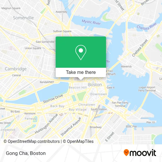
See Gong Cha, Boston, on the map
Public Transit to Gong Cha in Boston
Wondering how to get to Gong Cha in Boston? Moovit helps you find the best way to get to Gong Cha with step-by-step directions from the nearest public transit station.
Moovit provides free maps and live directions to help you navigate through your city. View schedules, routes, timetables, and find out how long does it take to get to Gong Cha in real time.
Looking for the nearest stop or station to Gong Cha? Check out this list of stops closest to your destination: Government Center; Tremont St @ Beacon St; Charles/Mgh - Cambridge St @ Lindall Pl; Park Street - Tremont St Opp Hamilton Pl; Charles/Mgh; Science Park/West End - Martha Rd @ Amy Ct; Government Center - Cambridge St @ Sudbury St; Cambridge St @ Government Ctr Sta; North Station; Causeway St (East); Beacon St Opp Walnut St; Portland St @ Causeway St.
Bus: 354, 43, 450, 501, 504, EZRIDE, SL4, SL5, 15, 39, 57, RED LINE SHUTTLE, RED LINE SHUTTLE, RED LINE SHUTTLE, RED LINE SHUTTLE, RED LINE SHUTTLE, RED LINE SHUTTLE.Train: GREENBUSH, HAVERHILL.Subway: BLUE LINE, GREEN LINE B, GREEN LINE D, ORANGE LINE, RED LINE, GREEN LINE C, GREEN LINE E, HAVERHILL LINE SHUTTLE, HAVERHILL LINE SHUTTLE, LOWELL LINE SHUTTLE, LOWELL LINE SHUTTLE, NEWBURYPORT/ROCKPORT LINE SHUTTLE.
Want to see if there’s another route that gets you there at an earlier time? Moovit helps you find alternative routes or times. Get directions from and directions to Gong Cha easily from the Moovit App or Website.
We make riding to Gong Cha easy, which is why over 1.7 million users, including users in Boston, trust Moovit as the best app for public transit. You don’t need to download an individual bus app or train app, Moovit is your all-in-one transit app that helps you find the best bus time or train time available.
For information on prices of bus, subway and train, costs and ride fares to Gong Cha, please check the Moovit app.
Use the app to navigate to popular places including to the airport, hospital, stadium, grocery store, mall, coffee shop, school, college, and university.
Gong Cha Address: 175 Cambridge St, Suite 160, Boston, 02114, Boston, MA 2114, USA street in Boston
- Charles River Plaza,
- Charles River Plaza Shopping Center,
- MGH Simches Research Building,
- Wyndham Boston Beacon Hill,
- Joy St / Cambridge St,
- MGH,
- Prooptical Boston (Nguyen Baokim Od Pro Optical Boston),
- Wingate by Wyndham-Beacon Hill,
- KMHW,
- MGH 50 Staniford Street 3rd flr,
- Museum Of African American History,
- Regina Cleri,
- Dental Partners of Boston - Charles River (DPB Charles River),
- Tip Tap Room,
- Ophthalmic Consultants of Boston,
- Department Of Unemployment Assistance,
- Antonio's Cucina Italiana (Hot Italian),
- Somewhere on Stanford St,
- EV Charging Station,
- Longfellow Garage (Longfellow Place)
Places Near Gong Cha (Boston)
- Quincy Market, Boston,
- Museum Of Science, Boston,
- Cheers, Boston,
- North End, Boston,
- Castle Island, Boston,
- Seaport District, Boston,
- Wilbur Theatre, Boston,
- Td Garden, Boston,
- Mgm Music Hall, Boston,
- Isabella Stewart Gardner Museum, Boston,
- Boston Children's Hospital, Boston,
- Boston Medical Center, Boston,
- Wang Theater, Boston,
- House Of Blues, Boston,
- Prudential Center, Boston,
- Faneuil Hall, Boston,
- Leader Bank Pavilion (Leader Bank Pavillion), Boston,
- Boston Common, Boston,
- Massachusetts General Hospital, Boston,
- Boston Convention & Exhibition Center, Boston
How to get to popular places in Boston with public transit
Get around Boston by public transit!
Traveling around Boston has never been so easy. See step by step directions as you travel to any attraction, street or major public transit station. View bus and train schedules, arrival times, service alerts and detailed routes on a map, so you know exactly how to get to anywhere in Boston.
When traveling to any destination around Boston use Moovit's Live Directions with Get Off Notifications to know exactly where and how far to walk, how long to wait for your line, and how many stops are left. Moovit will alert you when it's time to get off — no need to constantly re-check whether yours is the next stop.
Wondering how to use public transit in Boston or how to pay for public transit in Boston? Moovit public transit app can help you navigate your way with public transit easily, and at minimum cost. It includes public transit fees, ticket prices, and costs. Looking for a map of Boston public transit lines? Moovit public transit app shows all public transit maps in Boston with all Bus, Train, Subway and Ferry routes and stops on an interactive map.
Boston has 4 transit type(s), including: Bus, Train, Subway and Ferry, operated by several transit agencies, including MBTA, Southeastern Regional Transit Authority, MetroWest Regional Transit Authority, Rhode Island Public Transit Authority, WRTA, Lowell Regional Transit Authority, Merrimack Valley Transit, Montachusett Regional Transit Authority, Cape Cod Regional Transit Authority, Brockton Area Transit Authority, Martha's Vineyard Transit Authority, the WAVE - Nantucket Regional Transit Authority, GATRA, Cape Ann Transportation Authority and Massport