Directions to Good News Boston Church with public transportation
The following transit lines have routes that pass near Good News Boston Church
 Bus: 15, 16, 41, 8, 18.
- Train: FAIRMOUNT, FRANKLIN/FOXBORO, PROVIDENCE/STOUGHTON, FALL RIVER/NEW BEDFORD, GREENBUSH.
- Subway: RED LINE.
How to get to Good News Boston Church by bus?
Click on the bus route to see step by step directions with maps, line arrival times and updated time schedules.
From Galleria Mall
72 minFrom The Burren
83 minFrom Inman Sq
56 minFrom Registry of Motor Vehicles (RMV) Boston
54 minFrom Inman Square
78 minFrom West Roxbury VA Medical Center
63 minFrom Suffolk Downs
99 minFrom VA Hospital
54 minFrom Davis Sq
84 minFrom TownePlace Suites Boston Logan Airport/Chelsea
81 min
How to get to Good News Boston Church by train?
Click on the train route to see step by step directions with maps, line arrival times and updated time schedules.
How to get to Good News Boston Church by subway?
Click on the subway route to see step by step directions with maps, line arrival times and updated time schedules.
Bus stops near Good News Boston Church
Train stations near Good News Boston Church
Bus lines to Good News Boston Church
- 18, Andrew,VIEW
- RED LINE SHUTTLE, Park Street (Shuttle),VIEW
- RED LINE SHUTTLE, Ashmont - JFK/UMass (Shuttle),VIEW
- RED LINE SHUTTLE, Ashmont - JFK/UMass,VIEW
- RED/MATTAPAN LINE SHUTTLE, Mattapan - JFK/UMass,VIEW
- RED LINE SHUTTLE, Ashmont (Shuttle),VIEW
- 16, City Point Via Andrew,VIEW
- 17, Andrew,VIEW
- 41, Jfk/Umass,VIEW
What are the closest stations to Good News Boston Church?
The closest stations to Good News Boston Church are:
- Dorchester Ave @ Belfort St is 62 yards away, 2 min walk.
- Savin Hill - Dorchester Ave @ Bay St is 178 yards away, 3 min walk.
- Dorchester Ave @ Crescent Ave is 219 yards away, 3 min walk.
- Dorchester Ave @ Savin Hill Ave is 360 yards away, 5 min walk.
- Columbia Rd @ Dudley St is 384 yards away, 5 min walk.
- Uphams Corner is 1212 yards away, 15 min walk.
- Jfk/Umass is 1913 yards away, 23 min walk.
Which bus lines stop near Good News Boston Church?
These bus lines stop near Good News Boston Church: 15, 16, 41, 8.
Which train line stops near Good News Boston Church?
FAIRMOUNT (#1619 | Fairmount)
Which subway line stops near Good News Boston Church?
RED LINE (Ashmont/Braintree)
What’s the nearest train station to Good News Boston Church?
The nearest train station to Good News Boston Church is Uphams Corner. It’s a 15 min walk away.
What’s the nearest bus station to Good News Boston Church?
The nearest bus station to Good News Boston Church is Dorchester Ave @ Belfort St. It’s a 2 min walk away.
What time is the first subway to Good News Boston Church?
The RED LINE is the first subway that goes to Good News Boston Church. It stops nearby at 5:21 AM.
What time is the last subway to Good News Boston Church?
The RED LINE is the last subway that goes to Good News Boston Church. It stops nearby at 1:57 AM.
What time is the first train to Good News Boston Church?
The FAIRMOUNT is the first train that goes to Good News Boston Church. It stops nearby at 4:47 AM.
What time is the last train to Good News Boston Church?
The FAIRMOUNT is the last train that goes to Good News Boston Church. It stops nearby at 11:57 PM.
What time is the first bus to Good News Boston Church?
The 16 is the first bus that goes to Good News Boston Church. It stops nearby at 4:37 AM.
What time is the last bus to Good News Boston Church?
The 16 is the last bus that goes to Good News Boston Church. It stops nearby at 1:50 AM.
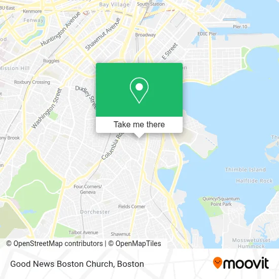
See Good News Boston Church on the map
Public Transportation to Good News Boston Church
Wondering how to get to Good News Boston Church? Moovit helps you find the best way to get to Good News Boston Church with step-by-step directions from the nearest public transit station.
Moovit provides free maps and live directions to help you navigate through your city. View schedules, routes, timetables, and find out how long does it take to get to Good News Boston Church in real time.
Looking for the nearest stop or station to Good News Boston Church? Check out this list of stops closest to your destination: Dorchester Ave @ Belfort St; Savin Hill - Dorchester Ave @ Bay St; Dorchester Ave @ Crescent Ave; Dorchester Ave @ Savin Hill Ave; Columbia Rd @ Dudley St; Uphams Corner; Jfk/Umass.
Bus: 15, 16, 41, 8, 18, RED LINE SHUTTLE, RED LINE SHUTTLE, RED LINE SHUTTLE, RED/MATTAPAN LINE SHUTTLE, RED LINE SHUTTLE.Train: FAIRMOUNT, FRANKLIN/FOXBORO, PROVIDENCE/STOUGHTON, FALL RIVER/NEW BEDFORD, GREENBUSH, KINGSTON, RED LINE.Subway: RED LINE.
Want to see if there’s another route that gets you there at an earlier time? Moovit helps you find alternative routes or times. Get directions from and directions to Good News Boston Church easily from the Moovit App or Website.
We make riding to Good News Boston Church easy, which is why over 1.7 million users, including users in Boston, trust Moovit as the best app for public transit. You don’t need to download an individual bus app or train app, Moovit is your all-in-one transit app that helps you find the best bus time or train time available.
For information on prices of bus, subway and train, costs and ride fares to Good News Boston Church, please check the Moovit app.
Use the app to navigate to popular places including to the airport, hospital, stadium, grocery store, mall, coffee shop, school, college, and university.
Good News Boston Church Address: 48 Pleasant St street in Boston
- Tufts Convenience,
- Marpac Automotive,
- Djonny Barber Shop,
- Taty's Kitchen & Bakery,
- Kingston Gallery,
- Uphams Corner,
- Boston Home Repair,
- City of Boston School Department,
- Stop & Shop Pizzeria Uno Bakery,
- Gao Vietnamese Kitchen,
- Coin Cloud Bitcoin ATM,
- 2 Pearl St Parking,
- Djadys Salon Full Barber Shop,
- Iron Man Locksmith,
- Ba le Dorchester,
- Libertyx Bitcoin ATM,
- Law Offices of Vy H. Truong, PC,
- So Sabe,
- Munchie Station,
- Stealth Garage Doors
Places Near Good News Boston Church
- Prudential Center, Boston,
- Wilbur Theatre, Boston,
- Mgm Music Hall, Boston,
- North End, Boston,
- Td Garden, Boston,
- Boston Children's Hospital, Boston,
- Seaport District, Boston,
- Cheers, Boston,
- Castle Island, Boston,
- Boston Convention & Exhibition Center, Boston,
- Massachusetts General Hospital, Boston,
- House Of Blues, Boston,
- Isabella Stewart Gardner Museum, Boston,
- Boston Common, Boston,
- Wang Theater, Boston,
- Boston Medical Center, Boston,
- Leader Bank Pavilion (Leader Bank Pavillion), Boston,
- Faneuil Hall, Boston,
- Museum Of Science, Boston,
- Quincy Market, Boston
How to get to popular places in Boston with public transit
Get around Boston by public transit!
Traveling around Boston has never been so easy. See step by step directions as you travel to any attraction, street or major public transit station. View bus and train schedules, arrival times, service alerts and detailed routes on a map, so you know exactly how to get to anywhere in Boston.
When traveling to any destination around Boston use Moovit's Live Directions with Get Off Notifications to know exactly where and how far to walk, how long to wait for your line, and how many stops are left. Moovit will alert you when it's time to get off — no need to constantly re-check whether yours is the next stop.
Wondering how to use public transit in Boston or how to pay for public transit in Boston? Moovit public transit app can help you navigate your way with public transit easily, and at minimum cost. It includes public transit fees, ticket prices, and costs. Looking for a map of Boston public transit lines? Moovit public transit app shows all public transit maps in Boston with all Bus, Train, Subway and Ferry routes and stops on an interactive map.
Boston has 4 transit type(s), including: Bus, Train, Subway and Ferry, operated by several transit agencies, including MBTA, Southeastern Regional Transit Authority, MetroWest Regional Transit Authority, Rhode Island Public Transit Authority, WRTA, Lowell Regional Transit Authority, Merrimack Valley Transit, Montachusett Regional Transit Authority, Cape Cod Regional Transit Authority, Brockton Area Transit Authority, Martha's Vineyard Transit Authority, the WAVE - Nantucket Regional Transit Authority, GATRA, Cape Ann Transportation Authority and Massport