How to get to Goodwin's Bbq by bus?
Click on the bus route to see step by step directions with maps, line arrival times and updated time schedules.
From Heartbreak Hill, Newton
77 minFrom McLean Hospital, Belmont
79 minFrom FOUR POINTS BY SHERATON Boston Newton, Newton
47 minFrom Newton Wellesley Hospital Green Building, Newton
77 minFrom Newton, MA, Newton
77 minFrom Winchester, MA, Winchester
107 minFrom Fresh Pond Mall, Cambridge
69 minFrom Brighton, Boston
64 minFrom Burlington, Ma, Burlington
114 minFrom MBTA / Alewife #6, Cambridge
61 min
Bus stop near Goodwin's Bbq in Waltham
- 404 Wyman St, 9 min walk,VIEW
Bus lines to Goodwin's Bbq in Waltham
- 61, North Waltham,VIEW
What are the closest stations to Goodwin's Bbq?
The closest stations to Goodwin's Bbq are:
- 404 Wyman St is 699 yards away, 9 min walk.
Which bus lines stop near Goodwin's Bbq?
These bus lines stop near Goodwin's Bbq: 61, 76.
What’s the nearest bus station to Goodwin's Bbq in Waltham?
The nearest bus station to Goodwin's Bbq in Waltham is 404 Wyman St. It’s a 9 min walk away.
What time is the first bus to Goodwin's Bbq in Waltham?
The 61 is the first bus that goes to Goodwin's Bbq in Waltham. It stops nearby at 6:06 AM.
What time is the last bus to Goodwin's Bbq in Waltham?
The 61 is the last bus that goes to Goodwin's Bbq in Waltham. It stops nearby at 8:21 PM.
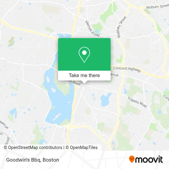
See Goodwin's Bbq, Waltham, on the map
Public Transit to Goodwin's Bbq in Waltham
Wondering how to get to Goodwin's Bbq in Waltham? Moovit helps you find the best way to get to Goodwin's Bbq with step-by-step directions from the nearest public transit station.
Moovit provides free maps and live directions to help you navigate through your city. View schedules, routes, timetables, and find out how long does it take to get to Goodwin's Bbq in real time.
Looking for the nearest stop or station to Goodwin's Bbq? Check out this list of stops closest to your destination: 404 Wyman St.
Bus: 61, 76.
Want to see if there’s another route that gets you there at an earlier time? Moovit helps you find alternative routes or times. Get directions from and directions to Goodwin's Bbq easily from the Moovit App or Website.
We make riding to Goodwin's Bbq easy, which is why over 1.7 million users, including users in Waltham, trust Moovit as the best app for public transit. You don’t need to download an individual bus app or train app, Moovit is your all-in-one transit app that helps you find the best bus time or train time available.
For information on prices of bus, train and subway, costs and ride fares to Goodwin's Bbq, please check the Moovit app.
Use the app to navigate to popular places including to the airport, hospital, stadium, grocery store, mall, coffee shop, school, college, and university.
Goodwin's Bbq Address: 1455 Trapelo Rd street in Waltham
- Exxon,
- Waltham Ma Nazarene Church,
- Chestnut Park at Cleveland Circle,
- Bourgeois, Laurie,
- LPB Construction,
- Fisher Windows,
- Ghamparian & Associates,
- Drift,
- Metro Site and Utility,
- Deciphera Pharmaceuticals,
- Craft Food Hall Project,
- LS the Post,
- Custom Protective Service,
- Country Club Associates,
- Chen Pr,
- Mentor Graphics Corporation,
- Stream Base Systems Inc,
- North Suffolk Mental Health Association,
- Hitachi Software,
- Chen Pr
Places Near Goodwin's Bbq (Waltham)
- Prudential Center, Boston,
- Td Garden, Boston,
- Boston Medical Center, Boston,
- House Of Blues, Boston,
- North End, Boston,
- Mgm Music Hall, Boston,
- Wang Theater, Boston,
- Boston Common, Boston,
- Boston Convention & Exhibition Center, Boston,
- Quincy Market, Boston,
- Cheers, Boston,
- Castle Island, Boston,
- Wilbur Theatre, Boston,
- Isabella Stewart Gardner Museum, Boston,
- Leader Bank Pavilion (Leader Bank Pavillion), Boston,
- Museum Of Science, Boston,
- Faneuil Hall, Boston,
- Seaport District, Boston,
- Boston Children's Hospital, Boston,
- Massachusetts General Hospital, Boston
How to get to popular places in Boston with public transit
Get around Waltham by public transit!
Traveling around Waltham has never been so easy. See step by step directions as you travel to any attraction, street or major public transit station. View bus and train schedules, arrival times, service alerts and detailed routes on a map, so you know exactly how to get to anywhere in Waltham.
When traveling to any destination around Waltham use Moovit's Live Directions with Get Off Notifications to know exactly where and how far to walk, how long to wait for your line, and how many stops are left. Moovit will alert you when it's time to get off — no need to constantly re-check whether yours is the next stop.
Wondering how to use public transit in Waltham or how to pay for public transit in Waltham? Moovit public transit app can help you navigate your way with public transit easily, and at minimum cost. It includes public transit fees, ticket prices, and costs. Looking for a map of Waltham public transit lines? Moovit public transit app shows all public transit maps in Waltham with all Bus, Train, Subway and Ferry routes and stops on an interactive map.
Boston has 4 transit type(s), including: Bus, Train, Subway and Ferry, operated by several transit agencies, including MBTA, Southeastern Regional Transit Authority, MetroWest Regional Transit Authority, Rhode Island Public Transit Authority, WRTA, Lowell Regional Transit Authority, Merrimack Valley Transit, Montachusett Regional Transit Authority, Cape Cod Regional Transit Authority, Brockton Area Transit Authority, Martha's Vineyard Transit Authority, the WAVE - Nantucket Regional Transit Authority, GATRA, Cape Ann Transportation Authority and Massport