Directions to Gordon Conwell (Boston) with public transportation
The following transit lines have routes that pass near Gordon Conwell
 Bus: 39, 41, 35.
- Train: NEEDHAM, PROVIDENCE/STOUGHTON.
- Subway: ORANGE LINE, GREEN LINE E.
How to get to Gordon Conwell by bus?
Click on the bus route to see step by step directions with maps, line arrival times and updated time schedules.
From Children's Hospital, Boston
47 minFrom Kkkk, Boston
75 minFrom Boston Long Wharf Ferry Terminal, Boston
47 minFrom Granite Links Golf Club at Quarry Hills, Quincy
81 minFrom Arsenal Mall, Watertown Town
58 minFrom Harvard Square, Cambridge
44 minFrom Massport Bus 77 Chelsea Employee Parking, Chelsea
72 minFrom TownePlace Suites Boston Logan Airport/Chelsea, Chelsea
72 minFrom DoubleTree by Hilton Boston Logan Airport Chelsea, Chelsea
77 min
How to get to Gordon Conwell by train?
Click on the train route to see step by step directions with maps, line arrival times and updated time schedules.
How to get to Gordon Conwell by subway?
Click on the subway route to see step by step directions with maps, line arrival times and updated time schedules.
Bus stop near Gordon Conwell in Boston
- Centre St @ Moraine St, 1 min walk,VIEW
Subway stations near Gordon Conwell in Boston
Bus lines to Gordon Conwell in Boston
What are the closest stations to Gordon Conwell?
The closest stations to Gordon Conwell are:
- Centre St @ Moraine St is 45 yards away, 1 min walk.
- Heath Street is 1085 yards away, 13 min walk.
- Stony Brook is 1881 yards away, 22 min walk.
Which bus lines stop near Gordon Conwell?
These bus lines stop near Gordon Conwell: 39, 41.
Which train lines stop near Gordon Conwell?
These train lines stop near Gordon Conwell: NEEDHAM, PROVIDENCE/STOUGHTON.
Which subway line stops near Gordon Conwell?
ORANGE LINE (Forest Hills)
What’s the nearest subway station to Gordon Conwell in Boston?
The nearest subway station to Gordon Conwell in Boston is Heath Street. It’s a 13 min walk away.
What’s the nearest bus station to Gordon Conwell in Boston?
The nearest bus station to Gordon Conwell in Boston is Centre St @ Moraine St. It’s a 1 min walk away.
What time is the first subway to Gordon Conwell in Boston?
The ORANGE LINE is the first subway that goes to Gordon Conwell in Boston. It stops nearby at 5:18 AM.
What time is the last subway to Gordon Conwell in Boston?
The GREEN LINE E is the last subway that goes to Gordon Conwell in Boston. It stops nearby at 2:00 AM.
What time is the first bus to Gordon Conwell in Boston?
The 39 is the first bus that goes to Gordon Conwell in Boston. It stops nearby at 4:43 AM.
What time is the last bus to Gordon Conwell in Boston?
The 39 is the last bus that goes to Gordon Conwell in Boston. It stops nearby at 1:28 AM.
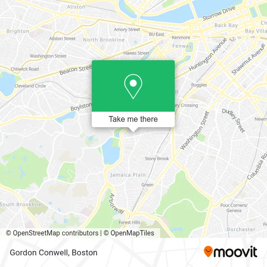
See Gordon Conwell, Boston, on the map
Public Transit to Gordon Conwell in Boston
Wondering how to get to Gordon Conwell in Boston? Moovit helps you find the best way to get to Gordon Conwell with step-by-step directions from the nearest public transit station.
Moovit provides free maps and live directions to help you navigate through your city. View schedules, routes, timetables, and find out how long does it take to get to Gordon Conwell in real time.
Looking for the nearest stop or station to Gordon Conwell? Check out this list of stops closest to your destination: Centre St @ Moraine St; Heath Street; Stony Brook.
Bus: 39, 41, 35.Train: NEEDHAM, PROVIDENCE/STOUGHTON.Subway: ORANGE LINE, GREEN LINE E.
Want to see if there’s another route that gets you there at an earlier time? Moovit helps you find alternative routes or times. Get directions from and directions to Gordon Conwell easily from the Moovit App or Website.
We make riding to Gordon Conwell easy, which is why over 1.7 million users, including users in Boston, trust Moovit as the best app for public transit. You don’t need to download an individual bus app or train app, Moovit is your all-in-one transit app that helps you find the best bus time or train time available.
For information on prices of bus, subway and train, costs and ride fares to Gordon Conwell, please check the Moovit app.
Use the app to navigate to popular places including to the airport, hospital, stadium, grocery store, mall, coffee shop, school, college, and university.
Gordon Conwell Address: 363 S Huntington Ave street in Boston
- Dr. Chuks Okoli, Mba, CPA, Edd - Okoli Financial,
- USPS Collection Box - Blue Box,
- Mspca Dog Park,
- Metropolitan Painting Co,
- Angell Animal Medical Center: in Boston and Waltham,
- Angell Animal Medical Center (Mspca Angell),
- Mspca,
- Angell Animal Medical Center (Angell Veterinary Dermatology Service Phone),
- MSPCA Angell Animal Medical Center,
- MSPCA Adoption Center,
- Mario's,
- Amazon Locker-Jamaicaplain,
- El Mundo Newspaper,
- Momo Masala,
- Don Tequeno Y Dona Arepa,
- Bella Luna Restaurant,
- Jamaica Plain,
- A Dt - ADT Alarm & Security - Main Number,
- Connolly Branch Library,
- Harvard Real Estate
Places Near Gordon Conwell (Boston)
- Cheers, Boston,
- Boston Medical Center, Boston,
- Boston Common, Boston,
- Prudential Center, Boston,
- Leader Bank Pavilion (Leader Bank Pavillion), Boston,
- Quincy Market, Boston,
- Boston Convention & Exhibition Center, Boston,
- Td Garden, Boston,
- Boston Children's Hospital, Boston,
- Castle Island, Boston,
- Mgm Music Hall, Boston,
- Seaport District, Boston,
- Museum Of Science, Boston,
- Isabella Stewart Gardner Museum, Boston,
- Wang Theater, Boston,
- North End, Boston,
- Faneuil Hall, Boston,
- House Of Blues, Boston,
- Wilbur Theatre, Boston,
- Massachusetts General Hospital, Boston
How to get to popular places in Boston with public transit
Get around Boston by public transit!
Traveling around Boston has never been so easy. See step by step directions as you travel to any attraction, street or major public transit station. View bus and train schedules, arrival times, service alerts and detailed routes on a map, so you know exactly how to get to anywhere in Boston.
When traveling to any destination around Boston use Moovit's Live Directions with Get Off Notifications to know exactly where and how far to walk, how long to wait for your line, and how many stops are left. Moovit will alert you when it's time to get off — no need to constantly re-check whether yours is the next stop.
Wondering how to use public transit in Boston or how to pay for public transit in Boston? Moovit public transit app can help you navigate your way with public transit easily, and at minimum cost. It includes public transit fees, ticket prices, and costs. Looking for a map of Boston public transit lines? Moovit public transit app shows all public transit maps in Boston with all Bus, Train, Subway and Ferry routes and stops on an interactive map.
Boston has 4 transit type(s), including: Bus, Train, Subway and Ferry, operated by several transit agencies, including MBTA, Southeastern Regional Transit Authority, MetroWest Regional Transit Authority, Rhode Island Public Transit Authority, WRTA, Lowell Regional Transit Authority, Merrimack Valley Transit, Montachusett Regional Transit Authority, Cape Cod Regional Transit Authority, Brockton Area Transit Authority, Martha's Vineyard Transit Authority, the WAVE - Nantucket Regional Transit Authority, GATRA, Cape Ann Transportation Authority and Massport