Directions to Gozgolffit (Needham) with public transportation
The following transit lines have routes that pass near Gozgolffit
 Bus: 52, 59.
- Train: NEEDHAM.
- Subway: GREEN LINE D.
How to get to Gozgolffit by bus?
Click on the bus route to see step by step directions with maps, line arrival times and updated time schedules.
From Rosenberg Building Bidmc, Boston
79 minFrom Centre St, Boston
112 minFrom Washington St, Boston
122 minFrom Beth Israel Deaconess Medical Center West Campus, Boston
79 minFrom Dedham District Court, Dedham
108 minFrom Beth Israel Deaconess Medical Center, West Campus - Farr Building, Boston
79 minFrom Boston Children's Hospital, Boston
81 minFrom Brighton, Boston
82 minFrom Costco, Dedham
139 minFrom Brookline, MA, Brookline
81 min
How to get to Gozgolffit by train?
Click on the train route to see step by step directions with maps, line arrival times and updated time schedules.
How to get to Gozgolffit by subway?
Click on the subway route to see step by step directions with maps, line arrival times and updated time schedules.
From Rosenberg Building Bidmc, Boston
64 minFrom Centre St, Boston
91 minFrom Washington St, Boston
96 minFrom Beth Israel Deaconess Medical Center West Campus, Boston
63 minFrom Beth Israel Deaconess Medical Center, West Campus - Farr Building, Boston
63 minFrom Boston Children's Hospital, Boston
60 minFrom Brighton, Boston
60 minFrom Brookline, MA, Brookline
68 min
Bus stop near Gozgolffit in Needham
- Chestnut St @ Elliot St, 6 min walk,VIEW
Subway station near Gozgolffit in Needham
- Newton Highlands, 22 min walk,VIEW
Train station near Gozgolffit in Needham
- Needham Center, 43 min walk,VIEW
Bus lines to Gozgolffit in Needham
- 59, Needham Junction Via Needham St,VIEW
What are the closest stations to Gozgolffit?
The closest stations to Gozgolffit are:
- Chestnut St @ Elliot St is 427 yards away, 6 min walk.
- Newton Highlands is 1822 yards away, 22 min walk.
- Needham Center is 3586 yards away, 43 min walk.
Which bus lines stop near Gozgolffit?
These bus lines stop near Gozgolffit: 52, 59.
Which train line stops near Gozgolffit?
NEEDHAM (#625 | Needham Heights)
Which subway line stops near Gozgolffit?
GREEN LINE D (Riverside)
What’s the nearest subway station to Gozgolffit in Needham?
The nearest subway station to Gozgolffit in Needham is Newton Highlands. It’s a 22 min walk away.
What’s the nearest bus station to Gozgolffit in Needham?
The nearest bus station to Gozgolffit in Needham is Chestnut St @ Elliot St. It’s a 6 min walk away.
What time is the first subway to Gozgolffit in Needham?
The GREEN LINE D is the first subway that goes to Gozgolffit in Needham. It stops nearby at 4:48 AM.
What time is the last subway to Gozgolffit in Needham?
The GREEN LINE D is the last subway that goes to Gozgolffit in Needham. It stops nearby at 2:44 AM.
What time is the first train to Gozgolffit in Needham?
The NEEDHAM is the first train that goes to Gozgolffit in Needham. It stops nearby at 7:05 AM.
What time is the last train to Gozgolffit in Needham?
The NEEDHAM is the last train that goes to Gozgolffit in Needham. It stops nearby at 6:38 PM.
What time is the first bus to Gozgolffit in Needham?
The 59 is the first bus that goes to Gozgolffit in Needham. It stops nearby at 6:23 AM.
What time is the last bus to Gozgolffit in Needham?
The 59 is the last bus that goes to Gozgolffit in Needham. It stops nearby at 8:02 PM.
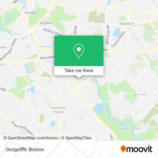
See Gozgolffit, Needham, on the map
Public Transit to Gozgolffit in Needham
Wondering how to get to Gozgolffit in Needham? Moovit helps you find the best way to get to Gozgolffit with step-by-step directions from the nearest public transit station.
Moovit provides free maps and live directions to help you navigate through your city. View schedules, routes, timetables, and find out how long does it take to get to Gozgolffit in real time.
Looking for the nearest stop or station to Gozgolffit? Check out this list of stops closest to your destination: Chestnut St @ Elliot St; Newton Highlands; Needham Center.
Bus: 52, 59.Train: NEEDHAM.Subway: GREEN LINE D.
Want to see if there’s another route that gets you there at an earlier time? Moovit helps you find alternative routes or times. Get directions from and directions to Gozgolffit easily from the Moovit App or Website.
We make riding to Gozgolffit easy, which is why over 1.7 million users, including users in Needham, trust Moovit as the best app for public transit. You don’t need to download an individual bus app or train app, Moovit is your all-in-one transit app that helps you find the best bus time or train time available.
For information on prices of bus, subway and train, costs and ride fares to Gozgolffit, please check the Moovit app.
Use the app to navigate to popular places including to the airport, hospital, stadium, grocery store, mall, coffee shop, school, college, and university.
Gozgolffit Address: 10 Charles St street in Needham
- Blair's The Locksmith,
- Chenguang,
- Boston Broadcasting,
- Consolidated Graphics,
- Open Software Development,
- Genalco Inc,
- Number One Source,
- Pete Upton,
- Ae Game Golf,
- Advigo Development Group,
- Alliance for Children,
- Levo Labs,
- Boston Behavior Learning Centers,
- Ala Recycling Industries,
- Exit 35C-B-A/Highland Ave/S,
- Skotel-Flutes,
- Garment Machinery Company, Inc.,
- Ihloom Cybersecurity,
- Fix It Guy,
- Nauset
Places Near Gozgolffit (Needham)
- North End, Boston,
- House Of Blues, Boston,
- Seaport District, Boston,
- Prudential Center, Boston,
- Castle Island, Boston,
- Td Garden, Boston,
- Massachusetts General Hospital, Boston,
- Cheers, Boston,
- Museum Of Science, Boston,
- Boston Medical Center, Boston,
- Wilbur Theatre, Boston,
- Isabella Stewart Gardner Museum, Boston,
- Leader Bank Pavilion (Leader Bank Pavillion), Boston,
- Boston Common, Boston,
- Boston Children's Hospital, Boston,
- Mgm Music Hall, Boston,
- Faneuil Hall, Boston,
- Wang Theater, Boston,
- Boston Convention & Exhibition Center, Boston,
- Quincy Market, Boston
How to get to popular places in Boston with public transit
Get around Needham by public transit!
Traveling around Needham has never been so easy. See step by step directions as you travel to any attraction, street or major public transit station. View bus and train schedules, arrival times, service alerts and detailed routes on a map, so you know exactly how to get to anywhere in Needham.
When traveling to any destination around Needham use Moovit's Live Directions with Get Off Notifications to know exactly where and how far to walk, how long to wait for your line, and how many stops are left. Moovit will alert you when it's time to get off — no need to constantly re-check whether yours is the next stop.
Wondering how to use public transit in Needham or how to pay for public transit in Needham? Moovit public transit app can help you navigate your way with public transit easily, and at minimum cost. It includes public transit fees, ticket prices, and costs. Looking for a map of Needham public transit lines? Moovit public transit app shows all public transit maps in Needham with all Bus, Train, Subway and Ferry routes and stops on an interactive map.
Boston has 4 transit type(s), including: Bus, Train, Subway and Ferry, operated by several transit agencies, including MBTA, Southeastern Regional Transit Authority, MetroWest Regional Transit Authority, Rhode Island Public Transit Authority, WRTA, Lowell Regional Transit Authority, Merrimack Valley Transit, Montachusett Regional Transit Authority, Cape Cod Regional Transit Authority, Brockton Area Transit Authority, Martha's Vineyard Transit Authority, the WAVE - Nantucket Regional Transit Authority, GATRA, Cape Ann Transportation Authority and Massport