How to get to Grace Hill Community Church by bus?
Click on the bus route to see step by step directions with maps, line arrival times and updated time schedules.
From Boston Latin Academy, Boston
92 minFrom Boston University Track and Tennis Center, Boston
98 minFrom Charles W. Eliot Bridge, Boston
99 minFrom 221 Longwood, Boston
79 minFrom Mass Eye & Ear, Boston
73 minFrom Bow Market, Somerville
69 minFrom Charles Playhouse, Boston
38 minFrom Beth Israel Deaconess Medical Center Is, Boston
66 minFrom Frog Pond, Boston
24 minFrom 110 Francis Street Garage, Boston
100 min
How to get to Grace Hill Community Church by subway?
Click on the subway route to see step by step directions with maps, line arrival times and updated time schedules.
From Boston Latin Academy, Boston
64 minFrom Boston University Track and Tennis Center, Boston
63 minFrom Charles W. Eliot Bridge, Boston
70 minFrom 221 Longwood, Boston
53 minFrom Mass Eye & Ear, Boston
57 minFrom Bow Market, Somerville
54 minFrom Charles Playhouse, Boston
34 minFrom Beth Israel Deaconess Medical Center Is, Boston
38 minFrom Frog Pond, Boston
33 minFrom 110 Francis Street Garage, Boston
61 min
Bus stops near Grace Hill Community Church in Boston
Subway station near Grace Hill Community Church in Boston
- Wood Island, 9 min walk,VIEW
Bus lines to Grace Hill Community Church in Boston
What are the closest stations to Grace Hill Community Church?
The closest stations to Grace Hill Community Church are:
- Bennington St @ Trident St is 268 yards away, 4 min walk.
- Mcclellan Highway @ Boardman St is 344 yards away, 5 min walk.
- Wood Island is 726 yards away, 9 min walk.
Which bus lines stop near Grace Hill Community Church?
These bus lines stop near Grace Hill Community Church: 120, 450.
Which subway line stops near Grace Hill Community Church?
BLUE LINE (Wonderland)
What’s the nearest subway station to Grace Hill Community Church in Boston?
The nearest subway station to Grace Hill Community Church in Boston is Wood Island. It’s a 9 min walk away.
What’s the nearest bus station to Grace Hill Community Church in Boston?
The nearest bus station to Grace Hill Community Church in Boston is Bennington St @ Trident St. It’s a 4 min walk away.
What time is the first subway to Grace Hill Community Church in Boston?
The BLUE LINE is the first subway that goes to Grace Hill Community Church in Boston. It stops nearby at 5:08 AM.
What time is the last subway to Grace Hill Community Church in Boston?
The BLUE LINE is the last subway that goes to Grace Hill Community Church in Boston. It stops nearby at 2:06 AM.
What time is the first bus to Grace Hill Community Church in Boston?
The 120 is the first bus that goes to Grace Hill Community Church in Boston. It stops nearby at 5:27 AM.
What time is the last bus to Grace Hill Community Church in Boston?
The 120 is the last bus that goes to Grace Hill Community Church in Boston. It stops nearby at 1:35 AM.
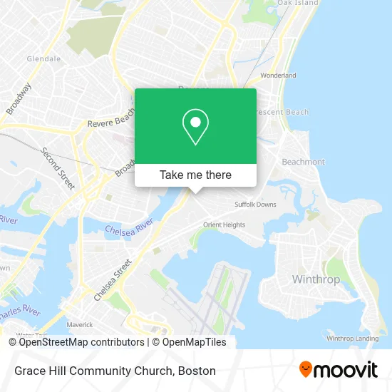
See Grace Hill Community Church, Boston, on the map
Public Transit to Grace Hill Community Church in Boston
Wondering how to get to Grace Hill Community Church in Boston? Moovit helps you find the best way to get to Grace Hill Community Church with step-by-step directions from the nearest public transit station.
Moovit provides free maps and live directions to help you navigate through your city. View schedules, routes, timetables, and find out how long does it take to get to Grace Hill Community Church in real time.
Looking for the nearest stop or station to Grace Hill Community Church? Check out this list of stops closest to your destination: Bennington St @ Trident St; Mcclellan Highway @ Boardman St; Wood Island.
Bus: 120, 450.Subway: BLUE LINE.
Want to see if there’s another route that gets you there at an earlier time? Moovit helps you find alternative routes or times. Get directions from and directions to Grace Hill Community Church easily from the Moovit App or Website.
We make riding to Grace Hill Community Church easy, which is why over 1.7 million users, including users in Boston, trust Moovit as the best app for public transit. You don’t need to download an individual bus app or train app, Moovit is your all-in-one transit app that helps you find the best bus time or train time available.
For information on prices of subway and bus, costs and ride fares to Grace Hill Community Church, please check the Moovit app.
Use the app to navigate to popular places including to the airport, hospital, stadium, grocery store, mall, coffee shop, school, college, and university.
Grace Hill Community Church Address: 30 Leyden St street in Boston
- Hilton Garden Inn Boston Logan Airport,
- Suffolk Downs,
- Cirque du Soleil,
- Legends Bar & Grill,
- Noyes Park,
- Budget,
- AVIS,
- Reference Real Estate,
- Bellair Expediting Boston,
- Grossman Co.,
- Constitution Beach,
- Bajucol,
- Don Orione Nursing Home,
- Business,
- USPS Collection Box - Blue Box,
- Madonna Queen Of the Universe Shrine,
- Dartmouth College,
- Madonna Shrine (Madonna Queen National Shrine),
- Madonna Queen Gift Shop,
- Beauty Nails Boston
Places Near Grace Hill Community Church (Boston)
- Wang Theater, Boston,
- Massachusetts General Hospital, Boston,
- Cheers, Boston,
- Td Garden, Boston,
- Boston Medical Center, Boston,
- Quincy Market, Boston,
- North End, Boston,
- Seaport District, Boston,
- Faneuil Hall, Boston,
- Isabella Stewart Gardner Museum, Boston,
- Boston Convention & Exhibition Center, Boston,
- Museum Of Science, Boston,
- Boston Common, Boston,
- Leader Bank Pavilion (Leader Bank Pavillion), Boston,
- Wilbur Theatre, Boston,
- Mgm Music Hall, Boston,
- Prudential Center, Boston,
- Castle Island, Boston,
- House Of Blues, Boston,
- Boston Children's Hospital, Boston
How to get to popular places in Boston with public transit
Get around Boston by public transit!
Traveling around Boston has never been so easy. See step by step directions as you travel to any attraction, street or major public transit station. View bus and train schedules, arrival times, service alerts and detailed routes on a map, so you know exactly how to get to anywhere in Boston.
When traveling to any destination around Boston use Moovit's Live Directions with Get Off Notifications to know exactly where and how far to walk, how long to wait for your line, and how many stops are left. Moovit will alert you when it's time to get off — no need to constantly re-check whether yours is the next stop.
Wondering how to use public transit in Boston or how to pay for public transit in Boston? Moovit public transit app can help you navigate your way with public transit easily, and at minimum cost. It includes public transit fees, ticket prices, and costs. Looking for a map of Boston public transit lines? Moovit public transit app shows all public transit maps in Boston with all Bus, Train, Subway and Ferry routes and stops on an interactive map.
Boston has 4 transit type(s), including: Bus, Train, Subway and Ferry, operated by several transit agencies, including MBTA, Southeastern Regional Transit Authority, MetroWest Regional Transit Authority, Rhode Island Public Transit Authority, WRTA, Lowell Regional Transit Authority, Merrimack Valley Transit, Montachusett Regional Transit Authority, Cape Cod Regional Transit Authority, Brockton Area Transit Authority, Martha's Vineyard Transit Authority, the WAVE - Nantucket Regional Transit Authority, GATRA, Cape Ann Transportation Authority and Massport