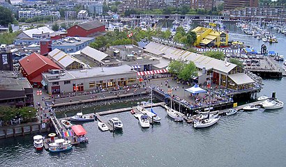
See Granville Island, Vancouver, on the map
Directions to Granville Island (Vancouver) with public transportation
The following transit lines have routes that pass near Granville Island
 Bus:
Bus: - SkyTrain:
- Ferry:
How to get to Granville Island by bus?
Click on the bus route to see step by step directions with maps, line arrival times and updated time schedules.
How to get to Granville Island by SkyTrain?
Click on the SkyTrain route to see step by step directions with maps, line arrival times and updated time schedules.
Bus stations near Granville Island in Vancouver
- Westbound W 2nd Ave @ Anderson St,5 min walk,
- Eastbound W 4th Ave @ Fir St,9 min walk,
- Northbound Granville St @ W 5th Ave,10 min walk,
- Westbound Beach Ave @ Howe St,26 min walk,
Ferry stations near Granville Island in Vancouver
- Granville Island,26 min walk,
- Granville Island Ferry Dock,27 min walk,
Bus lines to Granville Island in Vancouver
- 50,Waterfront Station,
- 4,Powell/Downtown/UBC,
- 7,Nanaimo Station/Dunbar,
- 14,Hastings/UBC,
- 84,UBC/VCC-Clark Station,
- 10,Granville/Waterfront Station,
- 16,29th Avenue Station/Arbutus,
- N9,Downtown/Lougheed Station/Coquitlam Central Station,
- N10,Downtown/Richmond NightBus,
- N17,Downtown/UBC NightBus,
- 23,English Bay,
What are the closest stations to Granville Island?
The closest stations to Granville Island are:
- Westbound W 2nd Ave @ Anderson St is 375 meters away, 5 min walk.
- Eastbound W 4th Ave @ Fir St is 660 meters away, 9 min walk.
- Northbound Granville St @ W 5th Ave is 716 meters away, 10 min walk.
- Westbound Beach Ave @ Howe St is 1999 meters away, 26 min walk.
- Granville Island is 2005 meters away, 26 min walk.
- Granville Island Ferry Dock is 2062 meters away, 27 min walk.
Which bus lines stop near Granville Island?
These bus lines stop near Granville Island: 10, 14, 4, 50, 84.
Which SkyTrain line stops near Granville Island?
CANADA LINE
What’s the nearest bus stop to Granville Island in Vancouver?
The nearest bus stop to Granville Island in Vancouver is Westbound W 2nd Ave @ Anderson St. It’s a 5 min walk away.
What’s the nearest ferry station to Granville Island in Vancouver?
The nearest ferry station to Granville Island in Vancouver is Granville Island. It’s a 26 min walk away.
What time is the first bus to Granville Island in Vancouver?
The 14 is the first bus that goes to Granville Island in Vancouver. It stops nearby at 3:16 AM.
What time is the last bus to Granville Island in Vancouver?
The N9 is the last bus that goes to Granville Island in Vancouver. It stops nearby at 3:23 AM.
What time is the first ferry to Granville Island in Vancouver?
The AQUABUS is the first ferry that goes to Granville Island in Vancouver. It stops nearby at 6:45 AM.
What time is the last ferry to Granville Island in Vancouver?
The AQUABUS is the last ferry that goes to Granville Island in Vancouver. It stops nearby at 10:30 PM.
How much is the ferry fare to Granville Island?
The ferry fare to Granville Island costs about $2.60.
How much is the bus fare to Granville Island?
The bus fare to Granville Island costs about $2.60.
See Granville Island, Vancouver, on the map
Public Transit to Granville Island in Vancouver
Wondering how to get to Granville Island in Vancouver, Canada? Moovit helps you find the best way to get to Granville Island with step-by-step directions from the nearest public transit station.
Moovit provides free maps and live directions to help you navigate through your city. View schedules, routes, timetables, and find out how long does it take to get to Granville Island in real time.
Looking for the nearest stop or station to Granville Island? Check out this list of stops closest to your destination: Westbound W 2nd Ave @ Anderson St; Eastbound W 4th Ave @ Fir St; Northbound Granville St @ W 5th Ave; Westbound Beach Ave @ Howe St; Granville Island; Granville Island Ferry Dock.
Bus:SkyTrain:Ferry:
Want to see if there’s another route that gets you there at an earlier time? Moovit helps you find alternative routes or times. Get directions from and directions to Granville Island easily from the Moovit App or Website.
We make riding to Granville Island easy, which is why over 1.5 million users, including users in Vancouver, trust Moovit as the best app for public transit. You don’t need to download an individual bus app or train app, Moovit is your all-in-one transit app that helps you find the best bus time or train time available.
For information on prices of bus, SkyTrain and ferry, costs and ride fares to Granville Island, please check the Moovit app.
Use the app to navigate to popular places including to the airport, hospital, stadium, grocery store, mall, coffee shop, school, college, and university.
Granville Island Address: Old Bridge Street street in Vancouver
Attractions near Granville Island
I'm Impressed Paper Arts,Granville Island,Emily Carr University of Art & Design,Materna Daniel Ceramics Gallery (Ceramics Studio),Arts Umbrella-South Surrey,The Sandbar (Sandbar Seafood Restaurant),Aquabus LTD,The Keg Steakhouse + Bar - Granville Island,Cats Socialhouse (Cat's Meow Restaurant the),Vancouver Art Therapy Institute,Kaboodles (Kaboodles Toy Store),Granville Island Kids Market,Westside Church - at the Granville Island Stage,Columbia Sportswear Co,The Sandbar Seafood Restaurant,Preserved by Janet Patricia,Granville Island Terminal (Aquabus),Aquabus Granville Island Dock,Granville Island Public Market,Muffin Granny (Grandville Island Turkey Stop)How to get to popular attractions in Vancouver with public transit
Haney Place Bus Station, Maple Ridge,Waterfront Station, Vancouver,Parallel 49 Brewing Co., Vancouver,Downtown, Vancouver,Ubc, Greater Vancouver A,Simon Fraser University, Burnaby,Stanley Park, Vancouver,Ikea Richmond, Richmond,Real Canadian Superstore, Delta,Burnaby Mountain Secondary School, Burnaby,Scotiabank Theatre Vancouver, Vancouver,Columbia College, Vancouver,White Rock, White Rock,Children's & Women's Health Centre of British Columbia, Vancouver,The Keg Steakhouse + Bar, Burnaby,Kwantlen Polytechnic University - Surrey Campus, Surrey,Pacific Centre Food Court, Vancouver,XXI Forever 21, Richmond,St. Paul's Hospital, Vancouver,Park Royal Shopping Centre, Capilano 5Get around Vancouver by public transit!
Traveling around Vancouver has never been so easy. See step by step directions as you travel to any attraction, street or major public transit station. View bus and train schedules, arrival times, service alerts and detailed routes on a map, so you know exactly how to get to anywhere in Vancouver.
When traveling to any destination around Vancouver use Moovit's Live Directions with Get Off Notifications to know exactly where and how far to walk, how long to wait for your line, and how many stops are left. Moovit will alert you when it's time to get off — no need to constantly re-check whether yours is the next stop.
Wondering how to use public transit in Vancouver or how to pay for public transit in Vancouver? Moovit public transit app can help you navigate your way with public transit easily, and at minimum cost. It includes public transit fees, ticket prices, and costs. Looking for a map of Vancouver public transit lines? Moovit public transit app shows all public transit maps in Vancouver with all bus, SkyTrain or ferry routes and stops on an interactive map.
Vancouver has 3 transit type(s), including: bus, SkyTrain or ferry, operated by several transit agencies, including TransLink, TransLink, TransLink, TransLink, False Creek Ferries, BC Ferries, Aquabus, BC Transit - Central Fraser Valley Transit System, BCTransit, BC Transit - Comox Valley Transit System, BC Transit - Aggasiz-Harrison and Hope Transit System, BC Transit - Chilliwack Transit System, BC Transit - Squamish, BC Transit - Whistler Transit System and BC Transit - Cowichan Valley Regional Transit System