Directions to Grapevine Realty Group (Boston) with public transportation
The following transit lines have routes that pass near Grapevine Realty Group
 Bus: 716, PROVIDENCE/STOUGHTON LINE SHUTTLE.
- Train: PROVIDENCE/STOUGHTON.
How to get to Grapevine Realty Group by bus?
Click on the bus route to see step by step directions with maps, line arrival times and updated time schedules.
How to get to Grapevine Realty Group by train?
Click on the train route to see step by step directions with maps, line arrival times and updated time schedules.
Bus stops near Grapevine Realty Group in Boston
Train station near Grapevine Realty Group in Boston
- Canton Center, 20 min walk,VIEW
Bus lines to Grapevine Realty Group in Boston
What are the closest stations to Grapevine Realty Group?
The closest stations to Grapevine Realty Group are:
- Washington St From High St To Cobbs Corner is 523 yards away, 7 min walk.
- Canton Center is 1678 yards away, 20 min walk.
- Washington St Opp Canton Center Station - Bus Shuttle is 1836 yards away, 22 min walk.
Which bus line stops near Grapevine Realty Group?
716 (Canton Village Shoppes)
Which train line stops near Grapevine Realty Group?
PROVIDENCE/STOUGHTON (#917 | Stoughton)
What’s the nearest train station to Grapevine Realty Group in Boston?
The nearest train station to Grapevine Realty Group in Boston is Canton Center. It’s a 20 min walk away.
What’s the nearest bus station to Grapevine Realty Group in Boston?
The nearest bus station to Grapevine Realty Group in Boston is Washington St From High St To Cobbs Corner. It’s a 7 min walk away.
What time is the first train to Grapevine Realty Group in Boston?
The PROVIDENCE/STOUGHTON is the first train that goes to Grapevine Realty Group in Boston. It stops nearby at 4:45 AM.
What time is the last train to Grapevine Realty Group in Boston?
The PROVIDENCE/STOUGHTON is the last train that goes to Grapevine Realty Group in Boston. It stops nearby at 12:25 AM.
What time is the first bus to Grapevine Realty Group in Boston?
The PROVIDENCE/STOUGHTON LINE SHUTTLE is the first bus that goes to Grapevine Realty Group in Boston. It stops nearby at 4:46 AM.
What time is the last bus to Grapevine Realty Group in Boston?
The PROVIDENCE/STOUGHTON LINE SHUTTLE is the last bus that goes to Grapevine Realty Group in Boston. It stops nearby at 12:37 AM.
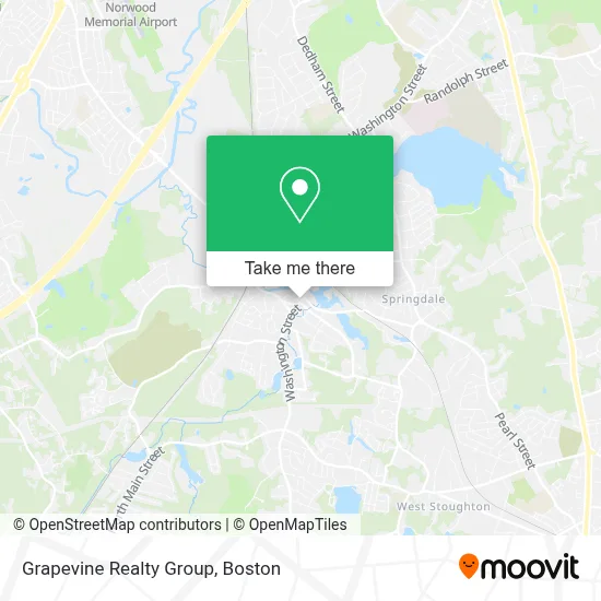
See Grapevine Realty Group, Boston, on the map
Public Transit to Grapevine Realty Group in Boston
Wondering how to get to Grapevine Realty Group in Boston? Moovit helps you find the best way to get to Grapevine Realty Group with step-by-step directions from the nearest public transit station.
Moovit provides free maps and live directions to help you navigate through your city. View schedules, routes, timetables, and find out how long does it take to get to Grapevine Realty Group in real time.
Looking for the nearest stop or station to Grapevine Realty Group? Check out this list of stops closest to your destination: Washington St From High St To Cobbs Corner; Canton Center; Washington St Opp Canton Center Station - Bus Shuttle.
Bus: 716, PROVIDENCE/STOUGHTON LINE SHUTTLE.Train: PROVIDENCE/STOUGHTON.
Want to see if there’s another route that gets you there at an earlier time? Moovit helps you find alternative routes or times. Get directions from and directions to Grapevine Realty Group easily from the Moovit App or Website.
We make riding to Grapevine Realty Group easy, which is why over 1.7 million users, including users in Boston, trust Moovit as the best app for public transit. You don’t need to download an individual bus app or train app, Moovit is your all-in-one transit app that helps you find the best bus time or train time available.
For information on prices of bus and train, costs and ride fares to Grapevine Realty Group, please check the Moovit app.
Use the app to navigate to popular places including to the airport, hospital, stadium, grocery store, mall, coffee shop, school, college, and university.
Grapevine Realty Group Address: 572 Washington St street in Boston
- Law Offices of Peter Clark,
- Ed McGonagle,
- Deb Aufiero Real Estate,
- Canton Cornerstone,
- Amazon Locker-Port,
- Spice Art,
- Anytime Any Place Locksmith,
- KNK Luxury Development Group,
- Kim Amy DMD - Kim, Amy DMD,
- Western Union,
- Robt M Golden Optometrist,
- Open Doors Yoga Studios Canton,
- Chris Albert 2023 Select Board Campaign,
- Community Communications,
- Dime Aesthetics,
- Playa Bowls,
- Gather,
- Walgreens Pharmacy,
- Advanced Skin Care And Hair Removal Center,
- Infinity Chimney Cleaning
Places Near Grapevine Realty Group (Boston)
- Leader Bank Pavilion (Leader Bank Pavillion), Boston,
- Isabella Stewart Gardner Museum, Boston,
- Prudential Center, Boston,
- Boston Common, Boston,
- Faneuil Hall, Boston,
- Boston Medical Center, Boston,
- Wang Theater, Boston,
- Mgm Music Hall, Boston,
- House Of Blues, Boston,
- Boston Children's Hospital, Boston,
- North End, Boston,
- Quincy Market, Boston,
- Td Garden, Boston,
- Wilbur Theatre, Boston,
- Cheers, Boston,
- Seaport District, Boston,
- Museum Of Science, Boston,
- Boston Convention & Exhibition Center, Boston,
- Massachusetts General Hospital, Boston,
- Castle Island, Boston
How to get to popular places in Boston with public transit
Get around Boston by public transit!
Traveling around Boston has never been so easy. See step by step directions as you travel to any attraction, street or major public transit station. View bus and train schedules, arrival times, service alerts and detailed routes on a map, so you know exactly how to get to anywhere in Boston.
When traveling to any destination around Boston use Moovit's Live Directions with Get Off Notifications to know exactly where and how far to walk, how long to wait for your line, and how many stops are left. Moovit will alert you when it's time to get off — no need to constantly re-check whether yours is the next stop.
Wondering how to use public transit in Boston or how to pay for public transit in Boston? Moovit public transit app can help you navigate your way with public transit easily, and at minimum cost. It includes public transit fees, ticket prices, and costs. Looking for a map of Boston public transit lines? Moovit public transit app shows all public transit maps in Boston with all Bus, Train, Subway and Ferry routes and stops on an interactive map.
Boston has 4 transit type(s), including: Bus, Train, Subway and Ferry, operated by several transit agencies, including MBTA, Southeastern Regional Transit Authority, MetroWest Regional Transit Authority, Rhode Island Public Transit Authority, WRTA, Lowell Regional Transit Authority, Merrimack Valley Transit, Montachusett Regional Transit Authority, Cape Cod Regional Transit Authority, Brockton Area Transit Authority, Martha's Vineyard Transit Authority, the WAVE - Nantucket Regional Transit Authority, GATRA, Cape Ann Transportation Authority and Massport