Directions to Gray's Tile (Worcester) with public transportation
The following transit lines have routes that pass near Gray's Tile
 Bus: 30, GREYHOUND US0230, 31, 825.
How to get to Gray's Tile by bus?
Click on the bus route to see step by step directions with maps, line arrival times and updated time schedules.
Bus stops near Gray's Tile in Worcester
Bus lines to Gray's Tile in Worcester
What are the closest stations to Gray's Tile?
The closest stations to Gray's Tile are:
- Park Ave + Sagamore St is 325 yards away, 5 min walk.
- Grove St + Chadwick St is 338 yards away, 5 min walk.
Which bus lines stop near Gray's Tile?
These bus lines stop near Gray's Tile: 30, GREYHOUND US0230.
What’s the nearest bus station to Gray's Tile in Worcester?
The nearest bus stations to Gray's Tile in Worcester are Park Ave + Sagamore St and Grove St + Chadwick St. The closest one is a 5 min walk away.
What time is the first bus to Gray's Tile in Worcester?
The 30 is the first bus that goes to Gray's Tile in Worcester. It stops nearby at 5:59 AM.
What time is the last bus to Gray's Tile in Worcester?
The 30 is the last bus that goes to Gray's Tile in Worcester. It stops nearby at 10:37 PM.
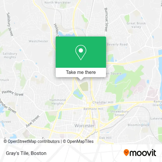
See Gray's Tile, Worcester, on the map
Public Transit to Gray's Tile in Worcester
Wondering how to get to Gray's Tile in Worcester? Moovit helps you find the best way to get to Gray's Tile with step-by-step directions from the nearest public transit station.
Moovit provides free maps and live directions to help you navigate through your city. View schedules, routes, timetables, and find out how long does it take to get to Gray's Tile in real time.
Looking for the nearest stop or station to Gray's Tile? Check out this list of stops closest to your destination: Park Ave + Sagamore St; Grove St + Chadwick St.
Bus: 30, GREYHOUND US0230, 31, 825.
Want to see if there’s another route that gets you there at an earlier time? Moovit helps you find alternative routes or times. Get directions from and directions to Gray's Tile easily from the Moovit App or Website.
We make riding to Gray's Tile easy, which is why over 1.7 million users, including users in Worcester, trust Moovit as the best app for public transit. You don’t need to download an individual bus app or train app, Moovit is your all-in-one transit app that helps you find the best bus time or train time available.
For information on prices of bus and train, costs and ride fares to Gray's Tile, please check the Moovit app.
Use the app to navigate to popular places including to the airport, hospital, stadium, grocery store, mall, coffee shop, school, college, and university.
Gray's Tile Address: 71 Edgeworth St street in Worcester
- Companion Care,
- Lutco,
- Zainab Abbas, MD,
- Shelly Weedon, Pa-C,
- David Geist, MD, Faad, Facms,
- Fallon Health,
- Summit Eldercare,
- Liberty Tax Service,
- Bonkers Balloon Factory,
- Commonwealth of Massachusetts Conservation and Recreation Dept,
- Asbestos of Central Mass,
- Amazon Career Center,
- Tighe & Bond,
- Trivium Construction,
- Crestpoint Financial Group - Ameriprise Financial Services,
- Eric Riggin - Ameriprise Financial Services,
- Best View Imaging,
- Ernie's Touchless Car Wash System,
- Worcester Mobile Truck Repair,
- DUNKIN'
Places Near Gray's Tile (Worcester)
- North End, Boston,
- Wang Theater, Boston,
- Massachusetts General Hospital, Boston,
- Quincy Market, Boston,
- Boston Medical Center, Boston,
- Wilbur Theatre, Boston,
- Faneuil Hall, Boston,
- Museum Of Science, Boston,
- Boston Common, Boston,
- House Of Blues, Boston,
- Isabella Stewart Gardner Museum, Boston,
- Boston Convention & Exhibition Center, Boston,
- Prudential Center, Boston,
- Castle Island, Boston,
- Mgm Music Hall, Boston,
- Boston Children's Hospital, Boston,
- Td Garden, Boston,
- Cheers, Boston,
- Seaport District, Boston,
- Leader Bank Pavilion (Leader Bank Pavillion), Boston
How to get to popular places in Boston with public transit
Get around Worcester by public transit!
Traveling around Worcester has never been so easy. See step by step directions as you travel to any attraction, street or major public transit station. View bus and train schedules, arrival times, service alerts and detailed routes on a map, so you know exactly how to get to anywhere in Worcester.
When traveling to any destination around Worcester use Moovit's Live Directions with Get Off Notifications to know exactly where and how far to walk, how long to wait for your line, and how many stops are left. Moovit will alert you when it's time to get off — no need to constantly re-check whether yours is the next stop.
Wondering how to use public transit in Worcester or how to pay for public transit in Worcester? Moovit public transit app can help you navigate your way with public transit easily, and at minimum cost. It includes public transit fees, ticket prices, and costs. Looking for a map of Worcester public transit lines? Moovit public transit app shows all public transit maps in Worcester with all Bus, Train, Subway and Ferry routes and stops on an interactive map.
Boston has 4 transit type(s), including: Bus, Train, Subway and Ferry, operated by several transit agencies, including MBTA, Southeastern Regional Transit Authority, MetroWest Regional Transit Authority, Rhode Island Public Transit Authority, WRTA, Lowell Regional Transit Authority, Merrimack Valley Transit, Montachusett Regional Transit Authority, Cape Cod Regional Transit Authority, Brockton Area Transit Authority, Martha's Vineyard Transit Authority, the WAVE - Nantucket Regional Transit Authority, GATRA, Cape Ann Transportation Authority and Massport