Directions to Greater Upper Marlboro, Maryland (Prince George's County) with public transportation
The following transit lines have routes that pass near Greater Upper Marlboro, Maryland
How to get to Greater Upper Marlboro, Maryland by bus?
Click on the bus route to see step by step directions with maps, line arrival times and updated time schedules.
Bus stations near Greater Upper Marlboro, Maryland in Prince George's County
- Old Crain Highway at Village Drive West,17 min walk,
Bus lines to Greater Upper Marlboro, Maryland in Prince George's County
- 53,Village Drive,
What are the closest stations to Greater Upper Marlboro, Maryland?
The closest stations to Greater Upper Marlboro, Maryland are:
- Old Crain Highway at Village Drive West is 1458 yards away, 17 min walk.
Which bus lines stop near Greater Upper Marlboro, Maryland?
These bus lines stop near Greater Upper Marlboro, Maryland: 20, 21.
What time is the first bus to Greater Upper Marlboro, Maryland in Prince George's County?
The 53 is the first bus that goes to Greater Upper Marlboro, Maryland in Prince George's County. It stops nearby at 6:15 AM.
What time is the last bus to Greater Upper Marlboro, Maryland in Prince George's County?
The 53 is the last bus that goes to Greater Upper Marlboro, Maryland in Prince George's County. It stops nearby at 6:21 PM.
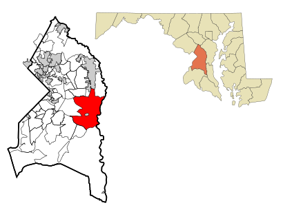
See Greater Upper Marlboro, Maryland, Prince George's County, on the map
Public Transit to Greater Upper Marlboro, Maryland in Prince George's County
Wondering how to get to Greater Upper Marlboro, Maryland in Prince George's County, United States? Moovit helps you find the best way to get to Greater Upper Marlboro, Maryland with step-by-step directions from the nearest public transit station.
Moovit provides free maps and live directions to help you navigate through your city. View schedules, routes, timetables, and find out how long does it take to get to Greater Upper Marlboro, Maryland in real time.
Looking for the nearest stop or station to Greater Upper Marlboro, Maryland? Check out this list of stops closest to your destination: Old Crain Highway at Village Drive West.
Bus:202153
Want to see if there’s another route that gets you there at an earlier time? Moovit helps you find alternative routes or times. Get directions from and directions to Greater Upper Marlboro, Maryland easily from the Moovit App or Website.
We make riding to Greater Upper Marlboro, Maryland easy, which is why over 1.5 million users, including users in Prince George's County, trust Moovit as the best app for public transit. You don’t need to download an individual bus app or train app, Moovit is your all-in-one transit app that helps you find the best bus time or train time available.
For information on prices of bus and metro, costs and ride fares to Greater Upper Marlboro, Maryland, please check the Moovit app.
Use the app to navigate to popular places including to the airport, hospital, stadium, grocery store, mall, coffee shop, school, college, and university.
Greater Upper Marlboro, Maryland Address: Bowie, MD 20772 street in Prince George's County
Attractions near Greater Upper Marlboro, Maryland
Credit Union 1,Venue at 112,Credit Union 1,DASH IN,Ogiata, Blessing,Latanya Howard Daycare,Evolution Dance Studio,Master Carpenters,Best Technicians,Joe Hudson's Collision Center,True Talents of the Arts,Recovery 1 Towing,Limos - Inc,Hems Site Solutions,McLellan & Company,Transportation Association of Maryland, Inc.,Art of Suga Bakery,Upper Marlboro, Maryland,Olando Aire,National Twilight NightHow to get to popular attractions in Prince George's County with public transit
Looney's Pub, Baltimore,Matchbox Vintage Pizza Bistro, Washington,Dacha Beer Garden, Washington,The Cheesecake Factory, Washington,Peking Gourmet Inn, Fairfax County,Horseshoe Baltimore, Baltimore,Baltimore Marriott Inner Harbor at Camden Yards, Baltimore,Hamilton's Bar & Grill, Washington,Costco Wholesale, Howard County,Herndon, Virginia, Fairfax County,Hyatt Regency Reston, Fairfax County,The Greene Turtle Sports Bar & Grille, Washington,Rasika, Washington,Lost Society, Washington,Miss Shirley's Cafe, Baltimore,Charles Village, Baltimore,Earth Treks Climbing Center, Montgomery County,The Ugly Mug, Washington,Duffy's Irish Pub, Washington,Bistrot Du Coin, WashingtonGet around Prince George's County by public transit!
Traveling around Prince George's County has never been so easy. See step by step directions as you travel to any attraction, street or major public transit station. View bus and train schedules, arrival times, service alerts and detailed routes on a map, so you know exactly how to get to anywhere in Prince George's County.
When traveling to any destination around Prince George's County use Moovit's Live Directions with Get Off Notifications to know exactly where and how far to walk, how long to wait for your line, and how many stops are left. Moovit will alert you when it's time to get off — no need to constantly re-check whether yours is the next stop.
Wondering how to use public transit in Prince George's County or how to pay for public transit in Prince George's County? Moovit public transit app can help you navigate your way with public transit easily, and at minimum cost. It includes public transit fees, ticket prices, and costs. Looking for a map of Prince George's County public transit lines? Moovit public transit app shows all public transit maps in Prince George's County with all bus or metro routes and stops on an interactive map.
Prince George's County has 2 transit type(s), including: bus or metro, operated by several transit agencies, including WMATA, WMATA, Montgomery County Ride On, Fairfax Connector, TheBus, DC Circulator, MDOT MTA, Marc, MDOT MTA, MDOT MTA, Virginia Railway Express (VRE), PRTC, DASH - Alexandria, Arlington Transit (ART) and DC Streetcar