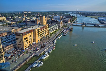
See Green Bay, Wisconsin on the map
Directions to Green Bay, Wisconsin with public transportation
The following transit lines have routes that pass near Green Bay, Wisconsin
 Bus:
Bus:
How to get to Green Bay, Wisconsin by bus?
Click on the bus route to see step by step directions with maps, line arrival times and updated time schedules.
Bus stations near Green Bay, Wisconsin
- Monroe & Walnut,2 min walk,
- Madison & Pine,3 min walk,
- Sw Corner Of Pine St & Madison St,4 min walk,
Bus lines to Green Bay, Wisconsin
- 1,East Mason,
- 16,Oneida Gaming-Ashwaubenon,
- 6,Outbound,
- 12,Inbound,
- 9,Outbound,
- 3,Mather,
- 4,Shawano,
What are the closest stations to Green Bay, Wisconsin?
The closest stations to Green Bay, Wisconsin are:
- Monroe & Walnut is 128 yards away, 2 min walk.
- Madison & Pine is 180 yards away, 3 min walk.
- Sw Corner Of Pine St & Madison St is 253 yards away, 4 min walk.
Which bus lines stop near Green Bay, Wisconsin?
These bus lines stop near Green Bay, Wisconsin: 15, 16, 6, 9.
What’s the nearest bus stop to Green Bay, Wisconsin?
The nearest bus stop to Green Bay, Wisconsin is Monroe & Walnut. It’s a 2 min walk away.
What time is the first bus to Green Bay, Wisconsin?
The 9 is the first bus that goes to Green Bay, Wisconsin. It stops nearby at 5:17 AM.
What time is the last bus to Green Bay, Wisconsin?
The 16 is the last bus that goes to Green Bay, Wisconsin. It stops nearby at 9:40 PM.
See Green Bay, Wisconsin on the map
Public Transportation to Green Bay, Wisconsin
Wondering how to get to Green Bay, Wisconsin, United States? Moovit helps you find the best way to get to Green Bay, Wisconsin with step-by-step directions from the nearest public transit station.
Moovit provides free maps and live directions to help you navigate through your city. View schedules, routes, timetables, and find out how long does it take to get to Green Bay, Wisconsin in real time.
Looking for the nearest stop or station to Green Bay, Wisconsin? Check out this list of stops closest to your destination: Monroe & Walnut; Madison & Pine; Sw Corner Of Pine St & Madison St.
Bus:
Want to see if there’s another route that gets you there at an earlier time? Moovit helps you find alternative routes or times. Get directions from and directions to Green Bay, Wisconsin easily from the Moovit App or Website.
We make riding to Green Bay, Wisconsin easy, which is why over 1.5 million users, including users in Green Bay, trust Moovit as the best app for public transit. You don’t need to download an individual bus app or train app, Moovit is your all-in-one transit app that helps you find the best bus time or train time available.
For information on prices of bus, costs and ride fares to Green Bay, Wisconsin, please check the Moovit app.
Use the app to navigate to popular places including to the airport, hospital, stadium, grocery store, mall, coffee shop, school, college, and university.
Green Bay, Wisconsin Address: Brown, WI street in Green Bay
Attractions near Green Bay, Wisconsin
Advanced Industrial Cleaning Solutions,League of Women Voters of Greater Green Bay,Rogue Games,Stealth Advise,The Micah Center,Community Pharmacy,John Dewey Academy of Learning,Brown County Library,Adl Monitoring Solutions, LLC,Ruesch Management,Brown County Central Library,Rise & Grind - A Community Space,Cultiva +,Cathedral Book & Gift,O'Neil Cannon Hollman Dejong,Wisconsin Insurance Services,United Personal Homecare,Building Inspctrs Association Nrthstrn,Parks, Rec & Forestry Events,Hennessy & Roach PCHow to get to popular attractions in Green Bay with public transit
Hampton Inn (Hampton by Hilton-Green Bay Downtown), Green Bay,1590 Smith St, Green Bay,Johnny Vapes, Bellevue,American Foods Group, Green Bay,Villa Hope CSP (Villa Hope Halfway House), Green Bay,The Fifth Level Of The Parking Ramp Oneida Casino, Ashwaubenon,Secsi, Green Bay,Sheridan Dr, Green Bay,St Vincent Hospital (St Mary's & St Vincent Home Health Care), Green Bay,1803 10th Ave, Green Bay,Lombardi Middle School, Green Bay,Menards Self Serve Propane Exchange, De Pere,Lice Clinics of America - de Pere (Lice Treatment Clinic in Green Bay Wi), De Pere,Hmong New Life AG (Hmong New Life Assembly of God), Green Bay,St John Paul II Classical School (Holy Family School), Green Bay,Overtime Bar & Grill (Last Drop Bar), Green Bay,St. Norbert College, De Pere,Honey Ct, De Pere,Five Star Handyman (5 Star Handyman,), Green Bay,Beach Road Liquor Store , Green BayGet around Green Bay by public transit!
Traveling around Green Bay has never been so easy. See step by step directions as you travel to any attraction, street or major public transit station. View bus and train schedules, arrival times, service alerts and detailed routes on a map, so you know exactly how to get to anywhere in Green Bay.
When traveling to any destination around Green Bay use Moovit's Live Directions with Get Off Notifications to know exactly where and how far to walk, how long to wait for your line, and how many stops are left. Moovit will alert you when it's time to get off — no need to constantly re-check whether yours is the next stop.
Wondering how to use public transit in Green Bay or how to pay for public transit in Green Bay? Moovit public transit app can help you navigate your way with public transit easily, and at minimum cost. It includes public transit fees, ticket prices, and costs. Looking for a map of Green Bay public transit lines? Moovit public transit app shows all public transit maps in Green Bay with all bus routes and stops on an interactive map.
Green Bay has 1 transit type(s), including: bus, operated by several transit agencies, including Green Bay Metro Transit, Coach Usa, Megabus, Greyhound-us, Indian Trails and Amtrak Chartered Vehicle