Directions to Green Tomatoe (Salem) with public transportation
The following transit lines have routes that pass near Green Tomatoe
 Bus: 455, 451.
- Train: NEWBURYPORT/ROCKPORT.
How to get to Green Tomatoe by bus?
Click on the bus route to see step by step directions with maps, line arrival times and updated time schedules.
How to get to Green Tomatoe by train?
Click on the train route to see step by step directions with maps, line arrival times and updated time schedules.
Bus stops near Green Tomatoe in Salem
Train station near Green Tomatoe in Salem
- Beverly, 23 min walk,VIEW
Bus lines to Green Tomatoe in Salem
What are the closest stations to Green Tomatoe?
The closest stations to Green Tomatoe are:
- Lafayette St @ Harbor St is 357 yards away, 5 min walk.
- Hawthorne Blvd @ Derby St is 549 yards away, 7 min walk.
- Beverly is 1896 yards away, 23 min walk.
Which bus line stops near Green Tomatoe?
455 (Salem Depot Via Central Square)
Which train line stops near Green Tomatoe?
NEWBURYPORT/ROCKPORT (#125 | Newburyport)
What’s the nearest train station to Green Tomatoe in Salem?
The nearest train station to Green Tomatoe in Salem is Beverly. It’s a 23 min walk away.
What’s the nearest bus station to Green Tomatoe in Salem?
The nearest bus station to Green Tomatoe in Salem is Lafayette St @ Harbor St. It’s a 5 min walk away.
What time is the first train to Green Tomatoe in Salem?
The NEWBURYPORT/ROCKPORT is the first train that goes to Green Tomatoe in Salem. It stops nearby at 5:16 AM.
What time is the last train to Green Tomatoe in Salem?
The NEWBURYPORT/ROCKPORT is the last train that goes to Green Tomatoe in Salem. It stops nearby at 12:31 AM.
What time is the first bus to Green Tomatoe in Salem?
The 455 is the first bus that goes to Green Tomatoe in Salem. It stops nearby at 5:02 AM.
What time is the last bus to Green Tomatoe in Salem?
The 455 is the last bus that goes to Green Tomatoe in Salem. It stops nearby at 1:07 AM.
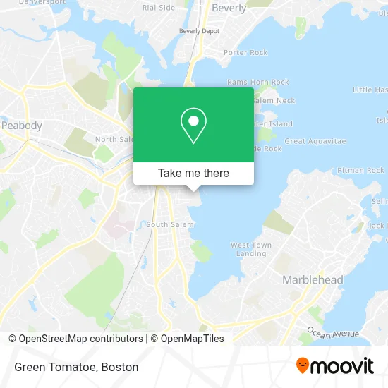
See Green Tomatoe, Salem, on the map
Public Transit to Green Tomatoe in Salem
Wondering how to get to Green Tomatoe in Salem? Moovit helps you find the best way to get to Green Tomatoe with step-by-step directions from the nearest public transit station.
Moovit provides free maps and live directions to help you navigate through your city. View schedules, routes, timetables, and find out how long does it take to get to Green Tomatoe in real time.
Looking for the nearest stop or station to Green Tomatoe? Check out this list of stops closest to your destination: Lafayette St @ Harbor St; Hawthorne Blvd @ Derby St; Beverly.
Bus: 455, 451.Train: NEWBURYPORT/ROCKPORT.
Want to see if there’s another route that gets you there at an earlier time? Moovit helps you find alternative routes or times. Get directions from and directions to Green Tomatoe easily from the Moovit App or Website.
We make riding to Green Tomatoe easy, which is why over 1.7 million users, including users in Salem, trust Moovit as the best app for public transit. You don’t need to download an individual bus app or train app, Moovit is your all-in-one transit app that helps you find the best bus time or train time available.
For information on prices of bus and train, costs and ride fares to Green Tomatoe, please check the Moovit app.
Use the app to navigate to popular places including to the airport, hospital, stadium, grocery store, mall, coffee shop, school, college, and university.
Green Tomatoe Address: 27 Congress St street in Salem
- Social Security Office (Social Services Department),
- Salem Water Taxi,
- Chris and Sons Painting & Carpentry,
- Picklepot,
- Pickering Wharf,
- Emd Floor Sanding,
- Valeries Outreach Centerchurch of God,
- 135 Lafayette Apartments,
- Daily Table,
- Dream Big Mural,
- Century Bank Branches,
- 9th Realm Gallery,
- David Fang DMD,
- Drug Rehab Salem,
- Urban Lifestyle,
- New York Fried Chicken,
- F. Robert Allison, Attorney at Law,
- Larry Leavitt Fitness and Self Defense,
- El Poblano Taqueria,
- Washington Street Café
Places Near Green Tomatoe (Salem)
- Mgm Music Hall, Boston,
- Quincy Market, Boston,
- Td Garden, Boston,
- Boston Common, Boston,
- House Of Blues, Boston,
- Wilbur Theatre, Boston,
- Isabella Stewart Gardner Museum, Boston,
- Leader Bank Pavilion (Leader Bank Pavillion), Boston,
- Boston Children's Hospital, Boston,
- Boston Medical Center, Boston,
- Wang Theater, Boston,
- Museum Of Science, Boston,
- Massachusetts General Hospital, Boston,
- Castle Island, Boston,
- Prudential Center, Boston,
- Cheers, Boston,
- Faneuil Hall, Boston,
- Seaport District, Boston,
- North End, Boston,
- Boston Convention & Exhibition Center, Boston
How to get to popular places in Boston with public transit
Get around Salem by public transit!
Traveling around Salem has never been so easy. See step by step directions as you travel to any attraction, street or major public transit station. View bus and train schedules, arrival times, service alerts and detailed routes on a map, so you know exactly how to get to anywhere in Salem.
When traveling to any destination around Salem use Moovit's Live Directions with Get Off Notifications to know exactly where and how far to walk, how long to wait for your line, and how many stops are left. Moovit will alert you when it's time to get off — no need to constantly re-check whether yours is the next stop.
Wondering how to use public transit in Salem or how to pay for public transit in Salem? Moovit public transit app can help you navigate your way with public transit easily, and at minimum cost. It includes public transit fees, ticket prices, and costs. Looking for a map of Salem public transit lines? Moovit public transit app shows all public transit maps in Salem with all Bus, Train, Subway and Ferry routes and stops on an interactive map.
Boston has 4 transit type(s), including: Bus, Train, Subway and Ferry, operated by several transit agencies, including MBTA, Southeastern Regional Transit Authority, MetroWest Regional Transit Authority, Rhode Island Public Transit Authority, WRTA, Lowell Regional Transit Authority, Merrimack Valley Transit, Montachusett Regional Transit Authority, Cape Cod Regional Transit Authority, Brockton Area Transit Authority, Martha's Vineyard Transit Authority, the WAVE - Nantucket Regional Transit Authority, GATRA, Cape Ann Transportation Authority and Massport