Directions to Greenhow, Inc (Newton) with public transportation
The following transit lines have routes that pass near Greenhow, Inc
 Bus: 505, 553, 554, 70, 558.
- Train: FITCHBURG, FRAMINGHAM/WORCESTER.
- Subway: GREEN LINE D.
How to get to Greenhow, Inc by bus?
Click on the bus route to see step by step directions with maps, line arrival times and updated time schedules.
From Brighton, Boston
47 minFrom New Balance, Boston
44 minFrom MIT Lincoln Laboratory, Lexington
170 minFrom Arsenal Mall, Watertown Town
58 minFrom Brighton District Court, Boston
39 minFrom Ac Hotel Cambridge, Cambridge
116 minFrom DoubleTree Suites by Hilton Hotel Boston - Cambridge, Boston
52 minFrom Raising Cane's, Boston
49 minFrom Regent Theatre, Arlington
93 minFrom Wachusett mountain, Boston
54 min
How to get to Greenhow, Inc by train?
Click on the train route to see step by step directions with maps, line arrival times and updated time schedules.
How to get to Greenhow, Inc by subway?
Click on the subway route to see step by step directions with maps, line arrival times and updated time schedules.
Bus stops near Greenhow, Inc in Newton
Train stations near Greenhow, Inc in Newton
Subway station near Greenhow, Inc in Newton
- Riverside, 32 min walk,VIEW
Bus lines to Greenhow, Inc in Newton
What are the closest stations to Greenhow, Inc?
The closest stations to Greenhow, Inc are:
- River St @ William St is 235 yards away, 3 min walk.
- Lexington St @ River St is 564 yards away, 7 min walk.
- Brandeis/Roberts is 2650 yards away, 32 min walk.
- Riverside is 2724 yards away, 32 min walk.
- West Newton is 4638 yards away, 55 min walk.
Which bus lines stop near Greenhow, Inc?
These bus lines stop near Greenhow, Inc: 505, 553, 554, 70.
Which train lines stop near Greenhow, Inc?
These train lines stop near Greenhow, Inc: FITCHBURG, FRAMINGHAM/WORCESTER.
Which subway line stops near Greenhow, Inc?
GREEN LINE D (Riverside)
What’s the nearest bus station to Greenhow, Inc in Newton?
The nearest bus station to Greenhow, Inc in Newton is River St @ William St. It’s a 3 min walk away.
What time is the first subway to Greenhow, Inc in Newton?
The GREEN LINE D is the first subway that goes to Greenhow, Inc in Newton. It stops nearby at 4:45 AM.
What time is the last subway to Greenhow, Inc in Newton?
The GREEN LINE D is the last subway that goes to Greenhow, Inc in Newton. It stops nearby at 2:48 AM.
What time is the first train to Greenhow, Inc in Newton?
The FRAMINGHAM/WORCESTER is the first train that goes to Greenhow, Inc in Newton. It stops nearby at 5:19 AM.
What time is the last train to Greenhow, Inc in Newton?
The FRAMINGHAM/WORCESTER is the last train that goes to Greenhow, Inc in Newton. It stops nearby at 12:22 AM.
What time is the first bus to Greenhow, Inc in Newton?
The 505 is the first bus that goes to Greenhow, Inc in Newton. It stops nearby at 5:59 AM.
What time is the last bus to Greenhow, Inc in Newton?
The 553 is the last bus that goes to Greenhow, Inc in Newton. It stops nearby at 8:58 PM.
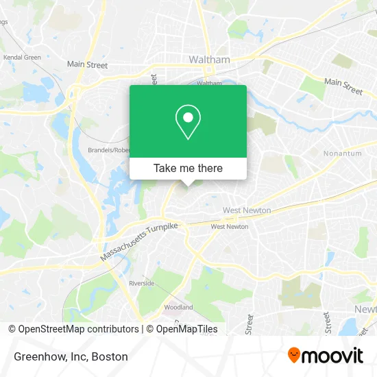
See Greenhow, Inc, Newton, on the map
Public Transit to Greenhow, Inc in Newton
Wondering how to get to Greenhow, Inc in Newton? Moovit helps you find the best way to get to Greenhow, Inc with step-by-step directions from the nearest public transit station.
Moovit provides free maps and live directions to help you navigate through your city. View schedules, routes, timetables, and find out how long does it take to get to Greenhow, Inc in real time.
Looking for the nearest stop or station to Greenhow, Inc? Check out this list of stops closest to your destination: River St @ William St; Lexington St @ River St; Brandeis/Roberts; Riverside; West Newton.
Bus: 505, 553, 554, 70, 558.Train: FITCHBURG, FRAMINGHAM/WORCESTER.Subway: GREEN LINE D.
Want to see if there’s another route that gets you there at an earlier time? Moovit helps you find alternative routes or times. Get directions from and directions to Greenhow, Inc easily from the Moovit App or Website.
We make riding to Greenhow, Inc easy, which is why over 1.7 million users, including users in Newton, trust Moovit as the best app for public transit. You don’t need to download an individual bus app or train app, Moovit is your all-in-one transit app that helps you find the best bus time or train time available.
For information on prices of bus, subway and train, costs and ride fares to Greenhow, Inc, please check the Moovit app.
Use the app to navigate to popular places including to the airport, hospital, stadium, grocery store, mall, coffee shop, school, college, and university.
Greenhow, Inc Address: 225 Riverview Ave Ste B3 street in Newton
- West Suburban YMCA,
- Burr Elementary School,
- Blast Fitness,
- Craig Blay Carpentry,
- Edward Jones - Financial Advisor: Timothy Braceland,
- Raquel's Daycare,
- Masterman's Move Better Fitness,
- Siemens AG,
- Norumbega Securities Services,
- FedEx,
- Piece by Piece Moving & Storage,
- Mystic Valley Traders,
- Windshield Camera Recalibration,
- West Newton,
- MBTA Bus Route 505,
- Care Solutions Personnel,
- Axerra Networks,
- Cabem Technologies,
- Competency Manager,
- West Newton MA USA
Places Near Greenhow, Inc (Newton)
- Isabella Stewart Gardner Museum, Boston,
- Cheers, Boston,
- Seaport District, Boston,
- House Of Blues, Boston,
- Boston Common, Boston,
- Wilbur Theatre, Boston,
- Leader Bank Pavilion (Leader Bank Pavillion), Boston,
- Faneuil Hall, Boston,
- Boston Medical Center, Boston,
- Quincy Market, Boston,
- Boston Children's Hospital, Boston,
- Massachusetts General Hospital, Boston,
- North End, Boston,
- Boston Convention & Exhibition Center, Boston,
- Museum Of Science, Boston,
- Mgm Music Hall, Boston,
- Wang Theater, Boston,
- Castle Island, Boston,
- Prudential Center, Boston,
- Td Garden, Boston
How to get to popular places in Boston with public transit
Get around Newton by public transit!
Traveling around Newton has never been so easy. See step by step directions as you travel to any attraction, street or major public transit station. View bus and train schedules, arrival times, service alerts and detailed routes on a map, so you know exactly how to get to anywhere in Newton.
When traveling to any destination around Newton use Moovit's Live Directions with Get Off Notifications to know exactly where and how far to walk, how long to wait for your line, and how many stops are left. Moovit will alert you when it's time to get off — no need to constantly re-check whether yours is the next stop.
Wondering how to use public transit in Newton or how to pay for public transit in Newton? Moovit public transit app can help you navigate your way with public transit easily, and at minimum cost. It includes public transit fees, ticket prices, and costs. Looking for a map of Newton public transit lines? Moovit public transit app shows all public transit maps in Newton with all Bus, Train, Subway and Ferry routes and stops on an interactive map.
Boston has 4 transit type(s), including: Bus, Train, Subway and Ferry, operated by several transit agencies, including MBTA, Southeastern Regional Transit Authority, MetroWest Regional Transit Authority, Rhode Island Public Transit Authority, WRTA, Lowell Regional Transit Authority, Merrimack Valley Transit, Montachusett Regional Transit Authority, Cape Cod Regional Transit Authority, Brockton Area Transit Authority, Martha's Vineyard Transit Authority, the WAVE - Nantucket Regional Transit Authority, GATRA, Cape Ann Transportation Authority and Massport