Directions to Greenmount Cemetery (Baltimore) with public transportation
The following transit lines have routes that pass near Greenmount Cemetery
How to get to Greenmount Cemetery by bus?
Click on the bus route to see step by step directions with maps, line arrival times and updated time schedules.
How to get to Greenmount Cemetery by metro?
Click on the metro route to see step by step directions with maps, line arrival times and updated time schedules.
Bus stations near Greenmount Cemetery in Baltimore
- Charles St & North Ave, 3 min walk,
- North Ave & Charles St Eb, 3 min walk,
- North Ave & Guilford Ave FS Eb, 5 min walk,
- Saint Paul St & North Ave FS Sb, 5 min walk,
- Charles St & Penn Station, 7 min walk,
- North Ave, 52 min walk,
Metro stations near Greenmount Cemetery in Baltimore
- State Center Metro, 13 min walk,
Train stations near Greenmount Cemetery in Baltimore
- Baltimore Penn Station, 16 min walk,
Light Rail stations near Greenmount Cemetery in Baltimore
- University Of Baltimore / Mt. Royal, 19 min walk,
Bus lines to Greenmount Cemetery in Baltimore
- CITYLINK GREEN, Downtown,
- CITYLINK SILVER, Hopkins University,
- 51, Towson Town Center,
- 95, Roland Park,
- 103, Cromwell Bridge Park & Ride,
- PURPLE ROUTE, 29th St. (Sb),
- CITYLINK GOLD, Canton Crossing,
- 53, State Center Metro,
- 71, Federal Hill,
- 702, Mount Vernon- Students Only,
- 85, North Ave Lr Station,
What are the closest stations to Greenmount Cemetery?
The closest stations to Greenmount Cemetery are:
- Charles St & North Ave is 212 yards away, 3 min walk.
- North Ave & Charles St Eb is 234 yards away, 3 min walk.
- North Ave & Guilford Ave FS Eb is 317 yards away, 5 min walk.
- Saint Paul St & North Ave FS Sb is 343 yards away, 5 min walk.
- Charles St & Penn Station is 551 yards away, 7 min walk.
- State Center Metro is 1039 yards away, 13 min walk.
- Baltimore Penn Station is 1317 yards away, 16 min walk.
- University Of Baltimore / Mt. Royal is 1568 yards away, 19 min walk.
- North Ave is 4361 yards away, 52 min walk.
Which bus lines stop near Greenmount Cemetery?
These bus lines stop near Greenmount Cemetery: 51, CITYLINK GOLD, CITYLINK GREEN, CITYLINK RED, CITYLINK SILVER, CITYLINK YELLOW.
Which metro line stops near Greenmount Cemetery?
METRO
Which light rail line stops near Greenmount Cemetery?
LIGHT RAIL
What’s the nearest light rail station to Greenmount Cemetery in Baltimore?
The nearest light rail station to Greenmount Cemetery in Baltimore is University Of Baltimore / Mt. Royal. It’s a 19 min walk away.
What’s the nearest metro station to Greenmount Cemetery in Baltimore?
The nearest metro station to Greenmount Cemetery in Baltimore is State Center Metro. It’s a 13 min walk away.
What’s the nearest train station to Greenmount Cemetery in Baltimore?
The nearest train station to Greenmount Cemetery in Baltimore is Baltimore Penn Station. It’s a 16 min walk away.
What’s the nearest bus stop to Greenmount Cemetery in Baltimore?
The nearest bus stops to Greenmount Cemetery in Baltimore are Charles St & North Ave and North Ave & Charles St Eb. The closest one is a 3 min walk away.
What time is the first light rail to Greenmount Cemetery in Baltimore?
The LIGHT RAIL is the first light rail that goes to Greenmount Cemetery in Baltimore. It stops nearby at 3:42 AM.
What time is the last light rail to Greenmount Cemetery in Baltimore?
The LIGHT RAIL is the last light rail that goes to Greenmount Cemetery in Baltimore. It stops nearby at 1:30 AM.
What time is the first metro to Greenmount Cemetery in Baltimore?
The METRO is the first metro that goes to Greenmount Cemetery in Baltimore. It stops nearby at 5:07 AM.
What time is the last metro to Greenmount Cemetery in Baltimore?
The METRO is the last metro that goes to Greenmount Cemetery in Baltimore. It stops nearby at 12:22 AM.
What time is the first train to Greenmount Cemetery in Baltimore?
The NORTHEAST REGIONAL is the first train that goes to Greenmount Cemetery in Baltimore. It stops nearby at 3:10 AM.
What time is the last train to Greenmount Cemetery in Baltimore?
The NORTHEAST REGIONAL is the last train that goes to Greenmount Cemetery in Baltimore. It stops nearby at 12:58 AM.
What time is the first bus to Greenmount Cemetery in Baltimore?
The CITYLINK GOLD is the first bus that goes to Greenmount Cemetery in Baltimore. It stops nearby at 3:18 AM.
What time is the last bus to Greenmount Cemetery in Baltimore?
The CITYLINK SILVER is the last bus that goes to Greenmount Cemetery in Baltimore. It stops nearby at 3:11 AM.
How much is the metro fare to Greenmount Cemetery?
The metro fare to Greenmount Cemetery costs about $2.00.
How much is the bus fare to Greenmount Cemetery?
The bus fare to Greenmount Cemetery costs about $2.00.
How much is the light rail fare to Greenmount Cemetery?
The light rail fare to Greenmount Cemetery costs about $2.00.
See Greenmount Cemetery, Baltimore, on the map
Public Transit to Greenmount Cemetery in Baltimore
Wondering how to get to Greenmount Cemetery in Baltimore, United States? Moovit helps you find the best way to get to Greenmount Cemetery with step-by-step directions from the nearest public transit station.
Moovit provides free maps and live directions to help you navigate through your city. View schedules, routes, timetables, and find out how long does it take to get to Greenmount Cemetery in real time.
Looking for the nearest stop or station to Greenmount Cemetery? Check out this list of stops closest to your destination: Charles St & North Ave; North Ave & Charles St Eb; North Ave & Guilford Ave FS Eb; Saint Paul St & North Ave FS Sb; Charles St & Penn Station; State Center Metro; Baltimore Penn Station; University Of Baltimore / Mt. Royal; North Ave.
Bus: 51, CITYLINK GOLD, CITYLINK GREEN, CITYLINK RED, CITYLINK SILVER, CITYLINK YELLOW, 95, 103, 53, 71.Train: MARC, ACELA, CARDINAL, CAROLINIAN, CRESCENT.Metro: METRO.Light Rail: LIGHT RAIL.
Want to see if there’s another route that gets you there at an earlier time? Moovit helps you find alternative routes or times. Get directions from and directions to Greenmount Cemetery easily from the Moovit App or Website.
We make riding to Greenmount Cemetery easy, which is why over 1.5 million users, including users in Baltimore, trust Moovit as the best app for public transit. You don’t need to download an individual bus app or train app, Moovit is your all-in-one transit app that helps you find the best bus time or train time available.
For information on prices of bus, metro and light rail, costs and ride fares to Greenmount Cemetery, please check the Moovit app.
Use the app to navigate to popular places including to the airport, hospital, stadium, grocery store, mall, coffee shop, school, college, and university.
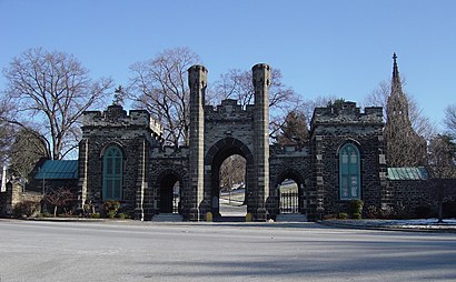
Greenmount Cemetery Address: 205 E Lafayette Ave Baltimore, MD 21202 street in Baltimore
Attractions near Greenmount Cemetery
Indie Soul Magazine,Trippe Supply Co.,Brian Dawkins,Guilford Ave Building 1800,N Calvert St Building 1827,Saint Paul St Building 1717,Tye's Organic Hair Design,St Paul St Building 1804,N Calvert St Building 1617,Astoria Charm,Classroomparent,Inheritance at BMPCS,E Lafayette Ave Building 317,Bmore Bunks,North Ave and N Calvert St,Arts District Parking,Guilford Hall Brewery,Guilford Hall Brewery,The Law Offices of Nicholas J. del Pizzo, III P.A.,Amtrack ParkingHow to get to popular attractions in Baltimore with public transit
Parkdale High School, Prince George's County,Howard University, Washington,Park Potomac Place, Montgomery County,1301 Pennsylvania Ave, Washington,Edmondson High School, Baltimore,St. Casimir Catholic Church, Baltimore,The Celtic House Irish Pub & Restaurant, Arlington County,Cherry Hill, Baltimore,Fannie Mae, Fairfax County,Argyle Middle School, Montgomery County,Homewood Suites by Hilton Baltimore-BWI Airport, Anne Arundel County,Liberty Crossing, Fairfax County,Hillendale Shopping Center, Baltimore County,Exit 69 - US 29 (Lee Hwy) / SR 237 (Washington Blvd) / Sycamore St, Arlington County,Broken Land Park & Ride, Howard County,Hybla Valley, Fairfax County,U.S. 301 Park and Ride, Charles County,Lee Jackson Hwy & Centreville Rd, Fairfax County,I-695 @ Exit 26 (York Rd / MD 45), Baltimore County,El Camino, WashingtonGet around Washington, D.C. - Baltimore, MD by public transit!
Traveling around Washington, D.C. - Baltimore, MD has never been so easy. See step by step directions as you travel to any attraction, street or major public transit station. View bus and train schedules, arrival times, service alerts and detailed routes on a map, so you know exactly how to get to anywhere in Washington, D.C. - Baltimore, MD.
When traveling to any destination around Washington, D.C. - Baltimore, MD use Moovit's Live Directions with Get Off Notifications to know exactly where and how far to walk, how long to wait for your line, and how many stops are left. Moovit will alert you when it's time to get off — no need to constantly re-check whether yours is the next stop.
Wondering how to use public transit in Washington, D.C. - Baltimore, MD or how to pay for public transit in Washington, D.C. - Baltimore, MD? Moovit public transit app can help you navigate your way with public transit easily, and at minimum cost. It includes public transit fees, ticket prices, and costs. Looking for a map of Washington, D.C. - Baltimore, MD public transit lines? Moovit public transit app shows all public transit maps in Washington, D.C. - Baltimore, MD with all Bus, Train, Metro, Light Rail and Ferry routes and stops on an interactive map.
Washington, D.C. - Baltimore, MD has 5 transit type(s), including: Bus, Train, Metro, Light Rail and Ferry, operated by several transit agencies, including WMATA, Montgomery County Ride On, Montgomery County MD Ride On, Fairfax Connector, TheBus, PRTC, DC Circulator, DASH - Alexandria, Arlington Transit (ART), DC Streetcar, RTA of Central Maryland, FRED, MDOT MTA, Marc, Virginia Railway Express (VRE)