How to get to Gregorys Graphics by bus?
Click on the bus route to see step by step directions with maps, line arrival times and updated time schedules.
From Central Terminal, Fort Lauderdale
44 minFrom Mount Sinai Medical Center, Miami
79 minFrom Tidal Cove Water Park, Miami
81 minFrom State Road 7 & West Sunrise Boulevard, Plantation
60 minFrom I-95, Fort Lauderdale
98 minFrom Antique Trade Center, Hollywood
41 minFrom Embassy Suites-Fort Lauderdale (Embassy Suites by Hilton Fort Lauderdale 17th Street), Fort Lauderdale
54 minFrom Broward General Hospital, Fort Lauderdale
50 minFrom Aventura Mall, Miami
77 minFrom Broward County, Fort Lauderdale
47 min
How to get to Gregorys Graphics by train?
Click on the train route to see step by step directions with maps, line arrival times and updated time schedules.
Bus stops near Gregorys Graphics in Hollywood
Train station near Gregorys Graphics in Hollywood
- Fort Lauderdale Airport Station, 19 min walk,VIEW
Bus lines to Gregorys Graphics in Hollywood
What are the closest stations to Gregorys Graphics?
The closest stations to Gregorys Graphics are:
- Stirling Road/Northwest 29th Avenue is 370 yards away, 5 min walk.
- North 29th Avenue/Stirling Road is 549 yards away, 7 min walk.
- Fort Lauderdale Airport Station is 1563 yards away, 19 min walk.
Which bus lines stop near Gregorys Graphics?
These bus lines stop near Gregorys Graphics: 12, 16.
Which train line stops near Gregorys Graphics?
TRIRAIL (Northbound To Mangonia Park)
What’s the nearest train station to Gregorys Graphics in Hollywood?
The nearest train station to Gregorys Graphics in Hollywood is Fort Lauderdale Airport Station. It’s a 19 min walk away.
What’s the nearest bus station to Gregorys Graphics in Hollywood?
The nearest bus station to Gregorys Graphics in Hollywood is Stirling Road/Northwest 29th Avenue. It’s a 5 min walk away.
What time is the first train to Gregorys Graphics in Hollywood?
The TRIRAIL is the first train that goes to Gregorys Graphics in Hollywood. It stops nearby at 4:20 AM.
What time is the last train to Gregorys Graphics in Hollywood?
The TRIRAIL is the last train that goes to Gregorys Graphics in Hollywood. It stops nearby at 10:29 PM.
What time is the first bus to Gregorys Graphics in Hollywood?
The 12 is the first bus that goes to Gregorys Graphics in Hollywood. It stops nearby at 5:31 AM.
What time is the last bus to Gregorys Graphics in Hollywood?
The 06 is the last bus that goes to Gregorys Graphics in Hollywood. It stops nearby at 11:59 PM.
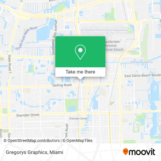
See Gregorys Graphics, Hollywood, on the map
Public Transit to Gregorys Graphics in Hollywood
Wondering how to get to Gregorys Graphics in Hollywood? Moovit helps you find the best way to get to Gregorys Graphics with step-by-step directions from the nearest public transit station.
Moovit provides free maps and live directions to help you navigate through your city. View schedules, routes, timetables, and find out how long does it take to get to Gregorys Graphics in real time.
Looking for the nearest stop or station to Gregorys Graphics? Check out this list of stops closest to your destination: Stirling Road/Northwest 29th Avenue; North 29th Avenue/Stirling Road; Fort Lauderdale Airport Station.
Bus: 12, 16, 06.Train: TRIRAIL.
Want to see if there’s another route that gets you there at an earlier time? Moovit helps you find alternative routes or times. Get directions from and directions to Gregorys Graphics easily from the Moovit App or Website.
We make riding to Gregorys Graphics easy, which is why over 1.5 million users, including users in Hollywood, trust Moovit as the best app for public transit. You don’t need to download an individual bus app or train app, Moovit is your all-in-one transit app that helps you find the best bus time or train time available.
For information on prices of bus and train, costs and ride fares to Gregorys Graphics, please check the Moovit app.
Use the app to navigate to popular places including to the airport, hospital, stadium, grocery store, mall, coffee shop, school, college, and university.
Gregorys Graphics Address: 2070 Tigertail Blvd Dania Beach, FL 33004 street in Hollywood
- Broward Machine,
- Custom Autoworks Inc,
- Xpedient Auto Services,
- Telephone Man,
- Hansell Tire Company,
- Must Air,
- Cambria Suites,
- EC Tire Services,
- A Speedy Towing Service,
- Basic Restoration Figure Lt,
- Cilia Beauty,
- Glamour Chateau,
- Florida Mattress Discount,
- Portissimo Art & Custom Frame Gallery,
- Haute Cribs,
- SMK Realty & Investments LLC,
- South Florida Appliance,
- Centennial Bank,
- Home2 Suites by Hilton Ft. Lauderdale Airport-Cruise Port,
- Home2 Suites-Fort Lauderdale
Places Near Gregorys Graphics (Hollywood)
- Little Havana, Miami,
- Wynwood, Miami,
- Brickell City Centre, Miami,
- Aventura Mall, Miami Beach,
- Sawgrass mall ( FL ), Miami Beach,
- Miami-Dade County Courthouse, Miami,
- Keiser University Flagship Campus, West Palm Beach,
- Zoo Miami, Miami,
- Miami Design District, Miami,
- Richard E. Gerstein Justice Building, Miami,
- Port of Miami Cruise Terminal, Miami,
- Bayside Marketplace, Miami,
- Marlins Park, Miami,
- Aventura Mall, Miami,
- Miami Freedom Park, Miami,
- Sawgrass Mall, Miami,
- Dolphin Mall, Miami,
- Dolphin Mall Bus, Miami,
- Hard Rock Stadium, Miami Gardens,
- Miami VA Hospital, Miami
How to get to popular places in Miami with public transit
Get around Hollywood by public transit!
Traveling around Hollywood has never been so easy. See step by step directions as you travel to any attraction, street or major public transit station. View bus and train schedules, arrival times, service alerts and detailed routes on a map, so you know exactly how to get to anywhere in Hollywood.
When traveling to any destination around Hollywood use Moovit's Live Directions with Get Off Notifications to know exactly where and how far to walk, how long to wait for your line, and how many stops are left. Moovit will alert you when it's time to get off — no need to constantly re-check whether yours is the next stop.
Wondering how to use public transit in Hollywood or how to pay for public transit in Hollywood? Moovit public transit app can help you navigate your way with public transit easily, and at minimum cost. It includes public transit fees, ticket prices, and costs. Looking for a map of Hollywood public transit lines? Moovit public transit app shows all public transit maps in Hollywood with all Bus, Train, Light Rail and Ferry routes and stops on an interactive map.
Miami has 4 transit type(s), including: Bus, Train, Light Rail and Ferry, operated by several transit agencies, including Broward County Transit, Miami-Dade Transit, Metrorail, Palm Tran, Tri-Rail, Brightline, MARTY, City of Homestead Trolley, Key West Transit, Treasure Coast Connector, GoLine IRT, Amtrak, Greyhound-us, FlixBus-us and Aventura Express Shuttle Bus