Directions to Greyhound: Bus Stop - Peter Pan Bus Line (Boston) with public transportation
The following transit lines have routes that pass near Greyhound: Bus Stop - Peter Pan Bus Line
 Bus: 31, B48, G73E, GREYHOUND US0255S, R42.
- Train: VERMONTER, VALLEY FLYER.
How to get to Greyhound: Bus Stop - Peter Pan Bus Line by bus?
Click on the bus route to see step by step directions with maps, line arrival times and updated time schedules.
From Registry Of Motor Vehicles (Rmv) Branch Office, Worcester
127 minFrom South High Community School, Worcester
220 minFrom Palladium, Worcester
128 minFrom Foxwoods, Worcester
153 minFrom Worcester, MA, Worcester
123 minFrom Gardner, MA, Gardner
187 minFrom Polar Park, Worcester
125 minFrom Dcu Center, Worcester
125 min
How to get to Greyhound: Bus Stop - Peter Pan Bus Line by train?
Click on the train route to see step by step directions with maps, line arrival times and updated time schedules.
Bus stops near Greyhound: Bus Stop - Peter Pan Bus Line in Boston
Train station near Greyhound: Bus Stop - Peter Pan Bus Line in Boston
- Northampton, 35 min walk,VIEW
Bus lines to Greyhound: Bus Stop - Peter Pan Bus Line in Boston
- R42, Northampton,VIEW
- R44, Williamsburg Via Va Hospital,VIEW
- B48, Holyoke Trans. Ctr. Via Rt. 5,VIEW
- G47, Northampton Via Westfield,VIEW
- G73E, Northampton Via Holyoke Mall,VIEW
- NE, Northampton,VIEW
- R41, Northampton Via Easthampton,VIEW
- GREYHOUND US0255S, New York Port Authority,VIEW
- 904, Pittsfield Itc,VIEW
- B43, Northampton,VIEW
- 31, Jwo Transit Center,VIEW
What are the closest stations to Greyhound: Bus Stop - Peter Pan Bus Line?
The closest stations to Greyhound: Bus Stop - Peter Pan Bus Line are:
- Crafts Avenue / Peter Pan is 102 yards away, 2 min walk.
- Old South / Conz (Mcdonald House) is 231 yards away, 3 min walk.
- Northampton (Northampton Market) is 256 yards away, 4 min walk.
- Northampton Court House is 328 yards away, 5 min walk.
- State St And Bedford Terrace (S) is 881 yards away, 11 min walk.
- Northampton is 2959 yards away, 35 min walk.
Which bus lines stop near Greyhound: Bus Stop - Peter Pan Bus Line?
These bus lines stop near Greyhound: Bus Stop - Peter Pan Bus Line: 31, B48, G73E, GREYHOUND US0255S.
Which train line stops near Greyhound: Bus Stop - Peter Pan Bus Line?
VERMONTER (St Albans)
What’s the nearest bus station to Greyhound: Bus Stop - Peter Pan Bus Line in Boston?
The nearest bus station to Greyhound: Bus Stop - Peter Pan Bus Line in Boston is Crafts Avenue / Peter Pan. It’s a 2 min walk away.
What time is the first train to Greyhound: Bus Stop - Peter Pan Bus Line in Boston?
The VALLEY FLYER is the first train that goes to Greyhound: Bus Stop - Peter Pan Bus Line in Boston. It stops nearby at 6:30 AM.
What time is the last train to Greyhound: Bus Stop - Peter Pan Bus Line in Boston?
The VALLEY FLYER is the last train that goes to Greyhound: Bus Stop - Peter Pan Bus Line in Boston. It stops nearby at 10:07 PM.
What time is the first bus to Greyhound: Bus Stop - Peter Pan Bus Line in Boston?
The R44 is the first bus that goes to Greyhound: Bus Stop - Peter Pan Bus Line in Boston. It stops nearby at 5:42 AM.
What time is the last bus to Greyhound: Bus Stop - Peter Pan Bus Line in Boston?
The B43 is the last bus that goes to Greyhound: Bus Stop - Peter Pan Bus Line in Boston. It stops nearby at 11:56 PM.
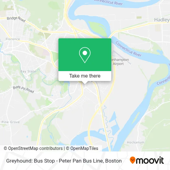
See Greyhound: Bus Stop - Peter Pan Bus Line, Boston, on the map
Public Transit to Greyhound: Bus Stop - Peter Pan Bus Line in Boston
Wondering how to get to Greyhound: Bus Stop - Peter Pan Bus Line in Boston? Moovit helps you find the best way to get to Greyhound: Bus Stop - Peter Pan Bus Line with step-by-step directions from the nearest public transit station.
Moovit provides free maps and live directions to help you navigate through your city. View schedules, routes, timetables, and find out how long does it take to get to Greyhound: Bus Stop - Peter Pan Bus Line in real time.
Looking for the nearest stop or station to Greyhound: Bus Stop - Peter Pan Bus Line? Check out this list of stops closest to your destination: Crafts Avenue / Peter Pan; Old South / Conz (Mcdonald House); Northampton (Northampton Market); Northampton Court House; State St And Bedford Terrace (S); Northampton.
Bus: 31, B48, G73E, GREYHOUND US0255S, R42, R44, G47, NE, R41, 904, B43.Train: VERMONTER, VALLEY FLYER.
Want to see if there’s another route that gets you there at an earlier time? Moovit helps you find alternative routes or times. Get directions from and directions to Greyhound: Bus Stop - Peter Pan Bus Line easily from the Moovit App or Website.
We make riding to Greyhound: Bus Stop - Peter Pan Bus Line easy, which is why over 1.7 million users, including users in Boston, trust Moovit as the best app for public transit. You don’t need to download an individual bus app or train app, Moovit is your all-in-one transit app that helps you find the best bus time or train time available.
For information on prices of bus and train, costs and ride fares to Greyhound: Bus Stop - Peter Pan Bus Line, please check the Moovit app.
Use the app to navigate to popular places including to the airport, hospital, stadium, grocery store, mall, coffee shop, school, college, and university.
Greyhound: Bus Stop - Peter Pan Bus Line Address: 1 Roundhouse Plz street in Boston
- Commonwealth of Massachusetts Mental Retardation Dept,
- Ichiban Japanese Restaurant,
- Rebecca Schachter,
- Peg Cowen Licsw,
- Al Griggs,
- Kayla Solomon,
- Halo Bike Couriers,
- Damn Good Haircuts,
- The Office,
- Northampton Ma Personal Injury Lawyer Martha's Vineyard Personal Injury Attorney,
- Seewald Alan Attorney,
- Vermont TRANSIT Lines,
- Peter Pan,
- LS Bottle-O,
- Municipal Office,
- Mis Dept,
- City of Northampton Building Commissioner,
- Allan Hankowski Cpa,
- Hankowski Alan PC CPA,
- Clean Slate
Places Near Greyhound: Bus Stop - Peter Pan Bus Line (Boston)
- Wang Theater, Boston,
- Massachusetts General Hospital, Boston,
- Cheers, Boston,
- Td Garden, Boston,
- Boston Medical Center, Boston,
- Quincy Market, Boston,
- North End, Boston,
- Seaport District, Boston,
- Faneuil Hall, Boston,
- Isabella Stewart Gardner Museum, Boston,
- Boston Convention & Exhibition Center, Boston,
- Museum Of Science, Boston,
- Boston Common, Boston,
- Leader Bank Pavilion (Leader Bank Pavillion), Boston,
- Wilbur Theatre, Boston,
- Mgm Music Hall, Boston,
- Prudential Center, Boston,
- Castle Island, Boston,
- House Of Blues, Boston,
- Boston Children's Hospital, Boston
How to get to popular places in Boston with public transit
Get around Boston by public transit!
Traveling around Boston has never been so easy. See step by step directions as you travel to any attraction, street or major public transit station. View bus and train schedules, arrival times, service alerts and detailed routes on a map, so you know exactly how to get to anywhere in Boston.
When traveling to any destination around Boston use Moovit's Live Directions with Get Off Notifications to know exactly where and how far to walk, how long to wait for your line, and how many stops are left. Moovit will alert you when it's time to get off — no need to constantly re-check whether yours is the next stop.
Wondering how to use public transit in Boston or how to pay for public transit in Boston? Moovit public transit app can help you navigate your way with public transit easily, and at minimum cost. It includes public transit fees, ticket prices, and costs. Looking for a map of Boston public transit lines? Moovit public transit app shows all public transit maps in Boston with all Bus, Train, Subway and Ferry routes and stops on an interactive map.
Boston has 4 transit type(s), including: Bus, Train, Subway and Ferry, operated by several transit agencies, including MBTA, Southeastern Regional Transit Authority, MetroWest Regional Transit Authority, Rhode Island Public Transit Authority, WRTA, Lowell Regional Transit Authority, Merrimack Valley Transit, Montachusett Regional Transit Authority, Cape Cod Regional Transit Authority, Brockton Area Transit Authority, Martha's Vineyard Transit Authority, the WAVE - Nantucket Regional Transit Authority, GATRA, Cape Ann Transportation Authority and Massport