See Griggs Street, Boston, on the map
Directions to Griggs Street (Boston) with public transportation
The following transit lines have routes that pass near Griggs Street
 Bus:
Bus: - Train:
- Subway:
How to get to Griggs Street by bus?
Click on the bus route to see step by step directions with maps, line arrival times and updated time schedules.
How to get to Griggs Street by train?
Click on the train route to see step by step directions with maps, line arrival times and updated time schedules.
How to get to Griggs Street by subway?
Click on the subway route to see step by step directions with maps, line arrival times and updated time schedules.
Subway stations near Griggs Street in Boston
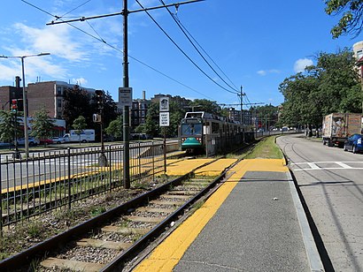
- Griggs Street,1 min walk,
Bus stations near Griggs Street in Boston
- Harvard Ave @ Commonwealth Ave,5 min walk,
- Brighton Ave @ Allston St,8 min walk,
- Cambridge St @ Barrows St,11 min walk,
- N Beacon St @ Cambridge St,11 min walk,
Bus lines to Griggs Street in Boston
- 66,Harvard Via Allston,
- 57,Haymarket Via Kenmore,
- 501,Downtown Via Cambridge St And Copley (Express),
- 64,Kendall/MIT,
What are the closest stations to Griggs Street?
The closest stations to Griggs Street are:
- Griggs Street is 14 yards away, 1 min walk.
- Harvard Ave @ Commonwealth Ave is 386 yards away, 5 min walk.
- Brighton Ave @ Allston St is 653 yards away, 8 min walk.
- Cambridge St @ Barrows St is 855 yards away, 11 min walk.
- N Beacon St @ Cambridge St is 918 yards away, 11 min walk.
Which bus lines stop near Griggs Street?
These bus lines stop near Griggs Street: 501, 57, 66.
Which train line stops near Griggs Street?
FRAMINGHAM/WORCESTER
Which subway line stops near Griggs Street?
GREEN LINE B
What’s the nearest subway station to Griggs Street in Boston?
The nearest subway station to Griggs Street in Boston is Griggs Street. It’s a 1 min walk away.
What’s the nearest bus stop to Griggs Street in Boston?
The nearest bus stop to Griggs Street in Boston is Harvard Ave @ Commonwealth Ave. It’s a 5 min walk away.
What time is the first subway to Griggs Street in Boston?
The GREEN LINE B is the first subway that goes to Griggs Street in Boston. It stops nearby at 4:54 AM.
What time is the last subway to Griggs Street in Boston?
The GREEN LINE B is the last subway that goes to Griggs Street in Boston. It stops nearby at 1:21 AM.
What time is the first bus to Griggs Street in Boston?
The 57 is the first bus that goes to Griggs Street in Boston. It stops nearby at 4:41 AM.
What time is the last bus to Griggs Street in Boston?
The 66 is the last bus that goes to Griggs Street in Boston. It stops nearby at 1:28 AM.
How much is the train fare to Griggs Street?
The train fare to Griggs Street costs about $2.40 - $13.25.
How much is the bus fare to Griggs Street?
The bus fare to Griggs Street costs about $1.70.
How much is the subway fare to Griggs Street?
The subway fare to Griggs Street costs about $2.40.
See Griggs Street, Boston, on the map
Public Transit to Griggs Street in Boston
Wondering how to get to Griggs Street in Boston, United States? Moovit helps you find the best way to get to Griggs Street with step-by-step directions from the nearest public transit station.
Moovit provides free maps and live directions to help you navigate through your city. View schedules, routes, timetables, and find out how long does it take to get to Griggs Street in real time.
Looking for the nearest stop or station to Griggs Street? Check out this list of stops closest to your destination: Griggs Street; Harvard Ave @ Commonwealth Ave; Brighton Ave @ Allston St; Cambridge St @ Barrows St; N Beacon St @ Cambridge St.
Bus:Train:Subway:
Want to see if there’s another route that gets you there at an earlier time? Moovit helps you find alternative routes or times. Get directions from and directions to Griggs Street easily from the Moovit App or Website.
We make riding to Griggs Street easy, which is why over 1.5 million users, including users in Boston, trust Moovit as the best app for public transit. You don’t need to download an individual bus app or train app, Moovit is your all-in-one transit app that helps you find the best bus time or train time available.
For information on prices of bus, subway and train, costs and ride fares to Griggs Street, please check the Moovit app.
Use the app to navigate to popular places including to the airport, hospital, stadium, grocery store, mall, coffee shop, school, college, and university.
Griggs Street Address: Commonwealth Avenue street in Boston
Attractions near Griggs Street
MBTA-Griggs St & Long Ave,Exclusive Maids,Title City Barbers,USPS Collection Box - Blue Box,Lovin Spoonfuls,Julia's Tailors and Cleaners,Common Glen Apartments,Ultra Safe Pest Management,Atm,All Access Boston,Main Content,Point of Vue Photography,5mg Price Rd,Fineberg Management,Proper Homes Boston with Matt,Proper Realty (Proper Homes Boston with Matt),Thanh's Real Estate,Propper Realty Group,Hopewell Family,Casa EmpireHow to get to popular attractions in Boston with public transit
Cranston, RI,I-95,Massachusetts, Medford,Cityside Restaurant & Bar, Boston,DCU Center Arena & Convention Center, Worcester,California Pizza Kitchen, Boston,The Capital Grille, Boston,FiRE + iCE Boston, Boston,Lincoln Tavern & Restaurant, Boston,Bell In Hand Tavern, Boston,Dave & Buster's,Picco, Boston,J.P. Licks Jamaica Plain, Boston,Cafeteria Boston, Boston,Charlie's Kitchen, Cambridge,Boston Medical Center, Boston,Modern Pastry Shop, Boston,Everett, Everett,Hopkinton, MA, Hopkinton,La Famiglia Giorgio's, BostonGet around Boston by public transit!
Traveling around Boston has never been so easy. See step by step directions as you travel to any attraction, street or major public transit station. View bus and train schedules, arrival times, service alerts and detailed routes on a map, so you know exactly how to get to anywhere in Boston.
When traveling to any destination around Boston use Moovit's Live Directions with Get Off Notifications to know exactly where and how far to walk, how long to wait for your line, and how many stops are left. Moovit will alert you when it's time to get off — no need to constantly re-check whether yours is the next stop.
Wondering how to use public transit in Boston or how to pay for public transit in Boston? Moovit public transit app can help you navigate your way with public transit easily, and at minimum cost. It includes public transit fees, ticket prices, and costs. Looking for a map of Boston public transit lines? Moovit public transit app shows all public transit maps in Boston with all bus, subway or train routes and stops on an interactive map.
Boston has 3 transit type(s), including: bus, subway or train, operated by several transit agencies, including MBTA, MBTA, MBTA, Southeastern Regional Transit Authority, MetroWest Regional Transit Authority, Rhode Island Public Transit Authority, WRTA, Lowell Regional Transit Authority, Merrimack Valley Transit, Montachusett Regional Transit Authority, Cape Cod Regional Transit Authority, Brockton Area Transit Authority, Cape Cod Regional Transit Authority, Martha's Vineyard Transit Authority and the WAVE - Nantucket Regional Transit Authority