Directions to Grow Christian Learning Center (Worcester) with public transportation
The following transit lines have routes that pass near Grow Christian Learning Center
 Bus: 19, 6, GREYHOUND US0230, 7, 27.
- Train: FRAMINGHAM/WORCESTER.
How to get to Grow Christian Learning Center by bus?
Click on the bus route to see step by step directions with maps, line arrival times and updated time schedules.
Bus stops near Grow Christian Learning Center in Worcester
Bus lines to Grow Christian Learning Center in Worcester
What are the closest stations to Grow Christian Learning Center?
The closest stations to Grow Christian Learning Center are:
- Queen St at Chandler is 197 yards away, 3 min walk.
- Chandler St at Piedmont is 306 yards away, 4 min walk.
- Main St + Hammond St is 313 yards away, 4 min walk.
Which bus lines stop near Grow Christian Learning Center?
These bus lines stop near Grow Christian Learning Center: 19, 6, GREYHOUND US0230.
Which train line stops near Grow Christian Learning Center?
FRAMINGHAM/WORCESTER (#525 | Worcester)
What’s the nearest bus station to Grow Christian Learning Center in Worcester?
The nearest bus station to Grow Christian Learning Center in Worcester is Queen St at Chandler. It’s a 3 min walk away.
What time is the first bus to Grow Christian Learning Center in Worcester?
The 27 is the first bus that goes to Grow Christian Learning Center in Worcester. It stops nearby at 5:13 AM.
What time is the last bus to Grow Christian Learning Center in Worcester?
The 19 is the last bus that goes to Grow Christian Learning Center in Worcester. It stops nearby at 10:47 PM.
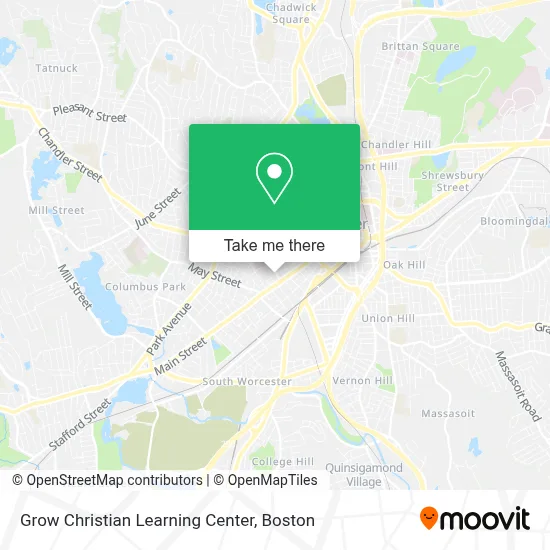
See Grow Christian Learning Center, Worcester, on the map
Public Transit to Grow Christian Learning Center in Worcester
Wondering how to get to Grow Christian Learning Center in Worcester? Moovit helps you find the best way to get to Grow Christian Learning Center with step-by-step directions from the nearest public transit station.
Moovit provides free maps and live directions to help you navigate through your city. View schedules, routes, timetables, and find out how long does it take to get to Grow Christian Learning Center in real time.
Looking for the nearest stop or station to Grow Christian Learning Center? Check out this list of stops closest to your destination: Queen St at Chandler; Chandler St at Piedmont; Main St + Hammond St.
Bus: 19, 6, GREYHOUND US0230, 7, 27, 33.Train: FRAMINGHAM/WORCESTER.
Want to see if there’s another route that gets you there at an earlier time? Moovit helps you find alternative routes or times. Get directions from and directions to Grow Christian Learning Center easily from the Moovit App or Website.
We make riding to Grow Christian Learning Center easy, which is why over 1.7 million users, including users in Worcester, trust Moovit as the best app for public transit. You don’t need to download an individual bus app or train app, Moovit is your all-in-one transit app that helps you find the best bus time or train time available.
For information on prices of bus and train, costs and ride fares to Grow Christian Learning Center, please check the Moovit app.
Use the app to navigate to popular places including to the airport, hospital, stadium, grocery store, mall, coffee shop, school, college, and university.
Location: Worcester, Boston
- Revolution Youth Ministry,
- El Buen Samaritano Food Program Inc. Worcester, Ma,
- Lunas Beauty Salon,
- Holden Community TV,
- M&F Health Services and Support LLC,
- Embark Church,
- Danco African Market,
- Ministerio Rios de Agua Viva Inc.,
- St Mary Health Care Center ,
- Webster Square Daycare Center 2,
- Jose Rosario Attorney,
- Worcester Roots,
- The Village Worcester,
- Link Transportation,
- Capital Tire,
- United Martial Arts Academies,
- wrta bus 7,
- JV's Barbershop,
- Cali for Nails Academy,
- The Albion
Places Near Grow Christian Learning Center (Worcester)
- Isabella Stewart Gardner Museum, Boston,
- Faneuil Hall, Boston,
- Wang Theater, Boston,
- Boston Common, Boston,
- Seaport District, Boston,
- Cheers, Boston,
- Boston Medical Center, Boston,
- Mgm Music Hall, Boston,
- Td Garden, Boston,
- Boston Convention & Exhibition Center, Boston,
- Boston Children's Hospital, Boston,
- Museum Of Science, Boston,
- Castle Island, Boston,
- Prudential Center, Boston,
- Wilbur Theatre, Boston,
- House Of Blues, Boston,
- North End, Boston,
- Massachusetts General Hospital, Boston,
- Leader Bank Pavilion (Leader Bank Pavillion), Boston,
- Quincy Market, Boston
How to get to popular places in Boston with public transit
Get around Worcester by public transit!
Traveling around Worcester has never been so easy. See step by step directions as you travel to any attraction, street or major public transit station. View bus and train schedules, arrival times, service alerts and detailed routes on a map, so you know exactly how to get to anywhere in Worcester.
When traveling to any destination around Worcester use Moovit's Live Directions with Get Off Notifications to know exactly where and how far to walk, how long to wait for your line, and how many stops are left. Moovit will alert you when it's time to get off — no need to constantly re-check whether yours is the next stop.
Wondering how to use public transit in Worcester or how to pay for public transit in Worcester? Moovit public transit app can help you navigate your way with public transit easily, and at minimum cost. It includes public transit fees, ticket prices, and costs. Looking for a map of Worcester public transit lines? Moovit public transit app shows all public transit maps in Worcester with all Bus, Train, Subway and Ferry routes and stops on an interactive map.
Boston has 4 transit type(s), including: Bus, Train, Subway and Ferry, operated by several transit agencies, including MBTA, Southeastern Regional Transit Authority, MetroWest Regional Transit Authority, Rhode Island Public Transit Authority, WRTA, Lowell Regional Transit Authority, Merrimack Valley Transit, Montachusett Regional Transit Authority, Cape Cod Regional Transit Authority, Brockton Area Transit Authority, Martha's Vineyard Transit Authority, the WAVE - Nantucket Regional Transit Authority, GATRA, Cape Ann Transportation Authority and Massport