See Grundtvigs Kirke, København, on the map
Directions to Grundtvigs Kirke (København) with public transportation
The following transit lines have routes that pass near Grundtvigs Kirke
 Bus:
Bus: - Train:
- Metro:
How to get to Grundtvigs Kirke by bus?
Click on the bus route to see step by step directions with maps, line arrival times and updated time schedules.
How to get to Grundtvigs Kirke by train?
Click on the train route to see step by step directions with maps, line arrival times and updated time schedules.
How to get to Grundtvigs Kirke by metro?
Click on the metro route to see step by step directions with maps, line arrival times and updated time schedules.
Bus stations near Grundtvigs Kirke in København
- Bispebjerg Parkalle (Frederiksborgvej),3 min walk,
- Tagensvej (Tuborgvej),7 min walk,
Train stations near Grundtvigs Kirke in København
- Bispebjerg St.,7 min walk,
- Emdrup St.,9 min walk,
Metro stations near Grundtvigs Kirke in København
- Skjolds Plads St. (Metro),7 min walk,
Bus lines to Grundtvigs Kirke in København
- 4A,Friheden St.,
- 6A,Emdrup Torv,
- 21,Rødovre St.,
What are the closest stations to Grundtvigs Kirke?
The closest stations to Grundtvigs Kirke are:
- Bispebjerg Parkalle (Frederiksborgvej) is 226 meters away, 3 min walk.
- Bispebjerg St. is 460 meters away, 7 min walk.
- Skjolds Plads St. (Metro) is 460 meters away, 7 min walk.
- Tagensvej (Tuborgvej) is 509 meters away, 7 min walk.
- Emdrup St. is 658 meters away, 9 min walk.
Which bus lines stop near Grundtvigs Kirke?
These bus lines stop near Grundtvigs Kirke: 21, 4A, 6A.
Which train line stops near Grundtvigs Kirke?
B
Which metro line stops near Grundtvigs Kirke?
M3
What’s the nearest metro station to Grundtvigs Kirke in København?
The nearest metro station to Grundtvigs Kirke in København is Skjolds Plads St. (Metro). It’s a 7 min walk away.
What’s the nearest train station to Grundtvigs Kirke in København?
The nearest train station to Grundtvigs Kirke in København is Bispebjerg St.. It’s a 7 min walk away.
What’s the nearest bus stop to Grundtvigs Kirke in København?
The nearest bus stop to Grundtvigs Kirke in København is Bispebjerg Parkalle (Frederiksborgvej). It’s a 3 min walk away.
What time is the first metro to Grundtvigs Kirke in København?
The M3 is the first metro that goes to Grundtvigs Kirke in København. It stops nearby at 3:02 AM.
What time is the last metro to Grundtvigs Kirke in København?
The M3 is the last metro that goes to Grundtvigs Kirke in København. It stops nearby at 3:09 AM.
What time is the first train to Grundtvigs Kirke in København?
The F is the first train that goes to Grundtvigs Kirke in København. It stops nearby at 5:04 AM.
What time is the last train to Grundtvigs Kirke in København?
The F is the last train that goes to Grundtvigs Kirke in København. It stops nearby at 1:01 AM.
What time is the first bus to Grundtvigs Kirke in København?
The 6A is the first bus that goes to Grundtvigs Kirke in København. It stops nearby at 3:01 AM.
What time is the last bus to Grundtvigs Kirke in København?
The 4A is the last bus that goes to Grundtvigs Kirke in København. It stops nearby at 3:26 AM.
See Grundtvigs Kirke, København, on the map
Public Transit to Grundtvigs Kirke in København
Wondering how to get to Grundtvigs Kirke in København, Denmark? Moovit helps you find the best way to get to Grundtvigs Kirke with step-by-step directions from the nearest public transit station.
Moovit provides free maps and live directions to help you navigate through your city. View schedules, routes, timetables, and find out how long does it take to get to Grundtvigs Kirke in real time.
Looking for the nearest stop or station to Grundtvigs Kirke? Check out this list of stops closest to your destination: Bispebjerg Parkalle (Frederiksborgvej); Bispebjerg St.; Skjolds Plads St. (Metro); Tagensvej (Tuborgvej); Emdrup St..
Bus:Train:Metro:
Want to see if there’s another route that gets you there at an earlier time? Moovit helps you find alternative routes or times. Get directions from and directions to Grundtvigs Kirke easily from the Moovit App or Website.
We make riding to Grundtvigs Kirke easy, which is why over 1.5 million users, including users in København, trust Moovit as the best app for public transit. You don’t need to download an individual bus app or train app, Moovit is your all-in-one transit app that helps you find the best bus time or train time available.
For information on prices of bus, train and metro, costs and ride fares to Grundtvigs Kirke, please check the Moovit app.
Use the app to navigate to popular places including to the airport, hospital, stadium, grocery store, mall, coffee shop, school, college, and university.
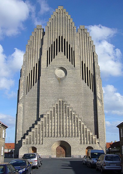
Grundtvigs Kirke Address: På Bjerget 14B street in København
Attractions near Grundtvigs Kirke
Grundtvigs Kirke,Translation By Faust,Bjerget,Team Sinoshop,Bispebjerg Sogns Menighedspleje,Bispebjerg Torv,4you Salon,Jeppes Bodega,Skuespiller Pauli Rybergs Fond,Bispebjerg Torv,Botilbuddet Bjergvænget,Clever,Nejlunds Dyrehandel,Min Frisor V/T,Icb Consulting,Bispebjerg Hospital - Uddannelsescenter,Bispebjerg Kirkegård,Bispebjerg Kirkegård (Frederiksborgvej),LIDL,Bispebjerg Hospital (Tuborgvej)How to get to popular attractions in København with public transit
Meny, Aalborg,Middelfart, Middelfart,Dansk Supermarked, Århus,Bus 400 / 400S (Hundige St. - Lyngby St.), Ishøj,Scandic Hotel Aarhus, Århus,Vigerslev Alle Station, København,Busstop Silkeborgvej / Åby Ringvej, Århus,The Shop, Odense,LEGO Project House, Billund,Bus 10 (Rådhuspladsen - Brønshøj Torv), Frederiksberg,Svendborgsund Broen,Novo Nordisk/ Hagedornsvej, Gentofte,Billund, Billund,VIA University College Campus Aarhus C, Århus,Ry, Skanderborg,Rudkøbing, Langeland,Virum, Lyngby-Taarbæk,FMI Kapacitetsansvarlig Koncern IT (KAKI), Hvidovre,Novo Nordisk 6A, Gladsaxe,Højbjerg, ÅrhusGet around København by public transit!
Traveling around København has never been so easy. See step by step directions as you travel to any attraction, street or major public transit station. View bus and train schedules, arrival times, service alerts and detailed routes on a map, so you know exactly how to get to anywhere in København.
When traveling to any destination around København use Moovit's Live Directions with Get Off Notifications to know exactly where and how far to walk, how long to wait for your line, and how many stops are left. Moovit will alert you when it's time to get off — no need to constantly re-check whether yours is the next stop.
Wondering how to use public transit in København or how to pay for public transit in København? Moovit public transit app can help you navigate your way with public transit easily, and at minimum cost. It includes public transit fees, ticket prices, and costs. Looking for a map of København public transit lines? Moovit public transit app shows all public transit maps in København with all bus, train or metro routes and stops on an interactive map.
København has 3 transit type(s), including: bus, train or metro, operated by several transit agencies, including Metroselskabet, DSB S-tog, Lokaltog A/S, DSB S-tog, Midttrafik, Odense Letbane, DSB, NT, GoCollective, Midttrafik, Skånetrafiken, Metroselskabet, Movia, NT and Midttrafik