Directions to Gulf Of Maine (Boston) with public transportation
The following transit lines have routes that pass near Gulf Of Maine
 Bus: 17, 4, 501, 92, SL4.
- Train: FAIRMOUNT, FITCHBURG, FRAMINGHAM/WORCESTER, PROVIDENCE/STOUGHTON.
- Subway: BLUE LINE.
- Ferry: QUINCY FERRY, GEORGES ISLAND FERRY, LONG WHARF FERRY, SPECTACLE ISLAND FERRY.
How to get to Gulf Of Maine by bus?
Click on the bus route to see step by step directions with maps, line arrival times and updated time schedules.
From Boston Children's Hospital, Boston
65 minFrom Marina Bay, Quincy
148 minFrom Boston College, Boston
76 minFrom Boston College (BC), Boston
77 minFrom Conte Forum, Boston
79 minFrom Chestnut Hill, Boston
78 minFrom Alumni Stadium, Boston
77 minFrom Harvard Square T Station - Red Line, Cambridge
66 minFrom Harvard T.H. Chan School of Public Health, Boston
59 minFrom Washington St, Boston
88 min
How to get to Gulf Of Maine by train?
Click on the train route to see step by step directions with maps, line arrival times and updated time schedules.
How to get to Gulf Of Maine by subway?
Click on the subway route to see step by step directions with maps, line arrival times and updated time schedules.
From Boston Children's Hospital, Boston
39 minFrom Boston College, Boston
66 minFrom Boston College (BC), Boston
67 minFrom Conte Forum, Boston
69 minFrom Chestnut Hill, Boston
68 minFrom Alumni Stadium, Boston
68 minFrom Harvard Square T Station - Red Line, Cambridge
29 minFrom Harvard T.H. Chan School of Public Health, Boston
37 minFrom Washington St, Boston
47 min
Bus stops near Gulf Of Maine in Boston
Ferry stations near Gulf Of Maine in Boston
Bus lines to Gulf Of Maine in Boston
- 4, North Station Via South Station,VIEW
- 15, Haymarket Via Fields Corner & Nubian,VIEW
- 39, Haymarket Via Forest Hills,VIEW
- 57, Haymarket Via Kenmore,VIEW
- 92, Sullivan,VIEW
- 93, Sullivan Via Navy Yard,VIEW
- RED LINE SHUTTLE, Harvard - JFK/UMass via Congress Street,VIEW
- RED LINE SHUTTLE, Harvard - Broadway,VIEW
- RED LINE SHUTTLE, Kendall/MIT - JFK/UMass,VIEW
- RED LINE SHUTTLE, JFK/UMass - Kendall/MIT (Shuttle),VIEW
- BLUE LINE SHUTTLE, Airport - Government Center (Express),VIEW
- BLUE LINE SHUTTLE, Airport - Government Center via Maverick,VIEW
- BLUE LINE SHUTTLE, Orient Heights - Government Center (Local),VIEW
- BLUE LINE SHUTTLE, Orient Heights - Government Center (Express),VIEW
- BLUE LINE SHUTTLE, Airport - Government Center (Local),VIEW
- ORANGE LINE SHUTTLE, State (Shuttle),VIEW
- BLUE LINE SHUTTLE, Government Center (Shuttle),VIEW
What are the closest stations to Gulf Of Maine?
The closest stations to Gulf Of Maine are:
- Atlantic Ave @ Rowes Wharf is 79 yards away, 1 min walk.
- Pearl St @ Congress St is 122 yards away, 2 min walk.
- Congress St @ State St is 212 yards away, 3 min walk.
- Aquarium - State St Opp Mckinley Sq is 311 yards away, 4 min walk.
- State is 316 yards away, 4 min walk.
- Aquarium - Surface Rd @ State St is 395 yards away, 5 min walk.
- Long Wharf North is 576 yards away, 7 min walk.
- Long Wharf (South) is 592 yards away, 8 min walk.
- Long Wharf (North) - Gate 5b is 621 yards away, 8 min walk.
- Long Wharf (North) - Gate 5c is 662 yards away, 8 min walk.
- Central Wharf (South) is 2032 yards away, 25 min walk.
Which bus lines stop near Gulf Of Maine?
These bus lines stop near Gulf Of Maine: 17, 4, 501, 92, SL4.
Which train lines stop near Gulf Of Maine?
These train lines stop near Gulf Of Maine: FAIRMOUNT, FITCHBURG, FRAMINGHAM/WORCESTER, PROVIDENCE/STOUGHTON.
Which subway line stops near Gulf Of Maine?
BLUE LINE (Wonderland)
Which ferry line stops near Gulf Of Maine?
QUINCY FERRY (Quincy Loop)
What’s the nearest bus station to Gulf Of Maine in Boston?
The nearest bus station to Gulf Of Maine in Boston is Atlantic Ave @ Rowes Wharf. It’s a 1 min walk away.
What’s the nearest ferry station to Gulf Of Maine in Boston?
The nearest ferry station to Gulf Of Maine in Boston is Long Wharf North. It’s a 7 min walk away.
What time is the first bus to Gulf Of Maine in Boston?
The 57 is the first bus that goes to Gulf Of Maine in Boston. It stops nearby at 5:03 AM.
What time is the last bus to Gulf Of Maine in Boston?
The 92 is the last bus that goes to Gulf Of Maine in Boston. It stops nearby at 7:52 PM.
What time is the first ferry to Gulf Of Maine in Boston?
The CHARLESTOWN FERRY is the first ferry that goes to Gulf Of Maine in Boston. It stops nearby at 6:30 AM.
What time is the last ferry to Gulf Of Maine in Boston?
The QUINCY FERRY is the last ferry that goes to Gulf Of Maine in Boston. It stops nearby at 8:30 PM.
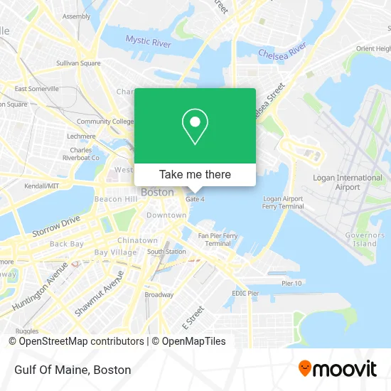
See Gulf Of Maine, Boston, on the map
Public Transit to Gulf Of Maine in Boston
Wondering how to get to Gulf Of Maine in Boston? Moovit helps you find the best way to get to Gulf Of Maine with step-by-step directions from the nearest public transit station.
Moovit provides free maps and live directions to help you navigate through your city. View schedules, routes, timetables, and find out how long does it take to get to Gulf Of Maine in real time.
Looking for the nearest stop or station to Gulf Of Maine? Check out this list of stops closest to your destination: Atlantic Ave @ Rowes Wharf; Pearl St @ Congress St; Congress St @ State St; Aquarium - State St Opp Mckinley Sq; State; Aquarium - Surface Rd @ State St; Long Wharf North; Long Wharf (South); Long Wharf (North) - Gate 5b; Long Wharf (North) - Gate 5c; Central Wharf (South).
Bus: 17, 4, 501, 92, SL4, 15, 39, 57, 93, RED LINE SHUTTLE, RED LINE SHUTTLE, RED LINE SHUTTLE, RED LINE SHUTTLE, BLUE LINE SHUTTLE, BLUE LINE SHUTTLE, BLUE LINE SHUTTLE, BLUE LINE SHUTTLE, BLUE LINE SHUTTLE, ORANGE LINE SHUTTLE.Train: FAIRMOUNT, FITCHBURG, FRAMINGHAM/WORCESTER, PROVIDENCE/STOUGHTON.Subway: BLUE LINE.Ferry: QUINCY FERRY, GEORGES ISLAND FERRY, LONG WHARF FERRY, SPECTACLE ISLAND FERRY.
Want to see if there’s another route that gets you there at an earlier time? Moovit helps you find alternative routes or times. Get directions from and directions to Gulf Of Maine easily from the Moovit App or Website.
We make riding to Gulf Of Maine easy, which is why over 1.7 million users, including users in Boston, trust Moovit as the best app for public transit. You don’t need to download an individual bus app or train app, Moovit is your all-in-one transit app that helps you find the best bus time or train time available.
For information on prices of subway, bus, train and ferry, costs and ride fares to Gulf Of Maine, please check the Moovit app.
Use the app to navigate to popular places including to the airport, hospital, stadium, grocery store, mall, coffee shop, school, college, and university.
Location: Boston
- Central Wharf,
- New England Aquarium,
- Boston Harbor Cruises Provincetown Ferry,
- Acuario Boston,
- Central Wharf (New England Aquarium),
- Photogenic,
- Boston Waterboat Marina (Boston Water Boat Marina),
- Bumpkin Island,
- Custom House Block,
- Boston Harbor Cruises,
- Provincetown Fast Ferry,
- New England Aquarium Whale Watching,
- Chart House Restaurant,
- Simons Theatre,
- Boston Harbor,
- Boston Long Wharf Ferry Terminal,
- THE RITA - Ferry,
- Aquarium New England ,
- New England Aquarium (New Orleans Glass Company),
- The Landing at Long Wharf
Places Near Gulf Of Maine (Boston)
- North End, Boston,
- Faneuil Hall, Boston,
- Boston Children's Hospital, Boston,
- Boston Convention & Exhibition Center, Boston,
- Isabella Stewart Gardner Museum, Boston,
- Cheers, Boston,
- Leader Bank Pavilion (Leader Bank Pavillion), Boston,
- Mgm Music Hall, Boston,
- Museum Of Science, Boston,
- Td Garden, Boston,
- Wang Theater, Boston,
- Seaport District, Boston,
- Boston Medical Center, Boston,
- Quincy Market, Boston,
- Boston Common, Boston,
- House Of Blues, Boston,
- Wilbur Theatre, Boston,
- Castle Island, Boston,
- Prudential Center, Boston,
- Massachusetts General Hospital, Boston
How to get to popular places in Boston with public transit
Get around Boston by public transit!
Traveling around Boston has never been so easy. See step by step directions as you travel to any attraction, street or major public transit station. View bus and train schedules, arrival times, service alerts and detailed routes on a map, so you know exactly how to get to anywhere in Boston.
When traveling to any destination around Boston use Moovit's Live Directions with Get Off Notifications to know exactly where and how far to walk, how long to wait for your line, and how many stops are left. Moovit will alert you when it's time to get off — no need to constantly re-check whether yours is the next stop.
Wondering how to use public transit in Boston or how to pay for public transit in Boston? Moovit public transit app can help you navigate your way with public transit easily, and at minimum cost. It includes public transit fees, ticket prices, and costs. Looking for a map of Boston public transit lines? Moovit public transit app shows all public transit maps in Boston with all Bus, Train, Subway and Ferry routes and stops on an interactive map.
Boston has 4 transit type(s), including: Bus, Train, Subway and Ferry, operated by several transit agencies, including MBTA, Southeastern Regional Transit Authority, MetroWest Regional Transit Authority, Rhode Island Public Transit Authority, WRTA, Lowell Regional Transit Authority, Merrimack Valley Transit, Montachusett Regional Transit Authority, Cape Cod Regional Transit Authority, Brockton Area Transit Authority, Martha's Vineyard Transit Authority, the WAVE - Nantucket Regional Transit Authority, GATRA, Cape Ann Transportation Authority and Massport