Directions to Gulf Oil (Randolph) with public transportation
The following transit lines have routes that pass near Gulf Oil
 Bus: 12, 238, 240.
- Train: FALL RIVER/NEW BEDFORD.
How to get to Gulf Oil by bus?
Click on the bus route to see step by step directions with maps, line arrival times and updated time schedules.
From Quincy, MA, Quincy
54 minFrom South Shore Hospital Outpatient Center, Weymouth Town
98 minFrom Milton, MA, Milton
37 minFrom Beth Israel Deaconess Hospital-Milton, Milton
24 minFrom Archbishop Williams High School, Braintree Town
42 minFrom Brockton, MA, Brockton
35 minFrom Milton Academy, Milton
32 minFrom South Shore Hospital- Pratt 5, Weymouth Town
105 minFrom Walmart, Quincy
71 min
How to get to Gulf Oil by train?
Click on the train route to see step by step directions with maps, line arrival times and updated time schedules.
Bus stops near Gulf Oil in Randolph
What are the closest stations to Gulf Oil?
The closest stations to Gulf Oil are:
- N Main St @ Credit Union Way is 97 yards away, 2 min walk.
- North Main St And Memorial Pkwy is 106 yards away, 2 min walk.
Which bus lines stop near Gulf Oil?
These bus lines stop near Gulf Oil: 12, 238, 240.
Which train line stops near Gulf Oil?
FALL RIVER/NEW BEDFORD (#1909 | Fall River)
What’s the nearest bus station to Gulf Oil in Randolph?
The nearest bus stations to Gulf Oil in Randolph are N Main St @ Credit Union Way and North Main St And Memorial Pkwy. The closest one is a 2 min walk away.
What time is the first bus to Gulf Oil in Randolph?
The 240 is the first bus that goes to Gulf Oil in Randolph. It stops nearby at 4:40 AM.
What time is the last bus to Gulf Oil in Randolph?
The 240 is the last bus that goes to Gulf Oil in Randolph. It stops nearby at 1:18 AM.
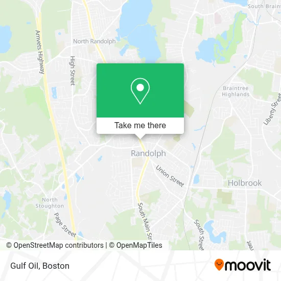
See Gulf Oil, Randolph, on the map
Public Transit to Gulf Oil in Randolph
Wondering how to get to Gulf Oil in Randolph? Moovit helps you find the best way to get to Gulf Oil with step-by-step directions from the nearest public transit station.
Moovit provides free maps and live directions to help you navigate through your city. View schedules, routes, timetables, and find out how long does it take to get to Gulf Oil in real time.
Looking for the nearest stop or station to Gulf Oil? Check out this list of stops closest to your destination: N Main St @ Credit Union Way; North Main St And Memorial Pkwy.
Bus: 12, 238, 240.Train: FALL RIVER/NEW BEDFORD.
Want to see if there’s another route that gets you there at an earlier time? Moovit helps you find alternative routes or times. Get directions from and directions to Gulf Oil easily from the Moovit App or Website.
We make riding to Gulf Oil easy, which is why over 1.7 million users, including users in Randolph, trust Moovit as the best app for public transit. You don’t need to download an individual bus app or train app, Moovit is your all-in-one transit app that helps you find the best bus time or train time available.
For information on prices of bus and train, costs and ride fares to Gulf Oil, please check the Moovit app.
Use the app to navigate to popular places including to the airport, hospital, stadium, grocery store, mall, coffee shop, school, college, and university.
Gulf Oil Address: 245 N Main St street in Randolph
- The Haitian American Business Expo, Inc.,
- ABC Commercial,
- Premier Auto Collision,
- TAC-9 Radio,
- Americas Food Basket,
- Kayliany Aesthetic,
- Timmy Taylor,
- Gotcha Fusion,
- New Life Counseling and Wellness Center, Inc.,
- Tori Japan,
- A Cut Beyond International Salon,
- Black Ice Cryotherapy,
- Lumi and Lather,
- Salon Shades & Textures,
- East Coast Laundry,
- Randolph Garage Door Repair Garage Door,
- Soley Leve Restaurant,
- Amazon Locker-Broadcast,
- smart Mobile,
- Forest Spa
Places Near Gulf Oil (Randolph)
- Td Garden, Boston,
- Isabella Stewart Gardner Museum, Boston,
- Mgm Music Hall, Boston,
- Boston Common, Boston,
- Wang Theater, Boston,
- House Of Blues, Boston,
- Boston Medical Center, Boston,
- Massachusetts General Hospital, Boston,
- North End, Boston,
- Quincy Market, Boston,
- Castle Island, Boston,
- Seaport District, Boston,
- Museum Of Science, Boston,
- Faneuil Hall, Boston,
- Boston Children's Hospital, Boston,
- Cheers, Boston,
- Wilbur Theatre, Boston,
- Boston Convention & Exhibition Center, Boston,
- Prudential Center, Boston,
- Leader Bank Pavilion (Leader Bank Pavillion), Boston
How to get to popular places in Boston with public transit
Get around Randolph by public transit!
Traveling around Randolph has never been so easy. See step by step directions as you travel to any attraction, street or major public transit station. View bus and train schedules, arrival times, service alerts and detailed routes on a map, so you know exactly how to get to anywhere in Randolph.
When traveling to any destination around Randolph use Moovit's Live Directions with Get Off Notifications to know exactly where and how far to walk, how long to wait for your line, and how many stops are left. Moovit will alert you when it's time to get off — no need to constantly re-check whether yours is the next stop.
Wondering how to use public transit in Randolph or how to pay for public transit in Randolph? Moovit public transit app can help you navigate your way with public transit easily, and at minimum cost. It includes public transit fees, ticket prices, and costs. Looking for a map of Randolph public transit lines? Moovit public transit app shows all public transit maps in Randolph with all Bus, Train, Subway and Ferry routes and stops on an interactive map.
Boston has 4 transit type(s), including: Bus, Train, Subway and Ferry, operated by several transit agencies, including MBTA, Southeastern Regional Transit Authority, MetroWest Regional Transit Authority, Rhode Island Public Transit Authority, WRTA, Lowell Regional Transit Authority, Merrimack Valley Transit, Montachusett Regional Transit Authority, Cape Cod Regional Transit Authority, Brockton Area Transit Authority, Martha's Vineyard Transit Authority, the WAVE - Nantucket Regional Transit Authority, GATRA, Cape Ann Transportation Authority and Massport