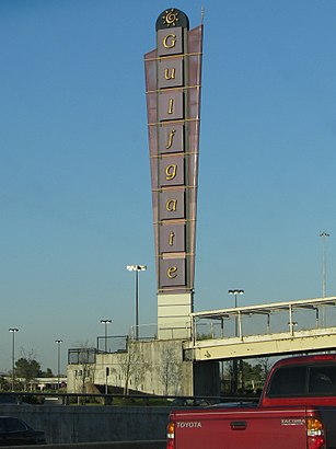
Directions to Gulfgate Shopping City (Houston) with public transportation
The following transit lines have routes that pass near Gulfgate Shopping City
How to get to Gulfgate Shopping City by bus?
Click on the bus route to see step by step directions with maps, line arrival times and updated time schedules.
Bus stations near Gulfgate Shopping City in Houston
- Woodridge Dr @ Village Way,6 min walk,
Bus lines to Gulfgate Shopping City in Houston
- 40,N Shepherd P&R - Northbound,
- 76,Magnolia Park Tc - Northbound,
What are the closest stations to Gulfgate Shopping City?
The closest stations to Gulfgate Shopping City are:
- Woodridge Dr @ Village Way is 463 yards away, 6 min walk.
Which bus lines stop near Gulfgate Shopping City?
These bus lines stop near Gulfgate Shopping City: 40, 76.
What’s the nearest bus stop to Gulfgate Shopping City in Houston?
The nearest bus stop to Gulfgate Shopping City in Houston is Woodridge Dr @ Village Way. It’s a 6 min walk away.
See Gulfgate Shopping City, Houston, on the map
self-made
Public Transit to Gulfgate Shopping City in Houston
Wondering how to get to Gulfgate Shopping City in Houston, United States? Moovit helps you find the best way to get to Gulfgate Shopping City with step-by-step directions from the nearest public transit station.
Moovit provides free maps and live directions to help you navigate through your city. View schedules, routes, timetables, and find out how long does it take to get to Gulfgate Shopping City in real time.
Looking for the nearest stop or station to Gulfgate Shopping City? Check out this list of stops closest to your destination: Woodridge Dr @ Village Way.
Bus:4076
Want to see if there’s another route that gets you there at an earlier time? Moovit helps you find alternative routes or times. Get directions from and directions to Gulfgate Shopping City easily from the Moovit App or Website.
We make riding to Gulfgate Shopping City easy, which is why over 1.5 million users, including users in Houston, trust Moovit as the best app for public transit. You don’t need to download an individual bus app or train app, Moovit is your all-in-one transit app that helps you find the best bus time or train time available.
For information on prices of bus, costs and ride fares to Gulfgate Shopping City, please check the Moovit app.
Use the app to navigate to popular places including to the airport, hospital, stadium, grocery store, mall, coffee shop, school, college, and university.
Location: Houston
self-made
Attractions near Gulfgate Shopping City
Eyemasters,Claire S,Foot Action,H-E-B,500,Salon de Cejas,Marshalls,Staples,VisionWorks,Hopewell Baptist Temple Church,Party City,510 Gulfgate Center Mall,1st convenience bank,Old Navy,Icing,3000 Woodridge Dr,Shoe Carnival,Ross Dress for Less,H-E-B Pharmacy,Best BuyHow to get to popular attractions in Houston with public transit
The Galleria, Houston,AIG, Houston,Ross Dress for Less, Houston,George Bush Intercontinental Airport (IAH), Houston,Beltway 8, Houston,El Bolillo Bakery, Houston,Texas Children's Hospital Garage 19, Houston,610 & Wallisville, Houston,Sam Houston Tollway & 249,Memorial City Mall, Houston,I-45 at FM1960,FM 1960 @ Veterans Memorial, Houston,Post Oak Blvd, Houston,Energy Corridor, Houston,Buca di Beppo Italian Restaurant, Houston,Katy, TX, Houston,610 North Loop Freeway, Houston,I-10 & Studemont St, Houston,UH-Downtown Academic Building, Houston,Pappadeaux Seafood Kitchen, HoustonGet around Houston by public transit!
Traveling around Houston has never been so easy. See step by step directions as you travel to any attraction, street or major public transit station. View bus and train schedules, arrival times, service alerts and detailed routes on a map, so you know exactly how to get to anywhere in Houston.
When traveling to any destination around Houston use Moovit's Live Directions with Get Off Notifications to know exactly where and how far to walk, how long to wait for your line, and how many stops are left. Moovit will alert you when it's time to get off — no need to constantly re-check whether yours is the next stop.
Wondering how to use public transit in Houston or how to pay for public transit in Houston? Moovit public transit app can help you navigate your way with public transit easily, and at minimum cost. It includes public transit fees, ticket prices, and costs. Looking for a map of Houston public transit lines? Moovit public transit app shows all public transit maps in Houston with all bus routes and stops on an interactive map.
Houston has 1 transit type(s), including: bus, operated by several transit agencies, including METRO, METRO, Greyhound-us, FlixBus-us and Megabus