Directions to Guv Studios (Boston) with public transportation
The following transit lines have routes that pass near Guv Studios
 Bus: 14, 30, 34E, 36, 50.
- Train: NEEDHAM, FRANKLIN/FOXBORO, ORANGE LINE, PROVIDENCE/STOUGHTON.
- Subway: ORANGE LINE.
How to get to Guv Studios by bus?
Click on the bus route to see step by step directions with maps, line arrival times and updated time schedules.
From Seaport District, Boston
81 minFrom 125 High Street, Boston
67 minFrom Puttshack, Boston
82 minFrom Watertown, MA, Watertown Town
69 minFrom Primark Boston, Boston
54 minFrom Wyndham Boston Beacon Hill, Boston
77 minFrom Wachusett mountain, Boston
81 minFrom Boston Medical Center, Boston
54 minFrom Holiday Inn Express Boston, Boston
53 minFrom Boston Common Visitor Center, Boston
53 min
How to get to Guv Studios by train?
Click on the train route to see step by step directions with maps, line arrival times and updated time schedules.
From Seaport District, Boston
43 minFrom 125 High Street, Boston
34 minFrom Puttshack, Boston
43 minFrom Primark Boston, Boston
36 minFrom Wyndham Boston Beacon Hill, Boston
50 minFrom Boston Medical Center, Boston
40 minFrom Holiday Inn Express Boston, Boston
74 minFrom Boston Common Visitor Center, Boston
40 min
How to get to Guv Studios by subway?
Click on the subway route to see step by step directions with maps, line arrival times and updated time schedules.
From Seaport District, Boston
72 minFrom 125 High Street, Boston
61 minFrom Puttshack, Boston
72 minFrom Primark Boston, Boston
52 minFrom Wyndham Boston Beacon Hill, Boston
65 minFrom Wachusett mountain, Boston
82 minFrom Boston Medical Center, Boston
61 minFrom Holiday Inn Express Boston, Boston
69 minFrom Boston Common Visitor Center, Boston
56 min
Bus stops near Guv Studios in Boston
Bus lines to Guv Studios in Boston
- 14, Heath St,VIEW
- 30, Forest Hills,VIEW
- 39, Haymarket Via Forest Hills,VIEW
- 34, Forest Hills - Dedham Mall,VIEW
- 40, Forest Hills - Georgetowne,VIEW
- 50, Forest Hills - Cleary Square,VIEW
- 34E, Forest Hills - Walpole Center via Washington St,VIEW
- 35, Forest Hills - Dedham Mall,VIEW
- 36, Forest Hills - VA Hospital,VIEW
- 37, Forest Hills - Baker & Vermont St,VIEW
- 51, Forest Hills - Reservoir,VIEW
What are the closest stations to Guv Studios?
The closest stations to Guv Studios are:
- Cummins Hwy @ Florence St is 78 yards away, 2 min walk.
- Washington St @ Poplar St is 259 yards away, 4 min walk.
- Corinth St @ Cohasset St is 306 yards away, 4 min walk.
- Bellevue is 618 yards away, 8 min walk.
- Forest Hills is 2153 yards away, 26 min walk.
Which bus lines stop near Guv Studios?
These bus lines stop near Guv Studios: 14, 30, 34E, 36, 50, 51.
Which train line stops near Guv Studios?
NEEDHAM (#625 | Needham Heights)
Which subway line stops near Guv Studios?
ORANGE LINE (Forest Hills)
What’s the nearest train station to Guv Studios in Boston?
The nearest train station to Guv Studios in Boston is Bellevue. It’s a 8 min walk away.
What’s the nearest bus station to Guv Studios in Boston?
The nearest bus station to Guv Studios in Boston is Cummins Hwy @ Florence St. It’s a 2 min walk away.
What time is the first subway to Guv Studios in Boston?
The ORANGE LINE is the first subway that goes to Guv Studios in Boston. It stops nearby at 5:15 AM.
What time is the last subway to Guv Studios in Boston?
The ORANGE LINE is the last subway that goes to Guv Studios in Boston. It stops nearby at 1:58 AM.
What time is the first train to Guv Studios in Boston?
The NEEDHAM is the first train that goes to Guv Studios in Boston. It stops nearby at 7:22 AM.
What time is the last train to Guv Studios in Boston?
The PROVIDENCE/STOUGHTON is the last train that goes to Guv Studios in Boston. It stops nearby at 12:08 AM.
What time is the first bus to Guv Studios in Boston?
The 39 is the first bus that goes to Guv Studios in Boston. It stops nearby at 4:32 AM.
What time is the last bus to Guv Studios in Boston?
The 36 is the last bus that goes to Guv Studios in Boston. It stops nearby at 1:38 AM.
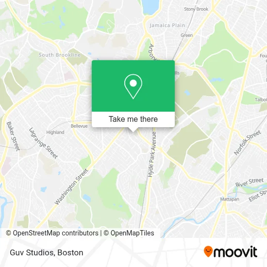
See Guv Studios, Boston, on the map
Public Transit to Guv Studios in Boston
Wondering how to get to Guv Studios in Boston? Moovit helps you find the best way to get to Guv Studios with step-by-step directions from the nearest public transit station.
Moovit provides free maps and live directions to help you navigate through your city. View schedules, routes, timetables, and find out how long does it take to get to Guv Studios in real time.
Looking for the nearest stop or station to Guv Studios? Check out this list of stops closest to your destination: Cummins Hwy @ Florence St; Washington St @ Poplar St; Corinth St @ Cohasset St; Bellevue; Forest Hills.
Bus: 14, 30, 34E, 36, 50, 51, 39, 34, 40, 35, 37.Train: NEEDHAM, FRANKLIN/FOXBORO, ORANGE LINE, PROVIDENCE/STOUGHTON.Subway: ORANGE LINE.
Want to see if there’s another route that gets you there at an earlier time? Moovit helps you find alternative routes or times. Get directions from and directions to Guv Studios easily from the Moovit App or Website.
We make riding to Guv Studios easy, which is why over 1.7 million users, including users in Boston, trust Moovit as the best app for public transit. You don’t need to download an individual bus app or train app, Moovit is your all-in-one transit app that helps you find the best bus time or train time available.
For information on prices of bus, subway and train, costs and ride fares to Guv Studios, please check the Moovit app.
Use the app to navigate to popular places including to the airport, hospital, stadium, grocery store, mall, coffee shop, school, college, and university.
Guv Studios Address: 49 Sycamore St street in Boston
- Roslindale,
- Grunber,
- Lost & Found Treasures,
- Social Security,
- Pay Attention To Detail,
- Roslindale Square,
- Registry of Motor Vehicles,
- Valentini Landscaping,
- Benjamin Eleonu, MD,
- Roslindale Pediatrics,
- J B Edward Uniforms (JB Pride Uniforms - We),
- RMV,
- Roslindale MBTA Commuter Station,
- MBTA Commuter Rail Train #2707,
- Roslindale Village Commuter Rail Station,
- Elpicha Barbershop (El Picha Barbershop),
- Metropolitan Hill / Beach Street, Massachusetts,
- Botanica Patron Santiago (Botanica Parton Santiago),
- Roslindale Sewr and Drain,
- Beara Pub
Places Near Guv Studios (Boston)
- House Of Blues, Boston,
- Prudential Center, Boston,
- Wang Theater, Boston,
- Boston Convention & Exhibition Center, Boston,
- Wilbur Theatre, Boston,
- Boston Children's Hospital, Boston,
- North End, Boston,
- Boston Medical Center, Boston,
- Boston Common, Boston,
- Museum Of Science, Boston,
- Td Garden, Boston,
- Mgm Music Hall, Boston,
- Massachusetts General Hospital, Boston,
- Faneuil Hall, Boston,
- Seaport District, Boston,
- Quincy Market, Boston,
- Isabella Stewart Gardner Museum, Boston,
- Cheers, Boston,
- Leader Bank Pavilion (Leader Bank Pavillion), Boston,
- Castle Island, Boston
How to get to popular places in Boston with public transit
Get around Boston by public transit!
Traveling around Boston has never been so easy. See step by step directions as you travel to any attraction, street or major public transit station. View bus and train schedules, arrival times, service alerts and detailed routes on a map, so you know exactly how to get to anywhere in Boston.
When traveling to any destination around Boston use Moovit's Live Directions with Get Off Notifications to know exactly where and how far to walk, how long to wait for your line, and how many stops are left. Moovit will alert you when it's time to get off — no need to constantly re-check whether yours is the next stop.
Wondering how to use public transit in Boston or how to pay for public transit in Boston? Moovit public transit app can help you navigate your way with public transit easily, and at minimum cost. It includes public transit fees, ticket prices, and costs. Looking for a map of Boston public transit lines? Moovit public transit app shows all public transit maps in Boston with all Bus, Train, Subway and Ferry routes and stops on an interactive map.
Boston has 4 transit type(s), including: Bus, Train, Subway and Ferry, operated by several transit agencies, including MBTA, Southeastern Regional Transit Authority, MetroWest Regional Transit Authority, Rhode Island Public Transit Authority, WRTA, Lowell Regional Transit Authority, Merrimack Valley Transit, Montachusett Regional Transit Authority, Cape Cod Regional Transit Authority, Brockton Area Transit Authority, Martha's Vineyard Transit Authority, the WAVE - Nantucket Regional Transit Authority, GATRA, Cape Ann Transportation Authority and Massport