Directions to Gwynn Systems Inc (Milton) with public transportation
The following transit lines have routes that pass near Gwynn Systems Inc
 Bus: 24, 240, 217, MATTAPAN LINE SHUTTLE, MATTAPAN LINE SHUTTLE.
- Train: FAIRMOUNT.
- Subway: MATTAPAN LINE.
How to get to Gwynn Systems Inc by bus?
Click on the bus route to see step by step directions with maps, line arrival times and updated time schedules.
From Pemberton Square, Boston
75 minFrom The Omni Seaport Hotel (Omni Boston Hotel at the Seaport), Boston
94 minFrom Faneuil Hall Marketplace, Boston
79 minFrom Harvard Medical School, Boston
56 minFrom Boston Long Wharf Ferry Terminal, Boston
93 minFrom New England Aquarium, Boston
93 minFrom Jamaica Plain V.A., Boston
50 minFrom City Hall Plaza, Boston
76 minFrom Reggie Lewis Athletic Center, Boston
43 minFrom Legal Sea Foods, Boston
92 min
How to get to Gwynn Systems Inc by train?
Click on the train route to see step by step directions with maps, line arrival times and updated time schedules.
From Pemberton Square, Boston
64 minFrom The Omni Seaport Hotel (Omni Boston Hotel at the Seaport), Boston
64 minFrom Faneuil Hall Marketplace, Boston
62 minFrom Harvard Medical School, Boston
87 minFrom Boston Long Wharf Ferry Terminal, Boston
64 minFrom New England Aquarium, Boston
64 minFrom City Hall Plaza, Boston
63 minFrom Reggie Lewis Athletic Center, Boston
91 minFrom Legal Sea Foods, Boston
63 min
How to get to Gwynn Systems Inc by subway?
Click on the subway route to see step by step directions with maps, line arrival times and updated time schedules.
From Pemberton Square, Boston
43 minFrom The Omni Seaport Hotel (Omni Boston Hotel at the Seaport), Boston
49 minFrom Faneuil Hall Marketplace, Boston
41 minFrom Harvard Medical School, Boston
59 minFrom Boston Long Wharf Ferry Terminal, Boston
49 minFrom New England Aquarium, Boston
50 minFrom Jamaica Plain V.A., Boston
71 minFrom City Hall Plaza, Boston
44 minFrom Reggie Lewis Athletic Center, Boston
51 minFrom Legal Sea Foods, Boston
49 min
Bus stops near Gwynn Systems Inc in Milton
Subway station near Gwynn Systems Inc in Milton
- Cedar Grove, 6 min walk,VIEW
Bus lines to Gwynn Systems Inc in Milton
What are the closest stations to Gwynn Systems Inc?
The closest stations to Gwynn Systems Inc are:
- Adams St @ Wharf St is 66 yards away, 1 min walk.
- Adams St @ Eliot St is 75 yards away, 1 min walk.
- Dorchester Ave @ Washington St is 295 yards away, 4 min walk.
- Cedar Grove is 484 yards away, 6 min walk.
Which bus lines stop near Gwynn Systems Inc?
These bus lines stop near Gwynn Systems Inc: 24, 240.
Which train line stops near Gwynn Systems Inc?
FAIRMOUNT (#1619 | Fairmount)
Which subway line stops near Gwynn Systems Inc?
MATTAPAN LINE (Mattapan)
What’s the nearest subway station to Gwynn Systems Inc in Milton?
The nearest subway station to Gwynn Systems Inc in Milton is Cedar Grove. It’s a 6 min walk away.
What’s the nearest bus station to Gwynn Systems Inc in Milton?
The nearest bus stations to Gwynn Systems Inc in Milton are Adams St @ Wharf St and Adams St @ Eliot St. The closest one is a 1 min walk away.
What time is the first subway to Gwynn Systems Inc in Milton?
The MATTAPAN LINE is the first subway that goes to Gwynn Systems Inc in Milton. It stops nearby at 5:02 AM.
What time is the last subway to Gwynn Systems Inc in Milton?
The MATTAPAN LINE is the last subway that goes to Gwynn Systems Inc in Milton. It stops nearby at 2:38 AM.
What time is the first bus to Gwynn Systems Inc in Milton?
The 15 is the first bus that goes to Gwynn Systems Inc in Milton. It stops nearby at 4:37 AM.
What time is the last bus to Gwynn Systems Inc in Milton?
The 24 is the last bus that goes to Gwynn Systems Inc in Milton. It stops nearby at 1:06 AM.
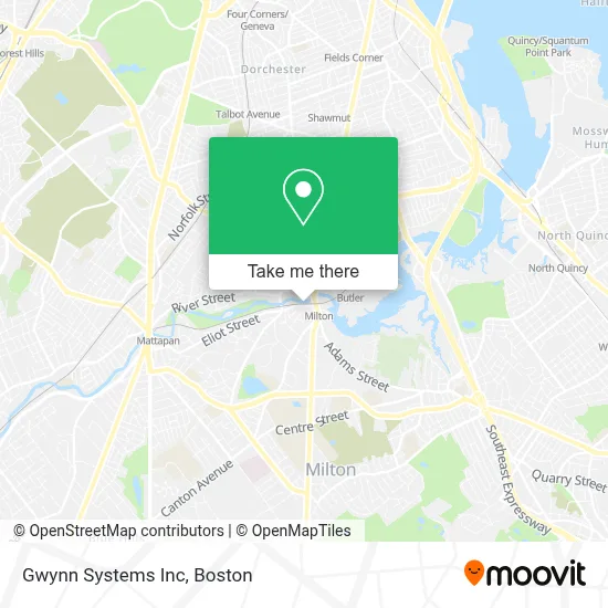
See Gwynn Systems Inc, Milton, on the map
Public Transit to Gwynn Systems Inc in Milton
Wondering how to get to Gwynn Systems Inc in Milton? Moovit helps you find the best way to get to Gwynn Systems Inc with step-by-step directions from the nearest public transit station.
Moovit provides free maps and live directions to help you navigate through your city. View schedules, routes, timetables, and find out how long does it take to get to Gwynn Systems Inc in real time.
Looking for the nearest stop or station to Gwynn Systems Inc? Check out this list of stops closest to your destination: Adams St @ Wharf St; Adams St @ Eliot St; Dorchester Ave @ Washington St; Cedar Grove.
Bus: 24, 240, 217, MATTAPAN LINE SHUTTLE, MATTAPAN LINE SHUTTLE, RED/MATTAPAN LINE SHUTTLE, 15, 12.Train: FAIRMOUNT.Subway: MATTAPAN LINE.
Want to see if there’s another route that gets you there at an earlier time? Moovit helps you find alternative routes or times. Get directions from and directions to Gwynn Systems Inc easily from the Moovit App or Website.
We make riding to Gwynn Systems Inc easy, which is why over 1.7 million users, including users in Milton, trust Moovit as the best app for public transit. You don’t need to download an individual bus app or train app, Moovit is your all-in-one transit app that helps you find the best bus time or train time available.
For information on prices of subway, bus and train, costs and ride fares to Gwynn Systems Inc, please check the Moovit app.
Use the app to navigate to popular places including to the airport, hospital, stadium, grocery store, mall, coffee shop, school, college, and university.
Gwynn Systems Inc Address: 1 Eliot St street in Milton
- Muscle & Flow,
- Saint John Paul II Catholic Academy,
- DHS Plumbing Heating & Cooling,
- Call A Locksmith Now,
- Walter Baker Chocolate Factory,
- Aesthella Lash Love,
- Skin and Body Firm,
- Quinn Francis W,
- USPS (Post Office-Milton Village),
- Coinstar,
- American Locksmith,
- Star Market,
- Milton Station MBTA,
- New Locks Installation Services,
- Beliah Ross, Licsw,
- Hannah Janice M,
- FedEx,
- Tina's Touch,
- Kerin Moran Hairstylist,
- Miller Law Office
Places Near Gwynn Systems Inc (Milton)
- Boston Convention & Exhibition Center, Boston,
- Mgm Music Hall, Boston,
- Quincy Market, Boston,
- North End, Boston,
- Boston Children's Hospital, Boston,
- Leader Bank Pavilion (Leader Bank Pavillion), Boston,
- Wang Theater, Boston,
- Seaport District, Boston,
- Prudential Center, Boston,
- House Of Blues, Boston,
- Cheers, Boston,
- Isabella Stewart Gardner Museum, Boston,
- Massachusetts General Hospital, Boston,
- Wilbur Theatre, Boston,
- Boston Common, Boston,
- Castle Island, Boston,
- Faneuil Hall, Boston,
- Td Garden, Boston,
- Museum Of Science, Boston,
- Boston Medical Center, Boston
How to get to popular places in Boston with public transit
Get around Milton by public transit!
Traveling around Milton has never been so easy. See step by step directions as you travel to any attraction, street or major public transit station. View bus and train schedules, arrival times, service alerts and detailed routes on a map, so you know exactly how to get to anywhere in Milton.
When traveling to any destination around Milton use Moovit's Live Directions with Get Off Notifications to know exactly where and how far to walk, how long to wait for your line, and how many stops are left. Moovit will alert you when it's time to get off — no need to constantly re-check whether yours is the next stop.
Wondering how to use public transit in Milton or how to pay for public transit in Milton? Moovit public transit app can help you navigate your way with public transit easily, and at minimum cost. It includes public transit fees, ticket prices, and costs. Looking for a map of Milton public transit lines? Moovit public transit app shows all public transit maps in Milton with all Bus, Train, Subway and Ferry routes and stops on an interactive map.
Boston has 4 transit type(s), including: Bus, Train, Subway and Ferry, operated by several transit agencies, including MBTA, Southeastern Regional Transit Authority, MetroWest Regional Transit Authority, Rhode Island Public Transit Authority, WRTA, Lowell Regional Transit Authority, Merrimack Valley Transit, Montachusett Regional Transit Authority, Cape Cod Regional Transit Authority, Brockton Area Transit Authority, Martha's Vineyard Transit Authority, the WAVE - Nantucket Regional Transit Authority, GATRA, Cape Ann Transportation Authority and Massport