See Hôpital Bretonneau, Paris, on the map
Directions to Hôpital Bretonneau (Paris) with public transportation
The following transit lines have routes that pass near Hôpital Bretonneau
 Train:
 - Metro:
- Bus:
How to get to Hôpital Bretonneau by bus?
Click on the bus route to see step by step directions with maps, line arrival times and updated time schedules.
How to get to Hôpital Bretonneau by train?
Click on the train route to see step by step directions with maps, line arrival times and updated time schedules.
How to get to Hôpital Bretonneau by metro?
Click on the metro route to see step by step directions with maps, line arrival times and updated time schedules.
Metro stations near Hôpital Bretonneau in Paris
- Place de Clichy,1 min walk,
- Lamarck - Caulaincourt,10 min walk,
Bus stations near Hôpital Bretonneau in Paris
- Damrémont - Marcadet,4 min walk,
- Lamarck - Guy Moquet,5 min walk,
- Davy,5 min walk,
- Guy Môquet,7 min walk,
- Damrémont - Caulaincourt,7 min walk,
Bus lines to Hôpital Bretonneau in Paris
- 95,Palais Royal - Comédie Française,
- BATIGNO,Porte de Saint-Ouen - Hôpital Bichat,
- 21,Palais Royal - Comédie Française,
- 31,Gare de L'Est,
- 80,Saint-Augustin,
What are the closest stations to Hôpital Bretonneau?
The closest stations to Hôpital Bretonneau are:
- Place de Clichy is 32 meters away, 1 min walk.
- Damrémont - Marcadet is 212 meters away, 4 min walk.
- Lamarck - Guy Moquet is 341 meters away, 5 min walk.
- Davy is 376 meters away, 5 min walk.
- Guy Môquet is 497 meters away, 7 min walk.
- Damrémont - Caulaincourt is 514 meters away, 7 min walk.
- Lamarck - Caulaincourt is 672 meters away, 10 min walk.
Which train line stops near Hôpital Bretonneau?
L
Which metro line stops near Hôpital Bretonneau?
13
Which bus lines stop near Hôpital Bretonneau?
These bus lines stop near Hôpital Bretonneau: 31, 68, 95.
What’s the nearest metro station to Hôpital Bretonneau in Paris?
The nearest metro station to Hôpital Bretonneau in Paris is Place de Clichy. It’s a 1 min walk away.
What’s the nearest bus stop to Hôpital Bretonneau in Paris?
The nearest bus stop to Hôpital Bretonneau in Paris is Damrémont - Marcadet. It’s a 4 min walk away.
What time is the first metro to Hôpital Bretonneau in Paris?
The 2 is the first metro that goes to Hôpital Bretonneau in Paris. It stops nearby at 5:32 AM.
What time is the last metro to Hôpital Bretonneau in Paris?
The 2 is the last metro that goes to Hôpital Bretonneau in Paris. It stops nearby at 1:04 AM.
What time is the first bus to Hôpital Bretonneau in Paris?
The 21 is the first bus that goes to Hôpital Bretonneau in Paris. It stops nearby at 5:03 AM.
What time is the last bus to Hôpital Bretonneau in Paris?
The 21 is the last bus that goes to Hôpital Bretonneau in Paris. It stops nearby at 1:21 AM.
See Hôpital Bretonneau, Paris, on the map
Public Transit to Hôpital Bretonneau in Paris
Wondering how to get to Hôpital Bretonneau in Paris, France? Moovit helps you find the best way to get to Hôpital Bretonneau with step-by-step directions from the nearest public transit station.
Moovit provides free maps and live directions to help you navigate through your city. View schedules, routes, timetables, and find out how long does it take to get to Hôpital Bretonneau in real time.
Looking for the nearest stop or station to Hôpital Bretonneau? Check out this list of stops closest to your destination: Place de Clichy; Damrémont - Marcadet; Lamarck - Guy Moquet; Davy; Guy Môquet; Damrémont - Caulaincourt; Lamarck - Caulaincourt.
Train:Metro:Bus:
Want to see if there’s another route that gets you there at an earlier time? Moovit helps you find alternative routes or times. Get directions from and directions to Hôpital Bretonneau easily from the Moovit App or Website.
We make riding to Hôpital Bretonneau easy, which is why over 1.5 million users, including users in Paris, trust Moovit as the best app for public transit. You don’t need to download an individual bus app or train app, Moovit is your all-in-one transit app that helps you find the best bus time or train time available.
For information on prices of metro, bus, train, light rail and RER, costs and ride fares to Hôpital Bretonneau, please check the Moovit app.
Use the app to navigate to popular places including to the airport, hospital, stadium, grocery store, mall, coffee shop, school, college, and university.
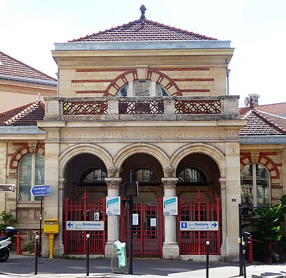
Hôpital Bretonneau Address: 23 rue Joseph de Maistre street in Paris
Attractions near Hôpital Bretonneau
Centre Dentaire,Entrée Centre Dentaire,3 BIS Rue Carpeaux,Arpeges,Grandes Carrières Clichy,Place Jacques Froment,4 Place Jacques Froment,Le Bb18,Rue Joseph de Maistre,Hôpital Bretonneau,Môm’artre,Place Jacques Froment,8h,Collège Antoine Coysevox,14 Rue Etex,Rue Etex,Square Carpeaux,Cité Veron,Sourdine,YAYHow to get to popular attractions in Paris with public transit
Musée D'Orsay, Paris,Place Napoléon Bonaparte, Fontainebleau,Parc Des Princes G To K, Paris,Aeroport Charles de Gaulle, Le Mesnil-Amelot,Centre Commercial Saint-Lazare Paris, Paris,Malakoff, Malakoff,Chambourcy, Chambourcy,Gendarmerie Nozay, Nozay,Orly, Orly,Orly Paris Airport, Paray-Vieille-Poste,Roche SAS, Boulogne-Billancourt,Starbucks, Paray-Vieille-Poste,Paray-Vieille-Poste, Paray-Vieille-Poste,Moutarde Street, Puteaux,Monoprix, Paris,Bercy Village, Paris,Edenred, Malakoff,Agence Delasource, Boulogne-Billancourt,59 Rivoli, Paris,Vaucresson, VaucressonGet around Paris by public transit!
Traveling around Paris has never been so easy. See step by step directions as you travel to any attraction, street or major public transit station. View bus and train schedules, arrival times, service alerts and detailed routes on a map, so you know exactly how to get to anywhere in Paris.
When traveling to any destination around Paris use Moovit's Live Directions with Get Off Notifications to know exactly where and how far to walk, how long to wait for your line, and how many stops are left. Moovit will alert you when it's time to get off — no need to constantly re-check whether yours is the next stop.
Wondering how to use public transit in Paris or how to pay for public transit in Paris? Moovit public transit app can help you navigate your way with public transit easily, and at minimum cost. It includes public transit fees, ticket prices, and costs. Looking for a map of Paris public transit lines? Moovit public transit app shows all public transit maps in Paris with all metro, bus, train, light rail or RER routes and stops on an interactive map.
Paris has 5 transit type(s), including: metro, bus, train, light rail or RER, operated by several transit agencies, including RATP, RER, RER Bus de remplacement, Train, Train Bus de remplacement, RATP, Tramway Bus de remplacement, TER, RATP, Tramway, ADP, ADP, RATP, Noctilien and Magical Shuttle