Directions to Hørsholm Kommune with public transportation
The following transit lines have routes that pass near Hørsholm Kommune
 Bus:
Bus: - Train:
How to get to Hørsholm Kommune by bus?
Click on the bus route to see step by step directions with maps, line arrival times and updated time schedules.
How to get to Hørsholm Kommune by train?
Click on the train route to see step by step directions with maps, line arrival times and updated time schedules.
Bus stations near Hørsholm Kommune
- Ådalsparkvej (Højmosen),6 min walk,
- Kokkedal St.,8 min walk,
Train stations near Hørsholm Kommune
- Rungsted Kyst St.,31 min walk,
Bus lines to Hørsholm Kommune
- 386,Mikkelborg Park,
- 500S,Kokkedal St.,
- 150S,Nørreport St.,
- 353,Hellebo Park,
- 365R,Fredensborg St.,
What are the closest stations to Hørsholm Kommune?
The closest stations to Hørsholm Kommune are:
- Ådalsparkvej (Højmosen) is 402 meters away, 6 min walk.
- Kokkedal St. is 527 meters away, 8 min walk.
- Rungsted Kyst St. is 2382 meters away, 31 min walk.
Which bus lines stop near Hørsholm Kommune?
These bus lines stop near Hørsholm Kommune: 150S, 353, 500S.
Which train line stops near Hørsholm Kommune?
RE
What’s the nearest bus stop to Hørsholm Kommune?
The nearest bus stop to Hørsholm Kommune is Ådalsparkvej (Højmosen). It’s a 6 min walk away.
What time is the first train to Hørsholm Kommune?
The RE is the first train that goes to Hørsholm Kommune. It stops nearby at 3:16 AM.
What time is the last train to Hørsholm Kommune?
The RE is the last train that goes to Hørsholm Kommune. It stops nearby at 1:28 AM.
What time is the first bus to Hørsholm Kommune?
The 150S is the first bus that goes to Hørsholm Kommune. It stops nearby at 3:32 AM.
What time is the last bus to Hørsholm Kommune?
The 150S is the last bus that goes to Hørsholm Kommune. It stops nearby at 3:36 AM.
See Hørsholm Kommune on the map
Public Transportation to Hørsholm Kommune
Wondering how to get to Hørsholm Kommune, Denmark? Moovit helps you find the best way to get to Hørsholm Kommune with step-by-step directions from the nearest public transit station.
Moovit provides free maps and live directions to help you navigate through your city. View schedules, routes, timetables, and find out how long does it take to get to Hørsholm Kommune in real time.
Looking for the nearest stop or station to Hørsholm Kommune? Check out this list of stops closest to your destination: Ådalsparkvej (Højmosen); Kokkedal St.; Rungsted Kyst St..
Bus:Train:
Want to see if there’s another route that gets you there at an earlier time? Moovit helps you find alternative routes or times. Get directions from and directions to Hørsholm Kommune easily from the Moovit App or Website.
We make riding to Hørsholm Kommune easy, which is why over 1.5 million users, including users in Hørsholm, trust Moovit as the best app for public transit. You don’t need to download an individual bus app or train app, Moovit is your all-in-one transit app that helps you find the best bus time or train time available.
For information on prices of bus and train, costs and ride fares to Hørsholm Kommune, please check the Moovit app.
Use the app to navigate to popular places including to the airport, hospital, stadium, grocery store, mall, coffee shop, school, college, and university.
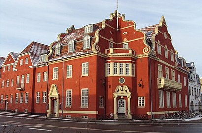
Hørsholm Kommune Address: Ådalsparkvej 2 2970 Usserød street in Hørsholm
Attractions near Hørsholm Kommune
Hoersholm Bibliotek Ka,Jobcenter Hørsholm,Hørsholm Rådhus,Hørsholm Rådhus (Ådalsparkvej),Rådhushallen,Mapcon,Herholdt Jensen Rådgivning,Ådalsparkens Tennisklub,Provinu,Brydes Vinduespolering M.M.,Magisk Massage,Bodynamic International Aps,Civiløkonom Mikael Westergren,Advokat Jørgen Eilschou Hertling,Dorete Bay,Rahbek Offset Aps,Scnet V/Sune Cording,Hellesøe Cph,Lagom Coffee Kafferisteri,Klauman MarketingHow to get to popular attractions in Hørsholm with public transit
Syddansk Universitet, Odense,DXC Technology Denmark, København,Nordea IT, Høje Taastrup,Degnemosen, København,Søborg, Gladsaxe,Lindholm Station, Aalborg,VIA University College Campus Aarhus C, Århus,Vigerslev Alle Station, København,Bus 400 / 400S (Hundige St. - Lyngby St.), Ishøj,Vejlby-Risskov Hallen, Århus,Sæby, Frederikshavn,Hotel Propellen Billund, Billund,Nonnesøen, Rudersdal,FMI Kapacitetsansvarlig Koncern IT (KAKI), Hvidovre,Ceres Arena, Århus,Falkonergårdens Gymnasium og HF, Frederiksberg,Aalborg Universitet, Aalborg,Jernbanebo, Nyborg,Busstop Silkeborgvej / Åby Ringvej, Århus,Studenterhus Aarhus, ÅrhusGet around Hørsholm by public transit!
Traveling around Hørsholm has never been so easy. See step by step directions as you travel to any attraction, street or major public transit station. View bus and train schedules, arrival times, service alerts and detailed routes on a map, so you know exactly how to get to anywhere in Hørsholm.
When traveling to any destination around Hørsholm use Moovit's Live Directions with Get Off Notifications to know exactly where and how far to walk, how long to wait for your line, and how many stops are left. Moovit will alert you when it's time to get off — no need to constantly re-check whether yours is the next stop.
Wondering how to use public transit in Hørsholm or how to pay for public transit in Hørsholm? Moovit public transit app can help you navigate your way with public transit easily, and at minimum cost. It includes public transit fees, ticket prices, and costs. Looking for a map of Hørsholm public transit lines? Moovit public transit app shows all public transit maps in Hørsholm with all bus or train routes and stops on an interactive map.
Hørsholm has 2 transit type(s), including: bus or train, operated by several transit agencies, including Metroselskabet, DSB S-tog, Lokaltog A/S, DSB S-tog, Midttrafik, Odense Letbane, DSB, NT, GoCollective, Midttrafik, Skånetrafiken, Metroselskabet, Movia, NT and Midttrafik