Directions to Hüdavendigar Cami (Osmangazi) with public transportation
The following transit lines have routes that pass near Hüdavendigar Cami
How to get to Hüdavendigar Cami by bus?
Click on the bus route to see step by step directions with maps, line arrival times and updated time schedules.
How to get to Hüdavendigar Cami by metro?
Click on the metro route to see step by step directions with maps, line arrival times and updated time schedules.
Bus stations near Hüdavendigar Cami in Osmangazi
- İlker Çelikcan Ftr Hastanesi 3, 2 min walk,
- Çekirge 9, 3 min walk,
- İlker Çelikcan Ftr Hastanesi 2, 3 min walk,
- Eski Kaplica, 4 min walk,
- Armutlu Meydani, 5 min walk,
Metro stations near Hüdavendigar Cami in Osmangazi
- Sırameşeler, 20 min walk,
Cable Car stations near Hüdavendigar Cami in Osmangazi
- Acemler Aktarma Merkezi, 43 min walk,
Bus lines to Hüdavendigar Cami in Osmangazi
- 2C, Acemler (Hareket Memurluğu),
- 3C, Çekirge (Hareket Memurluğu),
- 4B, Çekirge Devlet Hastanesi Peron 9,
- 5A, Çekirge Devlet Hastanesi Peron 6,
- 18, Buttim 2,
- 19C, Çekirge Devlet Hastanesi Peron 8,
- 19D, Çekirge Devlet Hastanesi Peron 7,
- 19E, Ulaşim Dairesi Başkanliği,
- 25A, Çekirge (Hareket Memurluğu),
- 28, Çekirge Devlet Hastanesi Peron 4,
- 29A, Çekirge Devlet Hastanesi Peron 6,
- 30, Siteler Hareket Noktasi,
- 96, Levazim 2,
- 1C, Uludağ Yolu 5,
- 1A, Derebahçe - Doburca,
- 2E, Kültür Mh. - Ring,
- F3, Mudanya Budo İskelesi -Teleferik,
- 6E, Özlüce - Derebahçe,
- 6F, Üçevler Mh. - Ring,
- 6FD, Demirci Mh. - Ring,
What are the closest stations to Hüdavendigar Cami?
The closest stations to Hüdavendigar Cami are:
- Çekirge 9 is 133 meters away, 3 min walk.
- İlker Çelikcan Ftr Hastanesi 3 is 141 meters away, 2 min walk.
- İlker Çelikcan Ftr Hastanesi 2 is 168 meters away, 3 min walk.
- Eski Kaplica is 216 meters away, 4 min walk.
- Armutlu Meydani is 317 meters away, 5 min walk.
- Sırameşeler is 1536 meters away, 20 min walk.
- Acemler Aktarma Merkezi is 3053 meters away, 43 min walk.
Which bus lines stop near Hüdavendigar Cami?
These bus lines stop near Hüdavendigar Cami: 19D, 25A, 6FD, 96, B40, B41B, B43.
Which metro line stops near Hüdavendigar Cami?
1
What’s the nearest metro station to Hüdavendigar Cami in Osmangazi?
The nearest metro station to Hüdavendigar Cami in Osmangazi is Sırameşeler. It’s a 20 min walk away.
What’s the nearest bus stop to Hüdavendigar Cami in Osmangazi?
The nearest bus stops to Hüdavendigar Cami in Osmangazi are Çekirge 9 and İlker Çelikcan Ftr Hastanesi 2. The closest one is a 3 min walk away.
What time is the first metro to Hüdavendigar Cami in Osmangazi?
The 1 is the first metro that goes to Hüdavendigar Cami in Osmangazi. It stops nearby at 3:00 AM.
What time is the last metro to Hüdavendigar Cami in Osmangazi?
The 1 is the last metro that goes to Hüdavendigar Cami in Osmangazi. It stops nearby at 12:35 AM.
What time is the first bus to Hüdavendigar Cami in Osmangazi?
The 38B2 is the first bus that goes to Hüdavendigar Cami in Osmangazi. It stops nearby at 3:48 AM.
What time is the last bus to Hüdavendigar Cami in Osmangazi?
The 38B is the last bus that goes to Hüdavendigar Cami in Osmangazi. It stops nearby at 3:55 AM.
What time is the first cable car to Hüdavendigar Cami in Osmangazi?
The ACEMLER AKTARMA MERKEZI - ORHANELI is the first cable car that goes to Hüdavendigar Cami in Osmangazi. It stops nearby at 7:03 AM.
What time is the last cable car to Hüdavendigar Cami in Osmangazi?
The ACEMLER AKTARMA MERKEZI - KELES is the last cable car that goes to Hüdavendigar Cami in Osmangazi. It stops nearby at 9:00 PM.
See Hüdavendigar Cami, Osmangazi, on the map
Public Transit to Hüdavendigar Cami in Osmangazi
Wondering how to get to Hüdavendigar Cami in Osmangazi, Turkey? Moovit helps you find the best way to get to Hüdavendigar Cami with step-by-step directions from the nearest public transit station.
Moovit provides free maps and live directions to help you navigate through your city. View schedules, routes, timetables, and find out how long does it take to get to Hüdavendigar Cami in real time.
Looking for the nearest stop or station to Hüdavendigar Cami? Check out this list of stops closest to your destination: Çekirge 9; İlker Çelikcan Ftr Hastanesi 3; İlker Çelikcan Ftr Hastanesi 2; Eski Kaplica; Armutlu Meydani; Sırameşeler; Acemler Aktarma Merkezi.
Bus: 19D, 25A, 6FD, 96, B40, B41B, B43, 3C, 4B, 5A, 18, 19C, 1C, 2C, 1A, 2E, F3, 6E, 6F.Metro: 1, M1, M2, 2, 3.Cable Car: ACEMLER AKTARMA MERKEZI - KELES, ACEMLER AKTARMA MERKEZI - ORHANELI.
Want to see if there’s another route that gets you there at an earlier time? Moovit helps you find alternative routes or times. Get directions from and directions to Hüdavendigar Cami easily from the Moovit App or Website.
We make riding to Hüdavendigar Cami easy, which is why over 1.5 million users, including users in Osmangazi, trust Moovit as the best app for public transit. You don’t need to download an individual bus app or train app, Moovit is your all-in-one transit app that helps you find the best bus time or train time available.
For information on prices of bus and metro, costs and ride fares to Hüdavendigar Cami, please check the Moovit app.
Use the app to navigate to popular places including to the airport, hospital, stadium, grocery store, mall, coffee shop, school, college, and university.
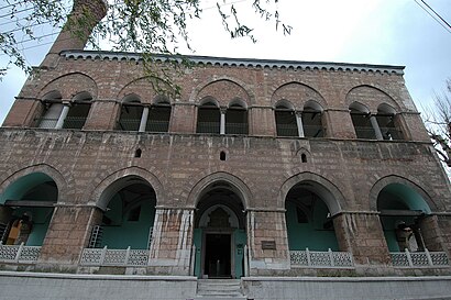
Hüdavendigar Cami Address: 1. Murat Caddesi street in Osmangazi
Attractions near Hüdavendigar Cami
I. Murad Hüdavendigar Camii,I. Murad Hüdavendigar Türbesi,Ara Konak Termal Hotel,Bursa Osmangazi 1 Murat Hüdavendigar Camii,Kadi Konagi Hotel,Birlik Vakfı Bursa Şubesi,Kadı Konağı Butik Termal Otel,I. Murat Hüdavendigar Çay Bahçesi,Çekirge Hakkı Paşa Cafe,Çınar Market,Ahsen Resim Çerçeve,Kaya Kuru Temizleme,Bursa Psikiyatri,Mahmut Atalay Cimnastik Spor Salonu,Manzara Cafe,Çekirge Manzara Kafe & Kahvaltı,1.Murat İlköğretim Okulu,I. Murat İlkokulu,bursa askeri hastane,Saklı BahçeHow to get to popular attractions in Osmangazi with public transit
Altınkum Plajı, Mudanya,Terminal Otobusu, Osmangazi,görükleye doğru, Nilüfer,Gemlik Acik Ceza İnfaz Kurumu, Gemlik,Tofaş Anadolu Arabaları Müzesi, Osmangazi,Atatürk Kent Ormani, Nilüfer,Kurtuluş Mahallesi, Nilüfer,bursa petek kerhanesi, Osmangazi,Kent Meydanı Bursaray İstasyonu, Osmangazi,Bursa Kapalı Çarşı, Osmangazi,Şevket Yılmaz Hast, Nilüfer,Güzelyalı Otobüs Durakları, Mudanya,Zeki Müren Güzel Sanatlar Lisesi, Nilüfer,Balkan Mahallesi, Nilüfer,Millet Mahallesi,Özlüce, Nilüfer,Bursa Yüksek İhtisas Eğitim ve Araştırma Hastanesi Nilüfer Ek Binası, Nilüfer,Barış Mahallesi, Nilüfer,Salon Kristal Park, Osmangazi,Merinos Atatürk Kongre Kültür Merkezi, OsmangaziGet around Bursa by public transit!
Traveling around Bursa has never been so easy. See step by step directions as you travel to any attraction, street or major public transit station. View bus and train schedules, arrival times, service alerts and detailed routes on a map, so you know exactly how to get to anywhere in Bursa.
When traveling to any destination around Bursa use Moovit's Live Directions with Get Off Notifications to know exactly where and how far to walk, how long to wait for your line, and how many stops are left. Moovit will alert you when it's time to get off — no need to constantly re-check whether yours is the next stop.
Wondering how to use public transit in Bursa or how to pay for public transit in Bursa? Moovit public transit app can help you navigate your way with public transit easily, and at minimum cost. It includes public transit fees, ticket prices, and costs. Looking for a map of Bursa public transit lines? Moovit public transit app shows all public transit maps in Bursa with all Bus, Metro, Light Rail, Cable Car and Gondola routes and stops on an interactive map.
Bursa has 5 transit type(s), including: Bus, Metro, Light Rail, Cable Car and Gondola, operated by several transit agencies, including BursaRay, BurTram, Burulaş, Minibüs, İlçe Otobüsleri, Bursa Teleferik