Directions to HADISE GIYIM (Beykoz) with public transportation
The following transit lines have routes that pass near HADISE GIYIM
 Bus: 121A, 136B, 15, 15BK, 15SD.
- Dolmus & Minibus: C367.
- Ferry: BEYKOZ - SARIYER, BEYKOZ - YENIKÖY.
How to get to HADISE GIYIM by bus?
Click on the bus route to see step by step directions with maps, line arrival times and updated time schedules.
From Gayrettepe Metro İstasyonu (M11), Şişli
80 minFrom Gültepe, Kagithane
93 minFrom 4.levent - zincirlikuyu, Şişli
80 minFrom Dünyagöz Hastanesi, Etiler, Beşiktaş
93 minFrom Baltalimanı Kemik Hastanesi, Sariyer
122 minFrom 522b Mecidiyeköy Ümraniye, Şişli
80 minFrom Volkswagen Arena, Sariyer
102 minFrom Kandilli, Kandilli, Üsküdar
79 minFrom E3 4. Levent - Sabiha Gökçen Havalimanı, Levent, Beşiktaş
91 minFrom Zincirlikuyu, Şişli
77 min
Bus stops near HADISE GIYIM in Beykoz
Bus lines to HADISE GIYIM in Beykoz
- C367, Dereseki,VIEW
- C367, Ortaçeşme,VIEW
- 11H, Çifteçınarlar-Tepeüstü,VIEW
- 15, Çifteçınarlar-Üsküdar Camii Önü,VIEW
- 15A, Anadolu Kavağı-Kavacık Aktarma,VIEW
- 15BK, Kadıköy-Şahinkaya Garajı,VIEW
- 15D, Anadolu Feneri-Sultaniye,VIEW
- 15F, Kadıköy-Türk Alman Üniversitesi,VIEW
- 15SD, Çifteçınarlar-Bayraktar Bulvarı,VIEW
- 15T, Üsküdar Camii Önü-Bombalıdere,VIEW
- 15TK, Kadıköy-Tokatköy,VIEW
- 15TY, Hekimbaşı-Tokatköy,VIEW
- 15ŞN, Çifteçınarlar-Şehit İsmail Kefal,VIEW
- 20, Dereseki-Ümraniye Eğitim Ve Araştırma Hastanesi,VIEW
- 121A, Mecidiyeköy Mezarlık-Türk Alman Üniversitesi,VIEW
- 135, Poyrazköy-Harmantepe,VIEW
- 135G, Köprübaşı-Tokatköy,VIEW
- 135K, Çifteçınarlar-Korubaşı Camii,VIEW
- 135T, Gölbahçe-Tokatköy,VIEW
- 136, Değirmendere Camii-Sultaniye,VIEW
What are the closest stations to HADISE GIYIM?
The closest stations to HADISE GIYIM are:
- Kundura Fabrikası - Beykoz Yönü is 176 meters away, 3 min walk.
- Taşocakları Camii - Son Durak Yönü is 527 meters away, 8 min walk.
Which bus lines stop near HADISE GIYIM?
These bus lines stop near HADISE GIYIM: 121A, 136B, 15, 15BK, 15SD, 15TY.
Which Dolmus & Minibus line stops near HADISE GIYIM?
C367 (Ortaçeşme)
Which ferry lines stop near HADISE GIYIM?
These ferry lines stop near HADISE GIYIM: BEYKOZ - SARIYER, BEYKOZ - YENIKÖY.
What’s the nearest bus station to HADISE GIYIM in Beykoz?
The nearest bus station to HADISE GIYIM in Beykoz is Kundura Fabrikası - Beykoz Yönü. It’s a 3 min walk away.
What time is the first bus to HADISE GIYIM in Beykoz?
The 15F is the first bus that goes to HADISE GIYIM in Beykoz. It stops nearby at 3:40 AM.
What time is the last bus to HADISE GIYIM in Beykoz?
The 15F is the last bus that goes to HADISE GIYIM in Beykoz. It stops nearby at 3:25 AM.
What time is the first Dolmus & Minibus to HADISE GIYIM in Beykoz?
The C367 is the first Dolmus & Minibus that goes to HADISE GIYIM in Beykoz. It stops nearby at 6:04 AM.
What time is the last Dolmus & Minibus to HADISE GIYIM in Beykoz?
The C367 is the last Dolmus & Minibus that goes to HADISE GIYIM in Beykoz. It stops nearby at 12:09 AM.
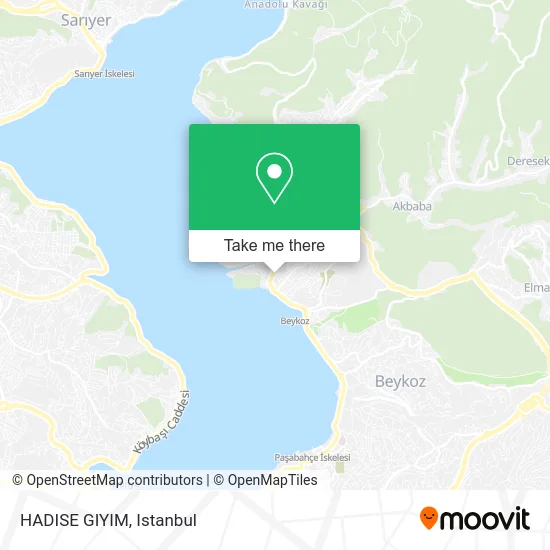
See HADISE GIYIM, Beykoz, on the map
Public Transit to HADISE GIYIM in Beykoz
Wondering how to get to HADISE GIYIM in Beykoz? Moovit helps you find the best way to get to HADISE GIYIM with step-by-step directions from the nearest public transit station.
Moovit provides free maps and live directions to help you navigate through your city. View schedules, routes, timetables, and find out how long does it take to get to HADISE GIYIM in real time.
Looking for the nearest stop or station to HADISE GIYIM? Check out this list of stops closest to your destination: Kundura Fabrikası - Beykoz Yönü; Taşocakları Camii - Son Durak Yönü.
Bus: 121A, 136B, 15, 15BK, 15SD, 15TY, C367, C367, 11H, 15A, C367.Dolmus & Minibus: C367.Ferry: BEYKOZ - SARIYER, BEYKOZ - YENIKÖY.
Want to see if there’s another route that gets you there at an earlier time? Moovit helps you find alternative routes or times. Get directions from and directions to HADISE GIYIM easily from the Moovit App or Website.
We make riding to HADISE GIYIM easy, which is why over 1.7 million users, including users in Beykoz, trust Moovit as the best app for public transit. You don’t need to download an individual bus app or train app, Moovit is your all-in-one transit app that helps you find the best bus time or train time available.
For information on prices of bus, Dolmus & Minibus and ferry, costs and ride fares to HADISE GIYIM, please check the Moovit app.
Use the app to navigate to popular places including to the airport, hospital, stadium, grocery store, mall, coffee shop, school, college, and university.
Location: Beykoz, Istanbul
- Şadan Tuhafiye,
- Ceren Akvaryum,
- Ss beykoz Motorlu Tasiyicilar kooperatif i,
- Karameşe Tekel Bayii,
- Ortaçeşme Sağlık Ocağı,
- Haciosman Efendi Camii,
- Özel Beykoz Tıp Merkezi,
- Sandığım Tekstil Evi,
- Fatih Harbiye - Beykoz Müzik Atölye,
- Anadolu Yakası,
- Okul Açık Store,
- Sırma,
- Beykoz Pazarı,
- İstanbul Evde Masaj,
- Kavacık Ağız Diş Sağlığı Merkezi,
- Yuvam Döşeme,
- Beykoz Yalikoy Camii,
- Burçin Giyim,
- Elit Mobilya,
- Baharatçı Sokak, 42
Places Near HADISE GIYIM (Beykoz)
- İstinye Park, Sariyer,
- Topkule Kışlası 47.Komando Tugay Komutanlığı, Esenler,
- Mehmet Emin Tokadî Hz. Türbesi, Fatih,
- Başakşehir Çam Ve Sakura Şehir Hastanesi, Basaksehir,
- Şehit Prof. Dr. İlhan Varank Eğitim Ve Araştırma Hastanesi, Sancaktepe,
- 2 Nolu Minibüss, Beylikduzu,
- Mall Of İstanbul, Basaksehir,
- Hilltown AVM, Maltepe,
- Gebze-Harem Minibüs Hattı, Gebze,
- İstanbul,
- METROPOL IsTaNBuL, Ataşehir,
- Beylikdüzü - 4 Nolu Minibüs Hattı, Beylikduzu,
- Bakırköy Sosyete Pazarı, Bakirköy,
- 41 Burda AVM, Kocaeli Merkezi,
- Gebze Koop Durağı, Gebze,
- 212 AVM, Bagcilar,
- Tersane İstanbul, Beyoğlu,
- Hz. Yuşa Tepesi, Beykoz,
- Karaköy Genelevi, Karaköy, Beyoğlu,
- VİALAND AVM, Eyüp
How to get to popular places in Istanbul with public transit
Get around Beykoz by public transit!
Traveling around Beykoz has never been so easy. See step by step directions as you travel to any attraction, street or major public transit station. View bus and train schedules, arrival times, service alerts and detailed routes on a map, so you know exactly how to get to anywhere in Beykoz.
When traveling to any destination around Beykoz use Moovit's Live Directions with Get Off Notifications to know exactly where and how far to walk, how long to wait for your line, and how many stops are left. Moovit will alert you when it's time to get off — no need to constantly re-check whether yours is the next stop.
Wondering how to use public transit in Beykoz or how to pay for public transit in Beykoz? Moovit public transit app can help you navigate your way with public transit easily, and at minimum cost. It includes public transit fees, ticket prices, and costs. Looking for a map of Beykoz public transit lines? Moovit public transit app shows all public transit maps in Beykoz with all Bus, Train, Metro, Tram, Ferry, Metrobus and Dolmus & Minibus routes and stops on an interactive map.
Istanbul has 7 transit type(s), including: Bus, Train, Metro, Tram, Ferry, Metrobus and Dolmus & Minibus, operated by several transit agencies, including Marmaray, Metro İstanbul, Metrobüs, UAB, İETT, İETT ÇIFT KATLI HATLAR, İETT BÖLGESEL HATLAR, TCDD, Şehir Hatları, Dentur Avrasya, Beyden, Turyol, Mavi Marmara, Havaist and Prenstur
