Directions to H&R Block (Malden) with public transportation
The following transit lines have routes that pass near H&R Block
 Bus: 104, 105, 108, 109, 411.
- Train: HAVERHILL, NEWBURYPORT/ROCKPORT.
- Subway: ORANGE LINE.
How to get to H&R Block by bus?
Click on the bus route to see step by step directions with maps, line arrival times and updated time schedules.
From Woburn, MA, Woburn
68 minFrom SoWa Winter Market, Boston
89 minFrom 60 School Street, Boston
50 minFrom Charles River, Boston
58 minFrom Symphony Hall, Boston
66 minFrom The Colonnade Hotel Boston, Boston
90 minFrom Boston Marriott Long Wharf Hotel Boston, Boston
51 minFrom Mount Auburn, Cambridge
69 minFrom MGH Bigelow 11 - General Medicine, Boston
56 minFrom Guitar Center, Boston
82 min
How to get to H&R Block by train?
Click on the train route to see step by step directions with maps, line arrival times and updated time schedules.
How to get to H&R Block by subway?
Click on the subway route to see step by step directions with maps, line arrival times and updated time schedules.
From SoWa Winter Market, Boston
64 minFrom 60 School Street, Boston
48 minFrom Charles River, Boston
60 minFrom Symphony Hall, Boston
57 minFrom The Colonnade Hotel Boston, Boston
58 minFrom Boston Marriott Long Wharf Hotel Boston, Boston
50 minFrom MGH Bigelow 11 - General Medicine, Boston
55 minFrom Guitar Center, Boston
72 min
Bus stops near H&R Block in Malden
Subway station near H&R Block in Malden
- Wellington, 28 min walk,VIEW
Bus lines to H&R Block in Malden
What are the closest stations to H&R Block?
The closest stations to H&R Block are:
- Chelsea is 44 yards away, 3 min walk.
- Willow St @ Lyme St is 295 yards away, 4 min walk.
- Salem St @ Granville Ave is 411 yards away, 5 min walk.
- Wellington is 2374 yards away, 28 min walk.
- Oak Grove is 3794 yards away, 45 min walk.
Which bus lines stop near H&R Block?
These bus lines stop near H&R Block: 104, 105, 108, 109, 411, 430.
Which train line stops near H&R Block?
HAVERHILL (#229 | Haverhill)
Which subway line stops near H&R Block?
ORANGE LINE (Oak Grove)
What’s the nearest subway station to H&R Block in Malden?
The nearest subway station to H&R Block in Malden is Wellington. It’s a 28 min walk away.
What’s the nearest train station to H&R Block in Malden?
The nearest train station to H&R Block in Malden is Chelsea. It’s a 3 min walk away.
What’s the nearest bus station to H&R Block in Malden?
The nearest bus station to H&R Block in Malden is Willow St @ Lyme St. It’s a 4 min walk away.
What time is the first subway to H&R Block in Malden?
The ORANGE LINE is the first subway that goes to H&R Block in Malden. It stops nearby at 5:15 AM.
What time is the last subway to H&R Block in Malden?
The ORANGE LINE is the last subway that goes to H&R Block in Malden. It stops nearby at 1:59 AM.
What time is the first train to H&R Block in Malden?
The HAVERHILL is the first train that goes to H&R Block in Malden. It stops nearby at 5:35 AM.
What time is the last train to H&R Block in Malden?
The NEWBURYPORT/ROCKPORT is the last train that goes to H&R Block in Malden. It stops nearby at 12:06 AM.
What time is the first bus to H&R Block in Malden?
The 105 is the first bus that goes to H&R Block in Malden. It stops nearby at 5:03 AM.
What time is the last bus to H&R Block in Malden?
The 108 is the last bus that goes to H&R Block in Malden. It stops nearby at 1:40 AM.
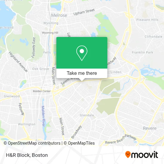
See H&R Block, Malden, on the map
Public Transit to H&R Block in Malden
Wondering how to get to H&R Block in Malden? Moovit helps you find the best way to get to H&R Block with step-by-step directions from the nearest public transit station.
Moovit provides free maps and live directions to help you navigate through your city. View schedules, routes, timetables, and find out how long does it take to get to H&R Block in real time.
Looking for the nearest stop or station to H&R Block? Check out this list of stops closest to your destination: Chelsea; Willow St @ Lyme St; Salem St @ Granville Ave; Wellington; Oak Grove.
Bus: 104, 105, 108, 109, 411, 430, 106.Train: HAVERHILL, NEWBURYPORT/ROCKPORT.Subway: ORANGE LINE.
Want to see if there’s another route that gets you there at an earlier time? Moovit helps you find alternative routes or times. Get directions from and directions to H&R Block easily from the Moovit App or Website.
We make riding to H&R Block easy, which is why over 1.7 million users, including users in Malden, trust Moovit as the best app for public transit. You don’t need to download an individual bus app or train app, Moovit is your all-in-one transit app that helps you find the best bus time or train time available.
For information on prices of bus, subway and train, costs and ride fares to H&R Block, please check the Moovit app.
Use the app to navigate to popular places including to the airport, hospital, stadium, grocery store, mall, coffee shop, school, college, and university.
H&R Block Address: 663 Eastern Ave street in Malden
- Salemwood School,
- Salemwood Elementary School (Malden School District),
- Malden School District,
- Mystic Valley Regional Charter School-K,
- D.C.N.E. Totaline Parts and Supplies,
- Ie Commercial Floor Cleaning,
- Brother Gilbert Stadium,
- Bcless,
- Planet Fitness,
- Rando Paul,
- Witchcraft Zone,
- D & D Construction,
- Jackie's Cleaning,
- Mystic Valley Charter School (Mystic Valley Regional Charter School Turf Field),
- Clary and Cimermanis Little Free Library,
- Radiant Beauty Salon,
- Alvim Team - Personal Training Studio,
- Joseph & Jules Design,
- Malden Catholic High School,
- Justice Gladys
Places Near H&R Block (Malden)
- House Of Blues, Boston,
- Prudential Center, Boston,
- Boston Convention & Exhibition Center, Boston,
- Wang Theater, Boston,
- Seaport District, Boston,
- Td Garden, Boston,
- Leader Bank Pavilion (Leader Bank Pavillion), Boston,
- Museum Of Science, Boston,
- North End, Boston,
- Castle Island, Boston,
- Boston Medical Center, Boston,
- Boston Children's Hospital, Boston,
- Boston Common, Boston,
- Quincy Market, Boston,
- Massachusetts General Hospital, Boston,
- Faneuil Hall, Boston,
- Wilbur Theatre, Boston,
- Cheers, Boston,
- Isabella Stewart Gardner Museum, Boston,
- Mgm Music Hall, Boston
How to get to popular places in Boston with public transit
Get around Malden by public transit!
Traveling around Malden has never been so easy. See step by step directions as you travel to any attraction, street or major public transit station. View bus and train schedules, arrival times, service alerts and detailed routes on a map, so you know exactly how to get to anywhere in Malden.
When traveling to any destination around Malden use Moovit's Live Directions with Get Off Notifications to know exactly where and how far to walk, how long to wait for your line, and how many stops are left. Moovit will alert you when it's time to get off — no need to constantly re-check whether yours is the next stop.
Wondering how to use public transit in Malden or how to pay for public transit in Malden? Moovit public transit app can help you navigate your way with public transit easily, and at minimum cost. It includes public transit fees, ticket prices, and costs. Looking for a map of Malden public transit lines? Moovit public transit app shows all public transit maps in Malden with all Bus, Train, Subway and Ferry routes and stops on an interactive map.
Boston has 4 transit type(s), including: Bus, Train, Subway and Ferry, operated by several transit agencies, including MBTA, Southeastern Regional Transit Authority, MetroWest Regional Transit Authority, Rhode Island Public Transit Authority, WRTA, Lowell Regional Transit Authority, Merrimack Valley Transit, Montachusett Regional Transit Authority, Cape Cod Regional Transit Authority, Brockton Area Transit Authority, Martha's Vineyard Transit Authority, the WAVE - Nantucket Regional Transit Authority, GATRA, Cape Ann Transportation Authority and Massport