How to get to Habibler Talebe Yurdu by bus?
Click on the bus route to see step by step directions with maps, line arrival times and updated time schedules.
From Tema World, Küçükçekmece
111 minFrom bağcılar eğitim araştırma hastanesi, Bagcilar
72 minFrom VİALAND AVM, Eyüp
91 minFrom Taksim ilkyardım hastanesi, Gaziosmanpasa
65 minFrom Sultangazi Ağız Ve Diş Hastanesi, Sultangazi
38 minFrom Mega Center, Bayrampasa
61 minFrom 303B Silivri Cezaevi Esenler Otogar iett hattı, Bayrampasa
62 minFrom Atakent Mahallesi, Küçükçekmece
83 minFrom Mall Of İstanbul, Basaksehir
84 minFrom Esenler Otogar, Esenler
47 min
Bus stops near Habibler Talebe Yurdu in Sultangazi
Bus lines to Habibler Talebe Yurdu in Sultangazi
- A15, İmrahor,VIEW
- A41, Bağcılar,VIEW
- A74, Yayla ,VIEW
- H-6, İstanbul Havalimanı Garaj-Yunus Emre Mahallesi,VIEW
- 36B, Cebeci Peronlar-Mehmet Akif Ersoy Camii,VIEW
- 36C, Cebeci Peronlar-Tepe Üstü,VIEW
- 36F, Cebeci Peronlar-Olimpiyatköy Metro,VIEW
- 36HT, Cebeci Peronlar-Tansu Sokak,VIEW
- 36V, Çimen Cami-Vezneciler,VIEW
- 36Y, Mahmutbey Metro-Taşoluk Peronlar,VIEW
- 48G, Köprübaşı Mahallesi-Mescid,VIEW
- 79C, Cebeci Peronlar-Kayaşehir,VIEW
- 79F, Yenibosna Metro-Kayabaşı Kiptaş,VIEW
- 79KM, Kayaşehir-Mecidiyeköy Metrobüs,VIEW
- 79KT, Tekstilkent-Giyimkent Metro İstasyonu-Kayabaşı Kiptaş Peron,VIEW
- 336, Taşoluk Peronlar-Eminönü Kantarcılar,VIEW
- 336A, Balaban Camii-Mescid,VIEW
- 336G, Tekstilkent-Giyimkent Metro İstasyonu-Taşoluk Peronlar,VIEW
- 336H, Mescid-İ Selam-Yassıören,VIEW
- 336K, Yeniköy-Mescid,VIEW
What are the closest stations to Habibler Talebe Yurdu?
The closest stations to Habibler Talebe Yurdu are:
- Habipler - Sultançiftliği Yönü is 237 meters away, 4 min walk.
- Habipler - Arnavutköy Yönü is 395 meters away, 6 min walk.
- Habipler Transit Yol - Arnavutköy Yönü is 587 meters away, 8 min walk.
- A-1 Caddesi - Cebeci Yönü is 690 meters away, 9 min walk.
Which bus lines stop near Habibler Talebe Yurdu?
These bus lines stop near Habibler Talebe Yurdu: 336, 336H, 79F, 79KM, 79KT, H-6.
Which Dolmus & Minibus line stops near Habibler Talebe Yurdu?
A15 (İmrahor)
What’s the nearest bus station to Habibler Talebe Yurdu in Sultangazi?
The nearest bus station to Habibler Talebe Yurdu in Sultangazi is Habipler - Sultançiftliği Yönü. It’s a 4 min walk away.
What time is the first bus to Habibler Talebe Yurdu in Sultangazi?
The H-6 is the first bus that goes to Habibler Talebe Yurdu in Sultangazi. It stops nearby at 4:00 AM.
What time is the last bus to Habibler Talebe Yurdu in Sultangazi?
The H-6 is the last bus that goes to Habibler Talebe Yurdu in Sultangazi. It stops nearby at 4:04 AM.
What time is the first Dolmus & Minibus to Habibler Talebe Yurdu in Sultangazi?
The A41 is the first Dolmus & Minibus that goes to Habibler Talebe Yurdu in Sultangazi. It stops nearby at 6:00 AM.
What time is the last Dolmus & Minibus to Habibler Talebe Yurdu in Sultangazi?
The A15 is the last Dolmus & Minibus that goes to Habibler Talebe Yurdu in Sultangazi. It stops nearby at 1:41 AM.
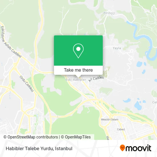
See Habibler Talebe Yurdu, Sultangazi, on the map
Public Transit to Habibler Talebe Yurdu in Sultangazi
Wondering how to get to Habibler Talebe Yurdu in Sultangazi? Moovit helps you find the best way to get to Habibler Talebe Yurdu with step-by-step directions from the nearest public transit station.
Moovit provides free maps and live directions to help you navigate through your city. View schedules, routes, timetables, and find out how long does it take to get to Habibler Talebe Yurdu in real time.
Looking for the nearest stop or station to Habibler Talebe Yurdu? Check out this list of stops closest to your destination: Habipler - Sultançiftliği Yönü; Habipler - Arnavutköy Yönü; Habipler Transit Yol - Arnavutköy Yönü; A-1 Caddesi - Cebeci Yönü.
Bus: 336, 336H, 79F, 79KM, 79KT, H-6, A15, A41, A74, 36B, TM18, 38H, 79GE, 336M, A74, TM15, 36CB, 36S.Dolmus & Minibus: A15.
Want to see if there’s another route that gets you there at an earlier time? Moovit helps you find alternative routes or times. Get directions from and directions to Habibler Talebe Yurdu easily from the Moovit App or Website.
We make riding to Habibler Talebe Yurdu easy, which is why over 1.7 million users, including users in Sultangazi, trust Moovit as the best app for public transit. You don’t need to download an individual bus app or train app, Moovit is your all-in-one transit app that helps you find the best bus time or train time available.
For information on prices of bus, Dolmus & Minibus and metro, costs and ride fares to Habibler Talebe Yurdu, please check the Moovit app.
Use the app to navigate to popular places including to the airport, hospital, stadium, grocery store, mall, coffee shop, school, college, and university.
Habibler Talebe Yurdu Address: Yıldızlar Caddesi, 8 street in Sultangazi
- Habibler Erkek Öğrenci Yurdu,
- PTT-Habıbler,
- Habibler,
- Kişmir Ekmek & Pasta,
- Kayaşehir,
- Kayaşehir 11,
- Kazdal Playstation House,
- Habibler Konferans Salonu,
- Habibler Meydan,
- Eski Habibler Meydan,
- Pirinççi Köyü Muhtarlığı,
- Habibler Merkez Camii,
- Merkez Camii Sultangazi,
- Pirinçci İsmek,
- Esmek Pirinççi Gençlik Merkezi,
- Eski Edirne Asfaltı Caddesi,
- Zeyrek Giyim,
- Habibler Rize Kömürcüler Köyü Derneği,
- habibler itfaiye istasyonu,
- Meydan Kahve
Places Near Habibler Talebe Yurdu (Sultangazi)
- 41 Burda AVM, Kocaeli Merkezi,
- Topkule Kışlası 47.Komando Tugay Komutanlığı, Esenler,
- Şehit Prof. Dr. İlhan Varank Eğitim Ve Araştırma Hastanesi, Sancaktepe,
- Gebze-Harem Minibüs Hattı, Gebze,
- Gebze Koop Durağı, Gebze,
- Başakşehir Çam Ve Sakura Şehir Hastanesi, Basaksehir,
- Bakırköy Sosyete Pazarı, Bakirköy,
- METROPOL IsTaNBuL, Ataşehir,
- Mehmet Emin Tokadî Hz. Türbesi, Fatih,
- İstinye Park, Sariyer,
- Hilltown AVM, Maltepe,
- Beylikdüzü - 4 Nolu Minibüs Hattı, Beylikduzu,
- 2 Nolu Minibüss, Beylikduzu,
- VİALAND AVM, Eyüp,
- Tersane İstanbul, Beyoğlu,
- 212 AVM, Bagcilar,
- Hz. Yuşa Tepesi, Beykoz,
- Karaköy Genelevi, Karaköy, Beyoğlu,
- İstanbul,
- Mall Of İstanbul, Basaksehir
How to get to popular places in Istanbul with public transit
Get around Sultangazi by public transit!
Traveling around Sultangazi has never been so easy. See step by step directions as you travel to any attraction, street or major public transit station. View bus and train schedules, arrival times, service alerts and detailed routes on a map, so you know exactly how to get to anywhere in Sultangazi.
When traveling to any destination around Sultangazi use Moovit's Live Directions with Get Off Notifications to know exactly where and how far to walk, how long to wait for your line, and how many stops are left. Moovit will alert you when it's time to get off — no need to constantly re-check whether yours is the next stop.
Wondering how to use public transit in Sultangazi or how to pay for public transit in Sultangazi? Moovit public transit app can help you navigate your way with public transit easily, and at minimum cost. It includes public transit fees, ticket prices, and costs. Looking for a map of Sultangazi public transit lines? Moovit public transit app shows all public transit maps in Sultangazi with all Bus, Train, Metro, Tram, Ferry, Metrobus and Dolmus & Minibus routes and stops on an interactive map.
Istanbul has 7 transit type(s), including: Bus, Train, Metro, Tram, Ferry, Metrobus and Dolmus & Minibus, operated by several transit agencies, including Marmaray, Metro İstanbul, Metrobüs, UAB, İETT, İETT ÇIFT KATLI HATLAR, İETT BÖLGESEL HATLAR, TCDD, Şehir Hatları, Dentur Avrasya, Beyden, Turyol, Mavi Marmara, Havaist and Prenstur
