How to get to Haddad Financial by bus?
Click on the bus route to see step by step directions with maps, line arrival times and updated time schedules.
From Allston, Boston
75 minFrom Massachusetts, Boston
73 minFrom St. Elizabeth's, Boston
80 minFrom New Balance, Boston
74 minFrom Boston College, Boston
80 minFrom AC Hotel by Marriott Boston Cleveland Circle, Boston
85 minFrom The Track at New Balance, Boston
76 minFrom Babson College, Wellesley
188 minFrom Sheraton-Needham Hotel (Sheraton Boston Needham Hotel), Needham
89 minFrom Brighton, Boston
97 min
Bus stops near Haddad Financial in Waltham
Train station near Haddad Financial in Waltham
- Waltham, 51 min walk,VIEW
What are the closest stations to Haddad Financial?
The closest stations to Haddad Financial are:
- Totten Pond Rd @ Winter St is 191 yards away, 3 min walk.
- Tomlin St @ Dale St is 1293 yards away, 15 min walk.
- Waltham is 4344 yards away, 51 min walk.
Which bus lines stop near Haddad Financial?
These bus lines stop near Haddad Financial: 554, 556, 558, 61.
What’s the nearest bus station to Haddad Financial in Waltham?
The nearest bus station to Haddad Financial in Waltham is Totten Pond Rd @ Winter St. It’s a 3 min walk away.
What time is the first train to Haddad Financial in Waltham?
The FITCHBURG is the first train that goes to Haddad Financial in Waltham. It stops nearby at 6:42 AM.
What time is the last train to Haddad Financial in Waltham?
The FITCHBURG is the last train that goes to Haddad Financial in Waltham. It stops nearby at 12:12 AM.
What time is the first bus to Haddad Financial in Waltham?
The 61 is the first bus that goes to Haddad Financial in Waltham. It stops nearby at 5:59 AM.
What time is the last bus to Haddad Financial in Waltham?
The 61 is the last bus that goes to Haddad Financial in Waltham. It stops nearby at 8:29 PM.
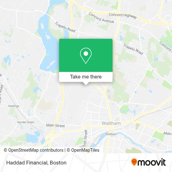
See Haddad Financial, Waltham, on the map
Public Transit to Haddad Financial in Waltham
Wondering how to get to Haddad Financial in Waltham? Moovit helps you find the best way to get to Haddad Financial with step-by-step directions from the nearest public transit station.
Moovit provides free maps and live directions to help you navigate through your city. View schedules, routes, timetables, and find out how long does it take to get to Haddad Financial in real time.
Looking for the nearest stop or station to Haddad Financial? Check out this list of stops closest to your destination: Totten Pond Rd @ Winter St; Tomlin St @ Dale St; Waltham.
Bus: 554, 556, 558, 61.Train: FITCHBURG.
Want to see if there’s another route that gets you there at an earlier time? Moovit helps you find alternative routes or times. Get directions from and directions to Haddad Financial easily from the Moovit App or Website.
We make riding to Haddad Financial easy, which is why over 1.7 million users, including users in Waltham, trust Moovit as the best app for public transit. You don’t need to download an individual bus app or train app, Moovit is your all-in-one transit app that helps you find the best bus time or train time available.
For information on prices of bus, subway and train, costs and ride fares to Haddad Financial, please check the Moovit app.
Use the app to navigate to popular places including to the airport, hospital, stadium, grocery store, mall, coffee shop, school, college, and university.
Haddad Financial Address: 201 Jones Rd street in Waltham
- Neurometrix Neurometrix,
- Oscient Pharmaceuticals,
- Classic Catering,
- Dr Chantal Nouvellon,
- Mary Kay Studio,
- Convergent Dental,
- Arm,
- Quattro Wireless,
- Apellis Pharmaceuticals,
- Tan Yang Lu,
- Sierra Architects,
- Cranial Technologies,
- CFHP - Citypoint,
- Sodexo,
- Asahi Kasei Pharma America,
- 42 North Dental,
- Novocardia Health,
- Argent,
- Torcasio, Sal F,
- FedEx
Places Near Haddad Financial (Waltham)
- Boston Convention & Exhibition Center, Boston,
- Wilbur Theatre, Boston,
- House Of Blues, Boston,
- North End, Boston,
- Isabella Stewart Gardner Museum, Boston,
- Mgm Music Hall, Boston,
- Boston Medical Center, Boston,
- Castle Island, Boston,
- Td Garden, Boston,
- Quincy Market, Boston,
- Leader Bank Pavilion (Leader Bank Pavillion), Boston,
- Museum Of Science, Boston,
- Prudential Center, Boston,
- Boston Children's Hospital, Boston,
- Faneuil Hall, Boston,
- Massachusetts General Hospital, Boston,
- Wang Theater, Boston,
- Seaport District, Boston,
- Boston Common, Boston,
- Cheers, Boston
How to get to popular places in Boston with public transit
Get around Waltham by public transit!
Traveling around Waltham has never been so easy. See step by step directions as you travel to any attraction, street or major public transit station. View bus and train schedules, arrival times, service alerts and detailed routes on a map, so you know exactly how to get to anywhere in Waltham.
When traveling to any destination around Waltham use Moovit's Live Directions with Get Off Notifications to know exactly where and how far to walk, how long to wait for your line, and how many stops are left. Moovit will alert you when it's time to get off — no need to constantly re-check whether yours is the next stop.
Wondering how to use public transit in Waltham or how to pay for public transit in Waltham? Moovit public transit app can help you navigate your way with public transit easily, and at minimum cost. It includes public transit fees, ticket prices, and costs. Looking for a map of Waltham public transit lines? Moovit public transit app shows all public transit maps in Waltham with all Bus, Train, Subway and Ferry routes and stops on an interactive map.
Boston has 4 transit type(s), including: Bus, Train, Subway and Ferry, operated by several transit agencies, including MBTA, Southeastern Regional Transit Authority, MetroWest Regional Transit Authority, Rhode Island Public Transit Authority, WRTA, Lowell Regional Transit Authority, Merrimack Valley Transit, Montachusett Regional Transit Authority, Cape Cod Regional Transit Authority, Brockton Area Transit Authority, Martha's Vineyard Transit Authority, the WAVE - Nantucket Regional Transit Authority, GATRA, Cape Ann Transportation Authority and Massport