How to get to Hagerty Landscaping by bus?
Click on the bus route to see step by step directions with maps, line arrival times and updated time schedules.
From Wollaston Beach, Quincy
67 minFrom Encompass Health Rehabilitation Hospital of Braintree, Braintree Town
78 minFrom Granite Links Golf Club at Quarry Hills, Quincy
119 minFrom crown Colony Shuttle, Quincy
64 minFrom Quincy, MA, Quincy
41 minFrom Staybridge Suites Boston-Quincy, Quincy
81 minFrom Qea, Quincy
73 minFrom rmv Braintree, Braintree Town
79 minFrom Quincy Center Station, Quincy
37 min
How to get to Hagerty Landscaping by train?
Click on the train route to see step by step directions with maps, line arrival times and updated time schedules.
Bus stop near Hagerty Landscaping in Boston
- Water St @ Commercial St, 4 min walk,VIEW
Train station near Hagerty Landscaping in Boston
- West Hingham, 35 min walk,VIEW
Bus lines to Hagerty Landscaping in Boston
- 222, East Weymouth,VIEW
What are the closest stations to Hagerty Landscaping?
The closest stations to Hagerty Landscaping are:
- Water St @ Commercial St is 326 yards away, 4 min walk.
- West Hingham is 2963 yards away, 35 min walk.
Which bus line stops near Hagerty Landscaping?
222 (East Weymouth)
Which train line stops near Hagerty Landscaping?
GREENBUSH (#1061 | Greenbush)
What’s the nearest bus station to Hagerty Landscaping in Boston?
The nearest bus station to Hagerty Landscaping in Boston is Water St @ Commercial St. It’s a 4 min walk away.
What time is the first train to Hagerty Landscaping in Boston?
The GREENBUSH is the first train that goes to Hagerty Landscaping in Boston. It stops nearby at 5:37 AM.
What time is the last train to Hagerty Landscaping in Boston?
The GREENBUSH is the last train that goes to Hagerty Landscaping in Boston. It stops nearby at 12:22 AM.
What time is the first bus to Hagerty Landscaping in Boston?
The 222 is the first bus that goes to Hagerty Landscaping in Boston. It stops nearby at 5:11 AM.
What time is the last bus to Hagerty Landscaping in Boston?
The 222 is the last bus that goes to Hagerty Landscaping in Boston. It stops nearby at 1:17 AM.
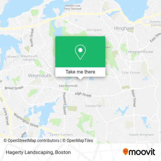
See Hagerty Landscaping, Boston, on the map
Public Transit to Hagerty Landscaping in Boston
Wondering how to get to Hagerty Landscaping in Boston? Moovit helps you find the best way to get to Hagerty Landscaping with step-by-step directions from the nearest public transit station.
Moovit provides free maps and live directions to help you navigate through your city. View schedules, routes, timetables, and find out how long does it take to get to Hagerty Landscaping in real time.
Looking for the nearest stop or station to Hagerty Landscaping? Check out this list of stops closest to your destination: Water St @ Commercial St; West Hingham.
Bus: 222.Train: GREENBUSH.
Want to see if there’s another route that gets you there at an earlier time? Moovit helps you find alternative routes or times. Get directions from and directions to Hagerty Landscaping easily from the Moovit App or Website.
We make riding to Hagerty Landscaping easy, which is why over 1.7 million users, including users in Boston, trust Moovit as the best app for public transit. You don’t need to download an individual bus app or train app, Moovit is your all-in-one transit app that helps you find the best bus time or train time available.
For information on prices of bus and train, costs and ride fares to Hagerty Landscaping, please check the Moovit app.
Use the app to navigate to popular places including to the airport, hospital, stadium, grocery store, mall, coffee shop, school, college, and university.
Hagerty Landscaping Address: 26 Volusia Rd street in Boston
- Pungitore Irrigation & Fertilizer,
- The Lighthouse,
- Center For Health And Development Atlantic Residence,
- Bouve Pond,
- Allerton Harbor Canvas,
- DUNKIN',
- Dickies Locksmith,
- Old Country Pizzeria & Roast Beef,
- Weymouth Mobile Locksmith,
- High Street Dental,
- bargaineer,
- Hingham Transfer Station,
- 1453 Commercial St Parking,
- The Overlook,
- Wendi Lou's Sunrise Cafe,
- Atm 7eleven, Inc.,
- Amazon Locker-Perkins,
- East Weymouth Barber,
- Pingree Parent Council,
- Jp3 Graphics
Places Near Hagerty Landscaping (Boston)
- Prudential Center, Boston,
- Cheers, Boston,
- Mgm Music Hall, Boston,
- Massachusetts General Hospital, Boston,
- Boston Medical Center, Boston,
- Isabella Stewart Gardner Museum, Boston,
- House Of Blues, Boston,
- Wang Theater, Boston,
- Seaport District, Boston,
- Boston Convention & Exhibition Center, Boston,
- North End, Boston,
- Leader Bank Pavilion (Leader Bank Pavillion), Boston,
- Boston Children's Hospital, Boston,
- Quincy Market, Boston,
- Boston Common, Boston,
- Td Garden, Boston,
- Wilbur Theatre, Boston,
- Castle Island, Boston,
- Museum Of Science, Boston,
- Faneuil Hall, Boston
How to get to popular places in Boston with public transit
Get around Boston by public transit!
Traveling around Boston has never been so easy. See step by step directions as you travel to any attraction, street or major public transit station. View bus and train schedules, arrival times, service alerts and detailed routes on a map, so you know exactly how to get to anywhere in Boston.
When traveling to any destination around Boston use Moovit's Live Directions with Get Off Notifications to know exactly where and how far to walk, how long to wait for your line, and how many stops are left. Moovit will alert you when it's time to get off — no need to constantly re-check whether yours is the next stop.
Wondering how to use public transit in Boston or how to pay for public transit in Boston? Moovit public transit app can help you navigate your way with public transit easily, and at minimum cost. It includes public transit fees, ticket prices, and costs. Looking for a map of Boston public transit lines? Moovit public transit app shows all public transit maps in Boston with all Bus, Train, Subway and Ferry routes and stops on an interactive map.
Boston has 4 transit type(s), including: Bus, Train, Subway and Ferry, operated by several transit agencies, including MBTA, Southeastern Regional Transit Authority, MetroWest Regional Transit Authority, Rhode Island Public Transit Authority, WRTA, Lowell Regional Transit Authority, Merrimack Valley Transit, Montachusett Regional Transit Authority, Cape Cod Regional Transit Authority, Brockton Area Transit Authority, Martha's Vineyard Transit Authority, the WAVE - Nantucket Regional Transit Authority, GATRA, Cape Ann Transportation Authority and Massport